Trending warmer into next week
COLUMBUS, Mississippi (WCBI) – Heat levels will begin building into next week with rain chances eventually returning as well.
SUNDAY: As high pressure slides east of the region, a weak southerly flow will get established across the Deep South. This will begin a warming trend as highs bounce back into the middle and upper 80s. The good news is the heat will be tolerable without much heat index concern.
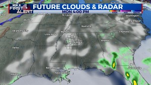
MEMORIAL DAY: Monday could start off mostly cloudy, but clouds should thin out through the day as highs stay in the upper 80s.
REST OF WEEK: Temperatures will make a run at 90 degrees yet again by mid-week in advance of a weakening front. Said front will bring an increase in storm chances, especially on Thursday. Thereafter, the front could become diffuse or wash out, leading to at least isolated storm chances lingering into Friday and Saturday.
TROPICS: Tropical Storm Agatha formed Saturday morning in the eastern Pacific. Before making landfall in central Mexico, it is expected to strengthen into a hurricane. The mountainous terrain will disrupt the storm, but regenerating low pressure could occur in the southern Gulf late next week. Still plenty of time to watch!


