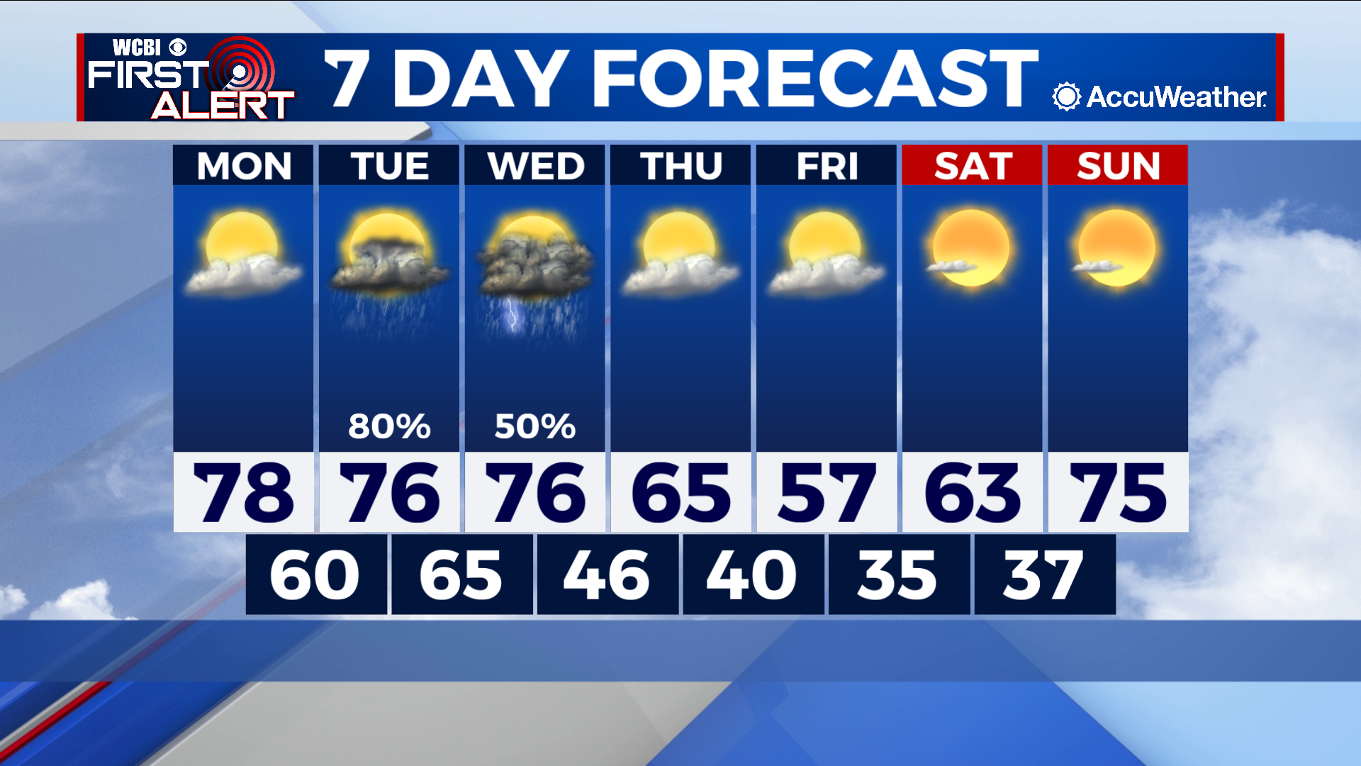
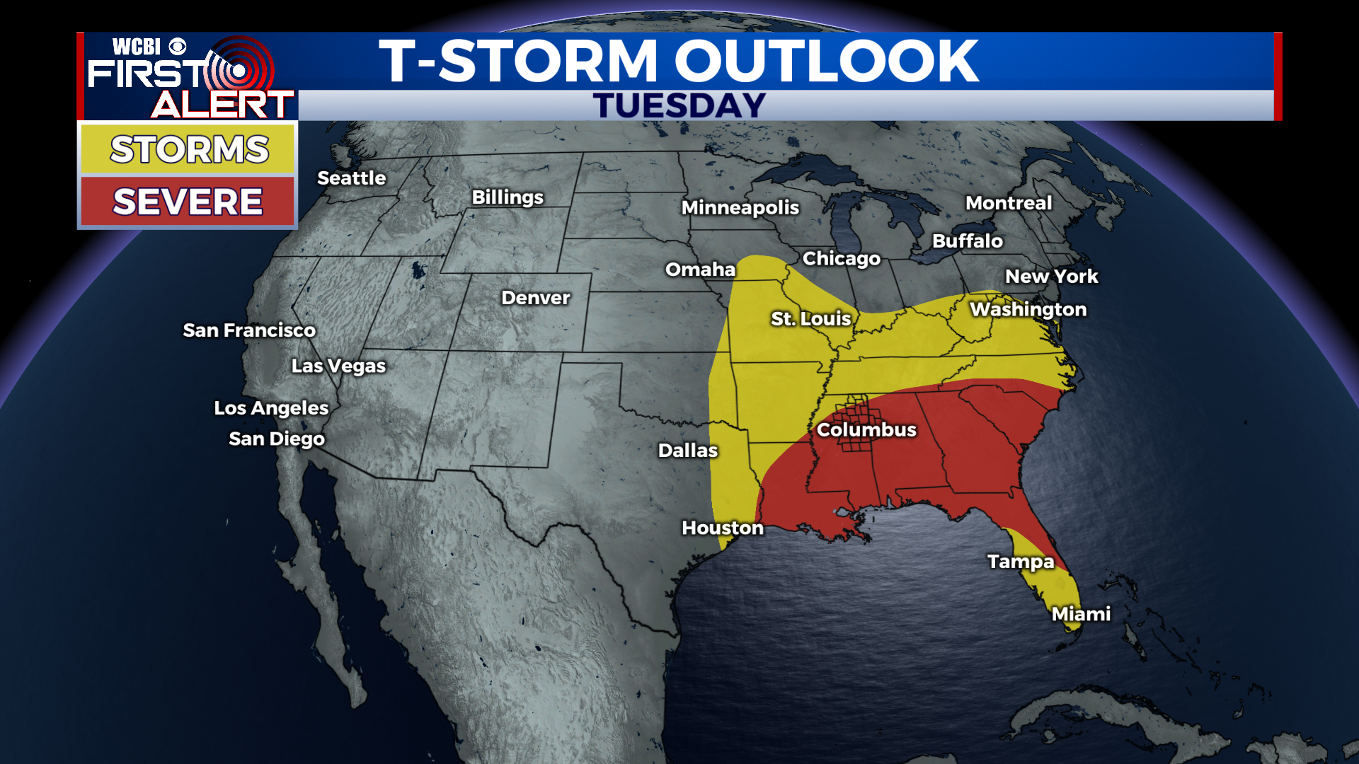
Tuesday and Wednesday bring damaging wind potential
COLUMBUS – SUMMARY: Another, albeit somewhat weaker round of severe weather takes aim at out viewing area early Tuesday into the early afternoon hours. A cold front Wednesday also brings a chance for some severe weather along with cooler temperatures which will set in for most of the remainder of the week.
MONDAY: Afternoon temperatures maximize in the upper 70s and may even break 80 as plentiful sunshine stretches throughout the region. Lows also continue to warm, this time into the 60s overnight. Rain chances remain minimal ahead of Tuesday’s severe weather event.
TUESDAY: Timing so far still puts Tuesday’s storms into the area early Tuesday with an early afternoon exit time. The threat to this point still consists of damaging winds and heavier rain totals. The odd tornado cannot be ruled out but that threat is mostly concentrated further south of our viewing area. In terms of daytime conditions, the day will actually be relatively comfortable putting all storms aside. Given the delay in front arrival until Wednesday, highs will maximize in the upper 70s once again, while lows improve into the mid 60s. As always we will continue to keep you updated on the situation as it evolves.
REST OF THE WEEK: Wednesday’s cold front will tack on an additional chance for rain, bringing with it yet another chance for severe weather. The primary threat remains the same as in Tuesday’s case, with damaging winds serving as the primary impact factor, with the outside chance for the odd tornado. It will be important to stay weather aware, as conditions can change between now and Wednesday. Cool air brought in by the front will drop highs down into the upper 50s and lows into the mid 30s by Friday. Clearing skies and dry conditions afterward will allow temperatures to slowly rebound, reaching the mid 70s by Saturday afternoon.