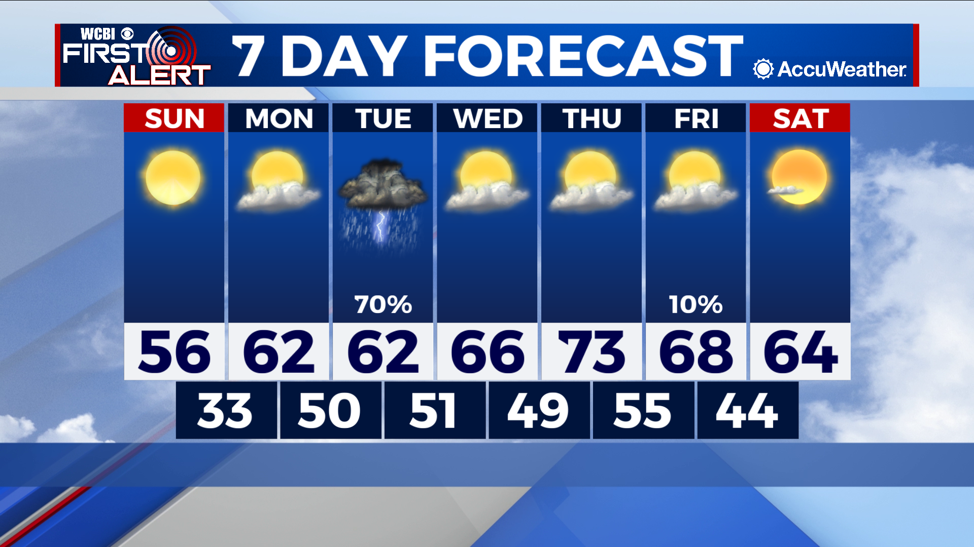
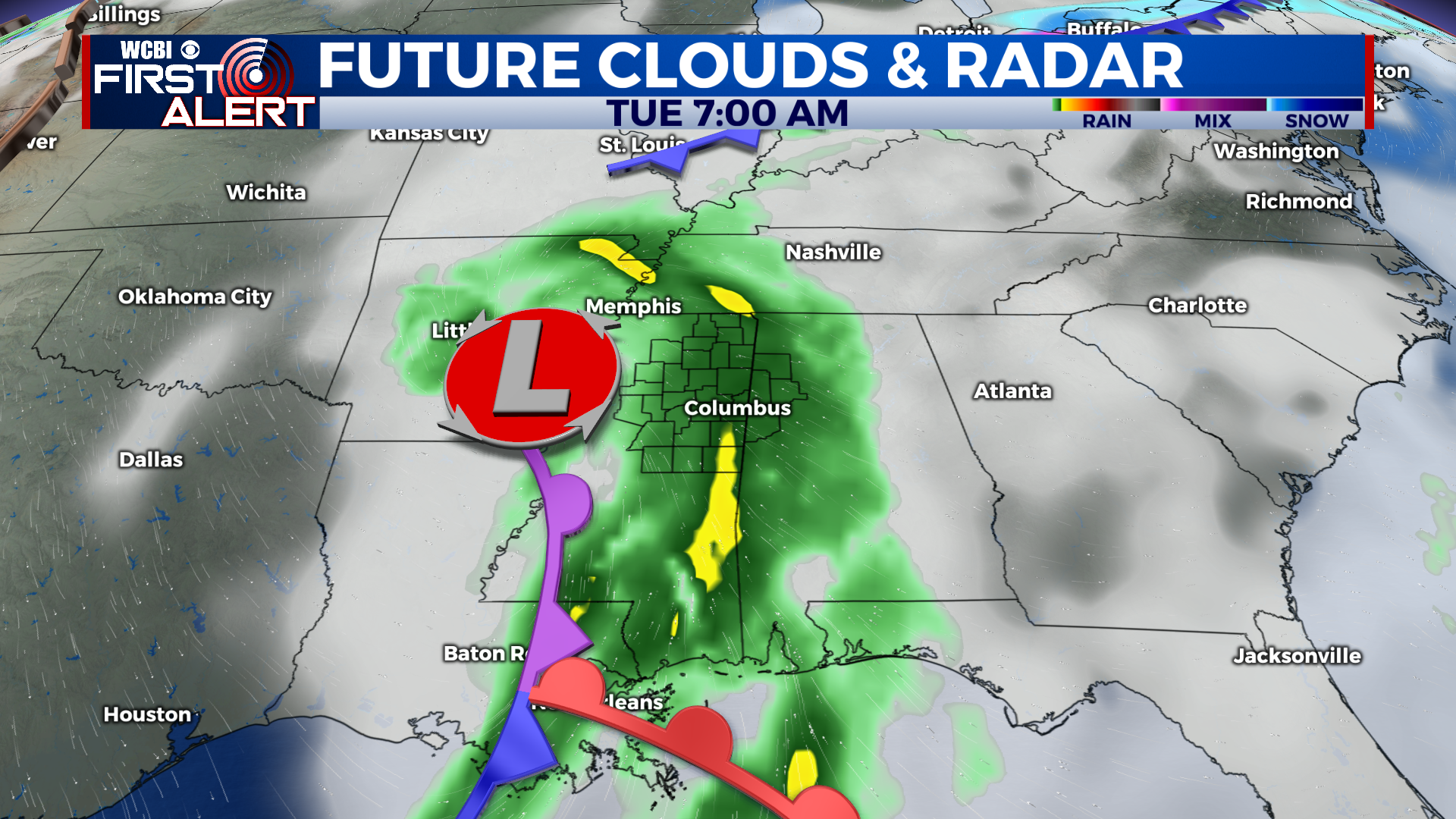
Tuesday system brings major rain chance of week
COLUMBUS – SUMMARY: Temperatures will slowly rebound into the low 70s by Thursday as some sunshine makes its way into the forecast. The core of a mid latitude cyclone will make its way through the heart of Northeast Mississippi Tuesday, bringing the chance for widespread thunderstorms across the area and the only major rain chance of the week. A cold front Friday will drop highs back down into the 60s. Lows will remain relatively consistent in the 50s throughout the week.
SUNDAY: Highs slowly rebound from the robust cold front that moved its way through the region Friday night. Sunny skies should help with warming a bit but will not be enough to push us higher than the upper 50s. Lows continue to remain relatively chilly in the lower 30s.
NEXT WEEK: Our Monday starts mild in the 60s before our system Tuesday breaks into the area. Thunderstorms and heavy rainfall appear to be the primary impacts at the moment, but we will keep you posted on the situation as it evolves. Conditions generally clear up from Wednesday onward, with the exception of a cold front on Friday. Some sunshine will aid in the warming trend and highs will be back into the 70s by Thursday with lows in the mid 50s. Friday’s cold front is not expected to be a huge factor, but will cause a healthy dip in temperatures down into the upper 60s.