Two rounds of rain boost yearly rain totals
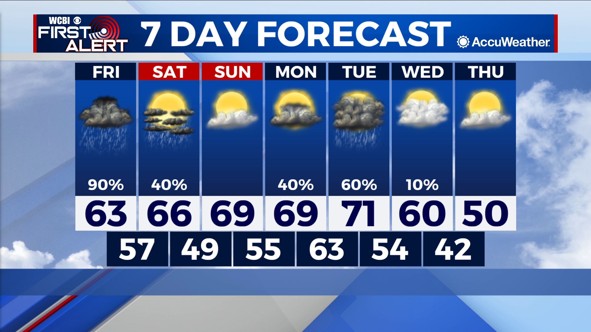
WEEKEND: Another chance for scattered showers and thunderstorms takes shape Saturday morning before clearing out by lunchtime. Highs top out in the mid to upper 60s Saturday while lows hit the upper 40s. Sunday brings us a day of more shine and some cloud cover, as highs climb once again into the upper 60s and potentially 70s for some. Lows drop into the mid 50s overnight. No rain is expected Sunday.
NEXT WEEK: Highs will slowly climb further into the low 70s by Tuesday, despite chances for scattered storms Monday. A cold front Tuesday brings the next big window for major rain chances, as well as the potential for severe weather. At this time, the western and northern portions of our viewing area have been included in an area of interest by the Storm Prediction center (SPC) for the period from Monday morning to Tuesday morning next week. Exact magnitude, duration, and timing are difficult to determine at this time and we will keep you updated as the situation evolves over the next several days. Regardless, temperatures will drop Wednesday and Thursday as a result of the cold air brought in, eventually bringing highs into the 50s once again and lows into the low 40s.