Unsettled pattern into next week
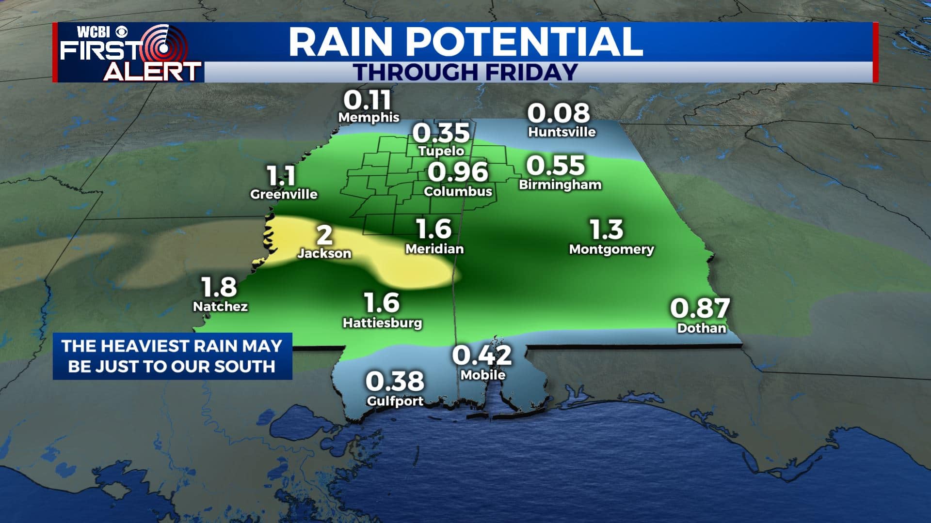
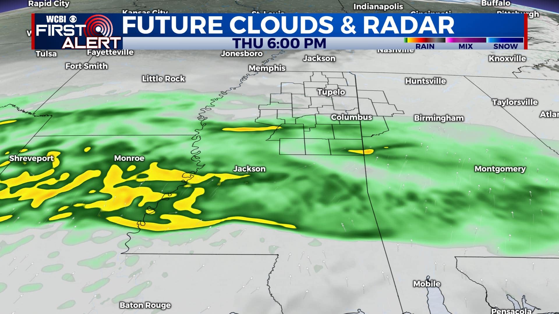
SUMMARY: A much more active and wet pattern is setting up for our area/region for the next week or so. Expect some locally steady to heavy rain Thursday into Friday. A better chance of storms (some strong?) will also exist early next week.
TUESDAY NIGHT: Evening showers and clouds with slow clearing from north to south late tonight. Lows in the mid to upper 30s in many spots by sunrise. Winds N 2-6 mph.
WEDNESDAY: Sun & clouds. Highs in the low to possibly mid 50s. Winds N 4-8 mph.
WEDNESDAY NIGHT: Turning cloudy with a 30-40% chance of showers. Milder lows in the mid 40s.
THURSDAY & FRIDAY: Mostly cloudy with areas of rain. Anywhere from about 1/4″ to 2″ of rain could fall in our area. Some higher totals are certainly possible but the latest projections suggest they are more likely to our south in Central & Southern Mississippi. Look for highs in the 50s with lows in the 40s.
FRIDAY NIGHT: Gradual clearing. Colder lows around 32.
SATURDAY: Sun & clouds. Highs in the low 50s.
SUNDAY: Mostly cloudy with rain showers possible. Highs in the low 50s.
MONDAY: Mostly cloudy. Rain and storms are likely and some could end up being on the strong side. It’s something we’ll keep watching during the coming days. Highs around 70.
Follow @WCBIWEATHER on Facebook, Twitter, Instagram, and the WCBI News App


Leave a Reply