Warm and humid w/increased weekend rain chance
COLUMBUS, Mississippi (WCBI) – Rain chances continue over the next few days, becoming most widespread by Sunday. Cooler air looks to move in as well.
THURSDAY: Expect a mostly cloudy, warm, and humid day with highs into the lower 80s. Scattered showers and a few storms are likely to form after lunch, and some could become briefly heavy.
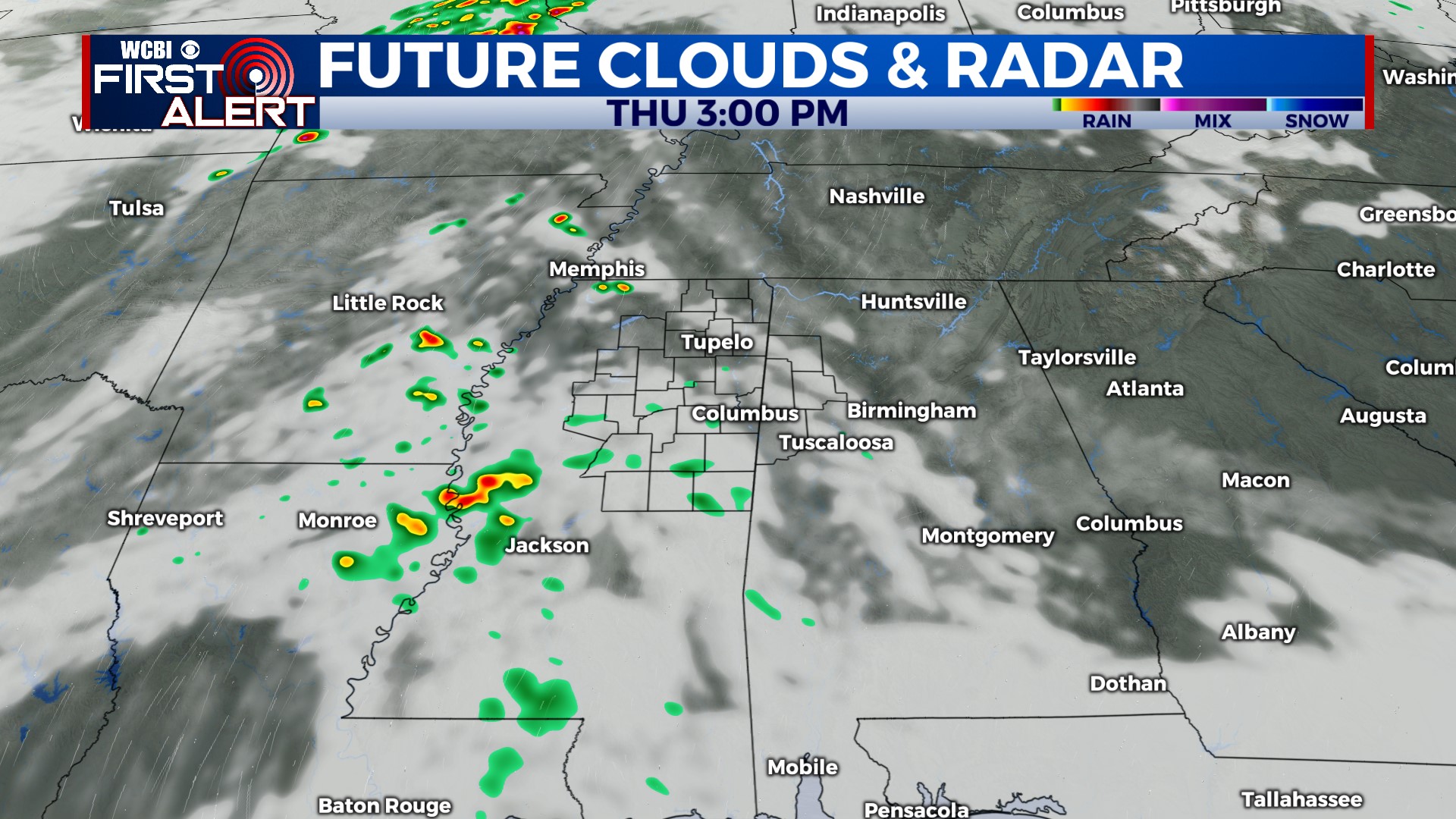
THURSDAY NIGHT: An incoming cold front will have scattered, locally strong to severe storms along it crossing the MS River well after sunset. The good news is the bulk of this activity should stay in Tennessee, but a few storms could make their way into northwestern MS late. Overall, severe weather concerns remain quite low.
FRIDAY: Thursday night’s front makes a slow pass through the region, thankfully with limited rain! Highs will be split across the region – in the upper 60s north of US 82 and in the low 80s south of US 82.
WEEKEND: Behind the front, moisture will slowly work “over” the front and bring increased rain chances. Scattered showers are likely much of the day Saturday, thankfully with little thunder expected. Be prepared to dodge some raindrops at Super Bulldog Weekend! Heavier, steadier rain is expected to move in late Saturday into Sunday morning. Through the day Sunday, rain should steadily shift east…but a good chunk of the day will be soggy and much cooler!
NEXT WEEK: Gradual clearing is expected Monday with warmer weather building back into mid-week.