Warm and unsettled week of weather ahead
COLUMBUS, Mississippi (WCBI) – Seasonably warm and quite humid weather takes hold much of this week. Daily rain chances accompany as well.
MONDAY: Warm and increasingly humid weather makes a return today as a warm front retreats across northern MS. Daytime temperatures reach the lower 80s with intervals of sun. A few showers and storms are likely to form late in the day, and these could become severe with gusty winds and hail…similar to Sunday’s pre-dawn storms. Not everyone will see these storms, however.
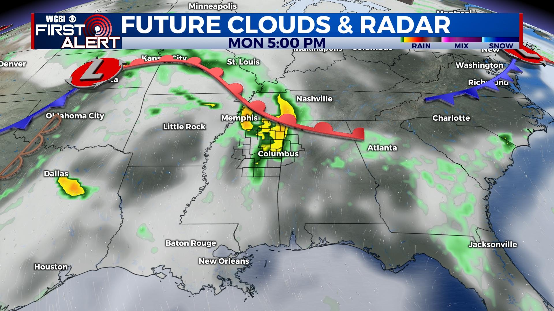
TUESDAY: Showers and storms west of the MS River will weaken before reaching north MS, but scattered showers and a few storms could redevelop along a stalling front across northwest MS in the afternoon. These could impact parts of north MS, but coverage is expected to remain relatively isolated. Thanks to southwest winds, highs will reach the mid to upper 80s – a bit warmer!
WEDNESDAY: Tuesday’s stationary front remains north of the WCBI coverage area, leaving us mostly dry and warm/humid. Any showers should be brief and widely spaced.
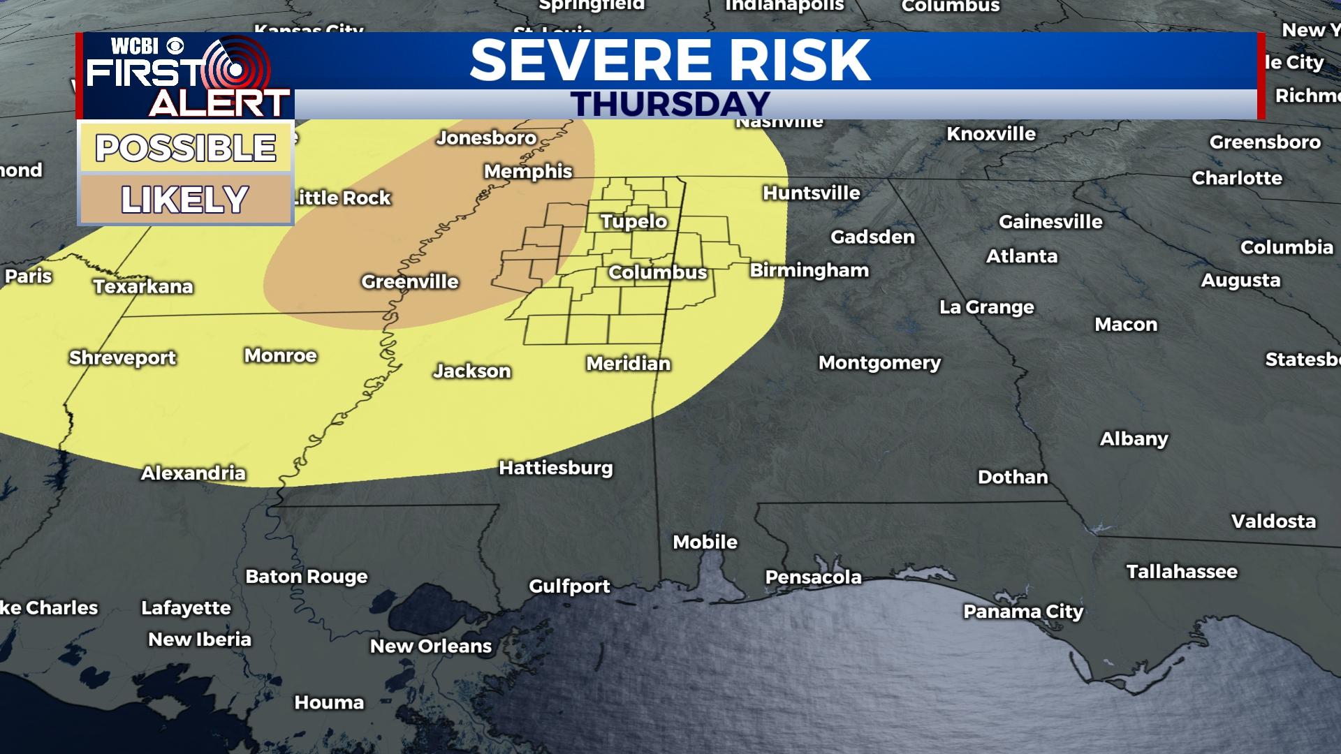
THURSDAY: A much stronger system and attendant cold front will bring higher shower/storm chances to the Deep South in the afternoon/evening hours. Increased wind shear will promote the risk of a few severe storms.
FRIDAY: Forecast models remain slightly disjointed as to the evolution of Friday’s forecast. For now, decreasing clouds/rain chances look to be the most likely scenario as highs drop back to the 70s.
WEEKEND: A brief reprieve in rain chances could occur Saturday, but additional showers could move back in Sunday.