Warm start to April with storm chance on the way
Wet weather returns on Tuesday
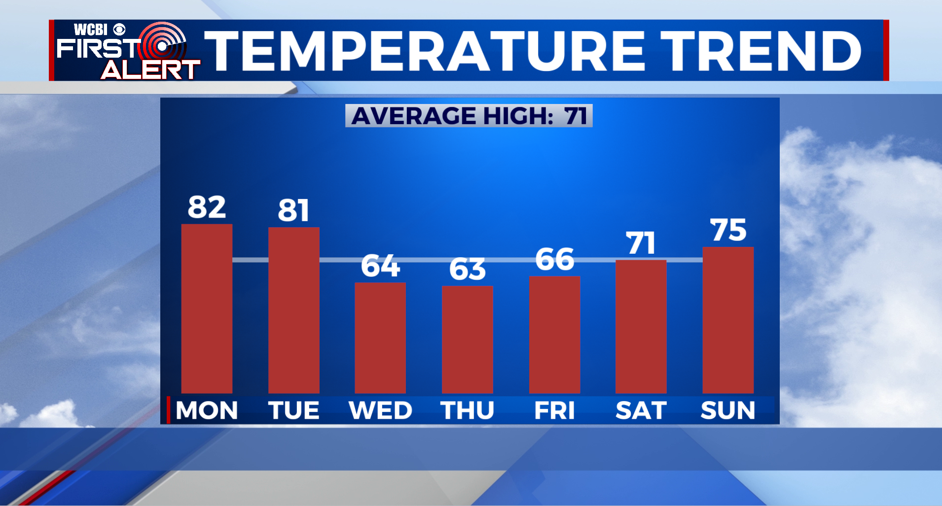
COLUMBUS, Mississippi (WCBI) – After an enjoyable Easter weekend, we will begin our April with warmer temperatures and a chance for storms Tuesday. Once those storms roll out of our area, we will see some clearing and milder temperatures for midweek.
MONDAY: We are kicking off our April on the warmer note with highs in the low 80s today, and it will be pretty cloudy for the majority of the day. Tonight, clouds will stick around, and we will only cool down into the upper 60s for those overnight lows.
TUESDAY: Our next weather maker will bring the chance of showers and storms into Northeast Mississippi by Tuesday evening. A few of these storms have the possibility to be severe with damaging wind gusts and hail being the main threats. An isolated tornado cannot be ruled out though. High temperatures will be in the low 80s while overnight lows will cool down into the upper 40s.
REST OF WEEK: Tuesday is our only rain chance this week! For midweek, we will have a brief cool down into the mid 60s! In addition to the mild afternoon temps, morning lows will be chilly as well ranging between the upper 30s and low 40s. Clouds will clear out it with the rain, leaving us with a mostly clear sky for midweek.