Warm weather continues, storm risk returns Wed & Thu
COLUMBUS, Mississippi (WCBI) – As warm weather continues into early March, strong to severe storms will return to the forecast.
TUESDAY: This still looks to be the best weather day of the week. Expect lots of sunshine and a warm afternoon with highs back in the lower 80s, similar to Monday but with less wind.
TUESDAY NIGHT: Temperatures will initially drop off fairly quickly after sunset, but southerly winds and increasing cloud cover will offset this cooling after midnight. Temperatures could even rise from the mid 50s back to near 60 degrees by daybreak.
WEDNESDAY: Another warm day is on tap with highs in the lower 80s and a mix of sun & clouds. Scattered showers are possible in the afternoon followed by an increased risk of storm development after 5p. Severe storms in Arkansas could develop into north MS after sunset, or new storms could develop over northern MS after sunset. Regardless, all modes of severe weather (hail, wind, tornado) would be possible with any mature storm.

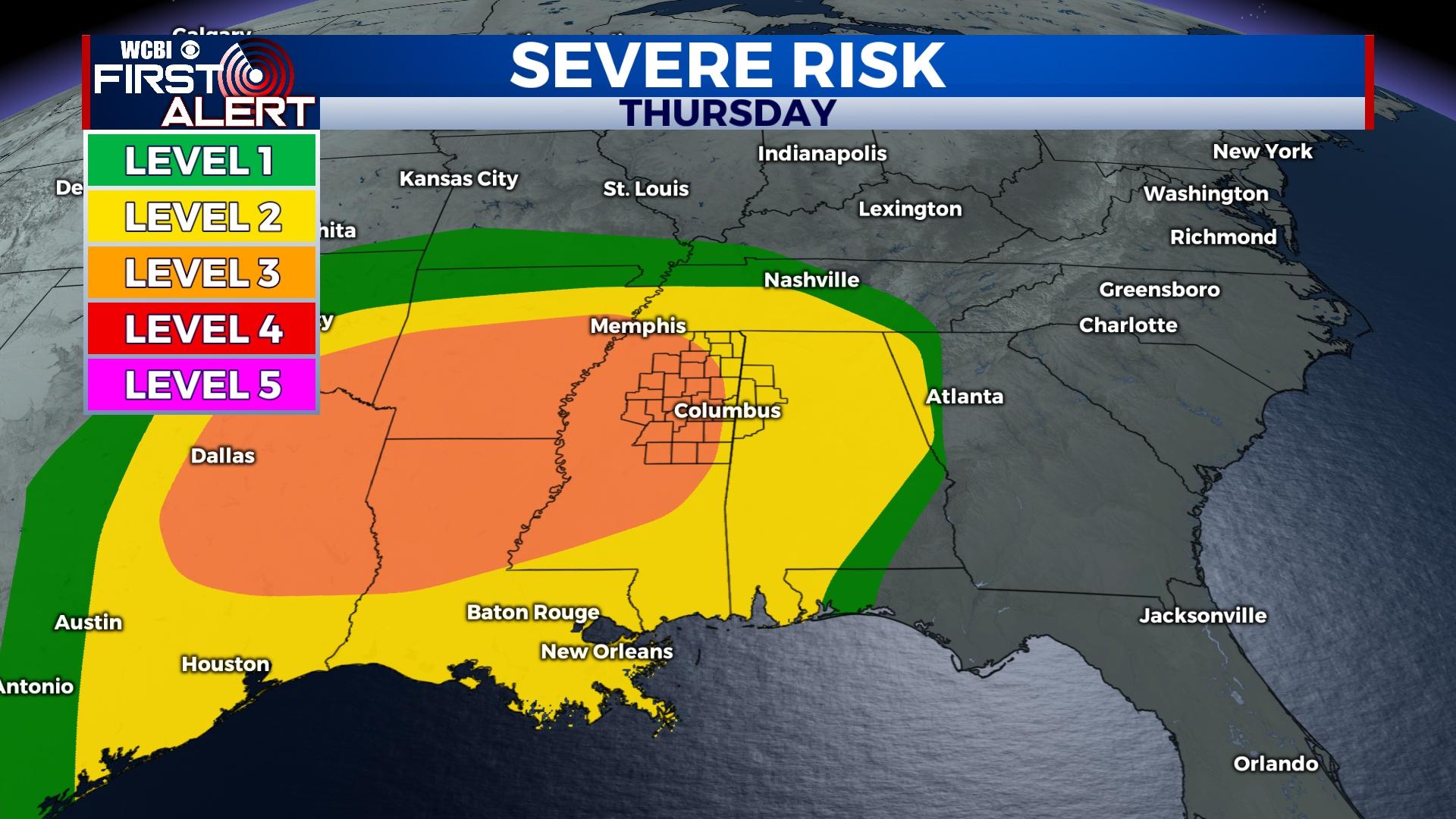
THURSDAY/FRIDAY: A large portion of the Mid-South remains in a level 3/5 enhanced risk of severe weather, though specific details of storm coverage and evolution remain unclear. Most of the day Thursday across north MS looks relatively tame, though any storm would have potential to become severe. The higher severe weather risk will build in late Thursday evening, likely after midnight. A line of strong to severe storms will sweep across north MS after midnight through daybreak Friday with attendant threats of wind damage and tornadoes. Behind these storms, rapid clearing and breezy weather will prevail much of Friday with highs back in the upper 60s.
WEEKEND: A gradual cool-down is expected with highs back in the lower to middle 60s. Morning lows will likely dip into the upper 30s Saturday and mid 30s Sunday.