Warmer mid-week ahead of Wednesday evening storms
COLUMBUS, Mississippi (WCBI) – Temperatures stay above average through mid-week. Strong to severe storms are possible Wednesday night.
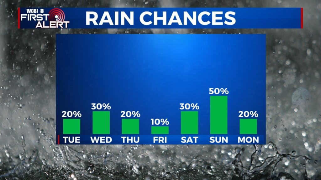
TUESDAY: Breaks of clouds this afternoon with highs in the lower 70s. A few showers could redevelop, but most will stay dry.
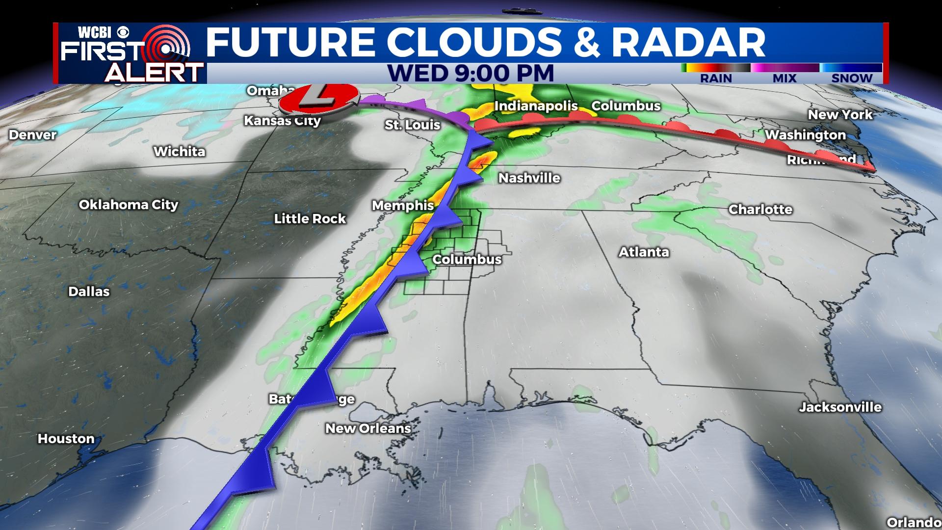
WEDNESDAY: The day should start cloudy with some patchy fog and temperatures in the upper 50s. While some briefly heavy showers or even a localized strong storm are possible by late morning, the more organized threat for severe weather will hold off until the evening hours. If any storm is able to materialize in the afternoon hours, it has potential to become severe. Otherwise, expect a warm, humid, and breezy day with highs in the 70s and wind gusts up to 25 mph.
WEDNESDAY NIGHT: A wavy line of strong to severe storms should move through north Mississippi after sunset into the late evening hours. Damaging winds and a few brief embedded tornadoes are possible along the line. The main time frame for severe weather looks to be from around 7p-midnight.
REST OF WEEK: Sunshine returns Thursday and Friday as temperatures drop back into the 60s and 50s by the end of the week.
WEEKEND: While still uncertain, it looks like the heavier rain chance may settle in Saturday night. Showers are still possible into Sunday as well, but the good news is trends suggest severe weather will not occur with this system.