Warming up, with a mid-week rain chance
COLUMBUS, Mississippi (WCBI) – There will be a mid-week chance for rain, along a stalled front. Warmer air will move in by Friday, bringing end of the week and weekend temps back into the low to middle 80s.
TUESDAY NIGHT: Staying mostly clear through most of the night. But a few clouds will begin moving in early morning Wednesday. Overnight low temperatures will be in the low to middle 50s across the corner. Cool but definitely warmer than the past 2 nights.
WED/THU: A weakening front from the north will start to fizzle out, but it will still bring enough moisture to generate a few showers each afternoon. These could be briefly heavy, and a storm or two are even possible. Highs will stay in the upper 70s both days. Low temps will range in the upper 50s to lower 60s.
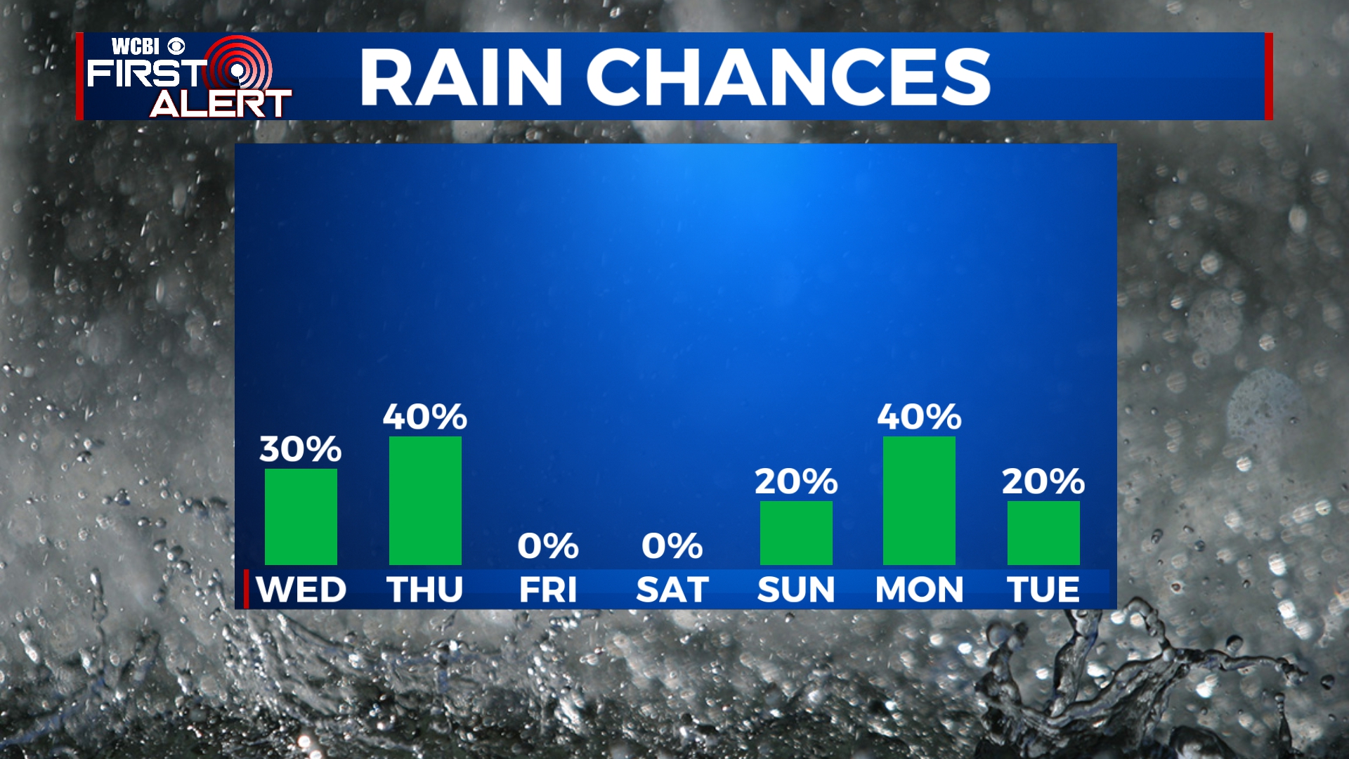
FRI/WEEKEND: The stalled front will surge North as a warm front, bringing in much warmer air for the weekend. Afternoon highs will easily reach the 80s. Friday & Saturday look dry, but the approach of a slow-moving cold front Sunday evening could spark off a few showers. The better chance of rain looks to hold off until Monday of next week.


