Watching Zeta and its impacts for Wednesday into Thursday
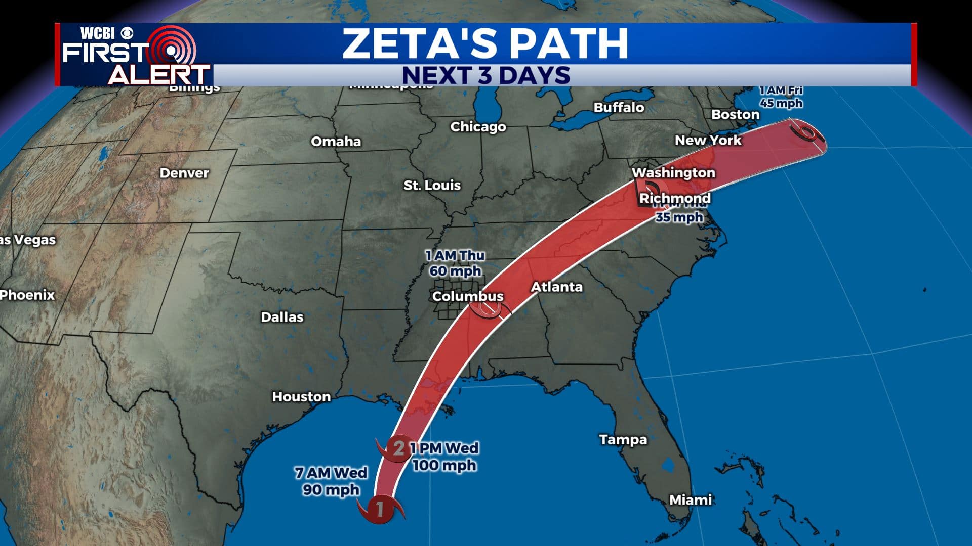
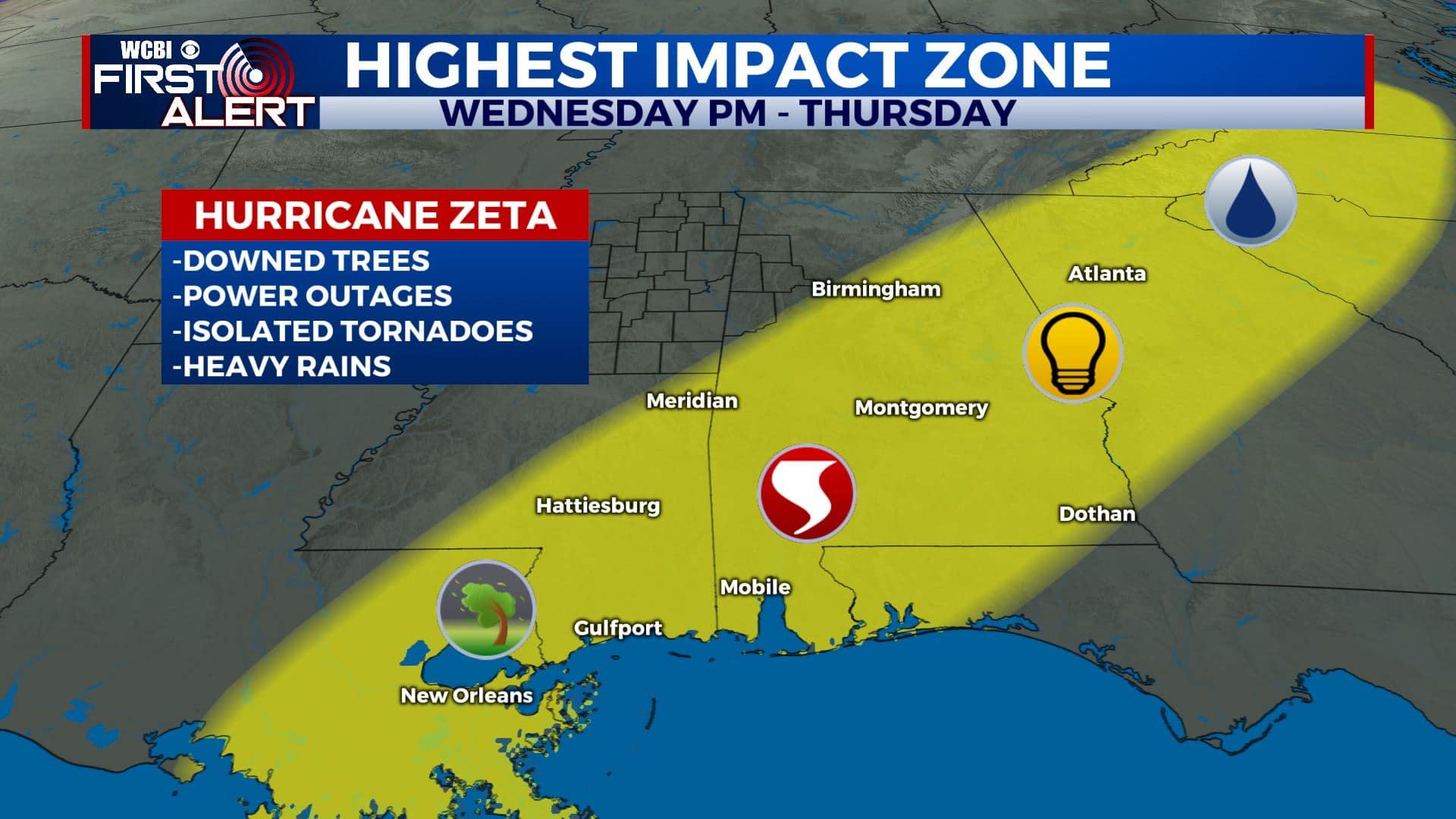
SUMMARY: As of 1pm Wednesday, Hurricane Zeta is now a Category 2 storm with winds at 100 mph. Should be making landfall along the northern Gulf Coast over the next several hours. Inland Tropical Storm Warnings are now in effect for areas east of us. Tropical moisture from Zeta is going to merge with a cold front Wednesday into Thursday. Some wind gusts could be over 30 mph at times Wednesday night into Thursday but no widespread issues are expected in our area at this time. Drier, sunny and cooler weather weather builds back in by Friday. It will continue through Halloween weekend and into early next week.
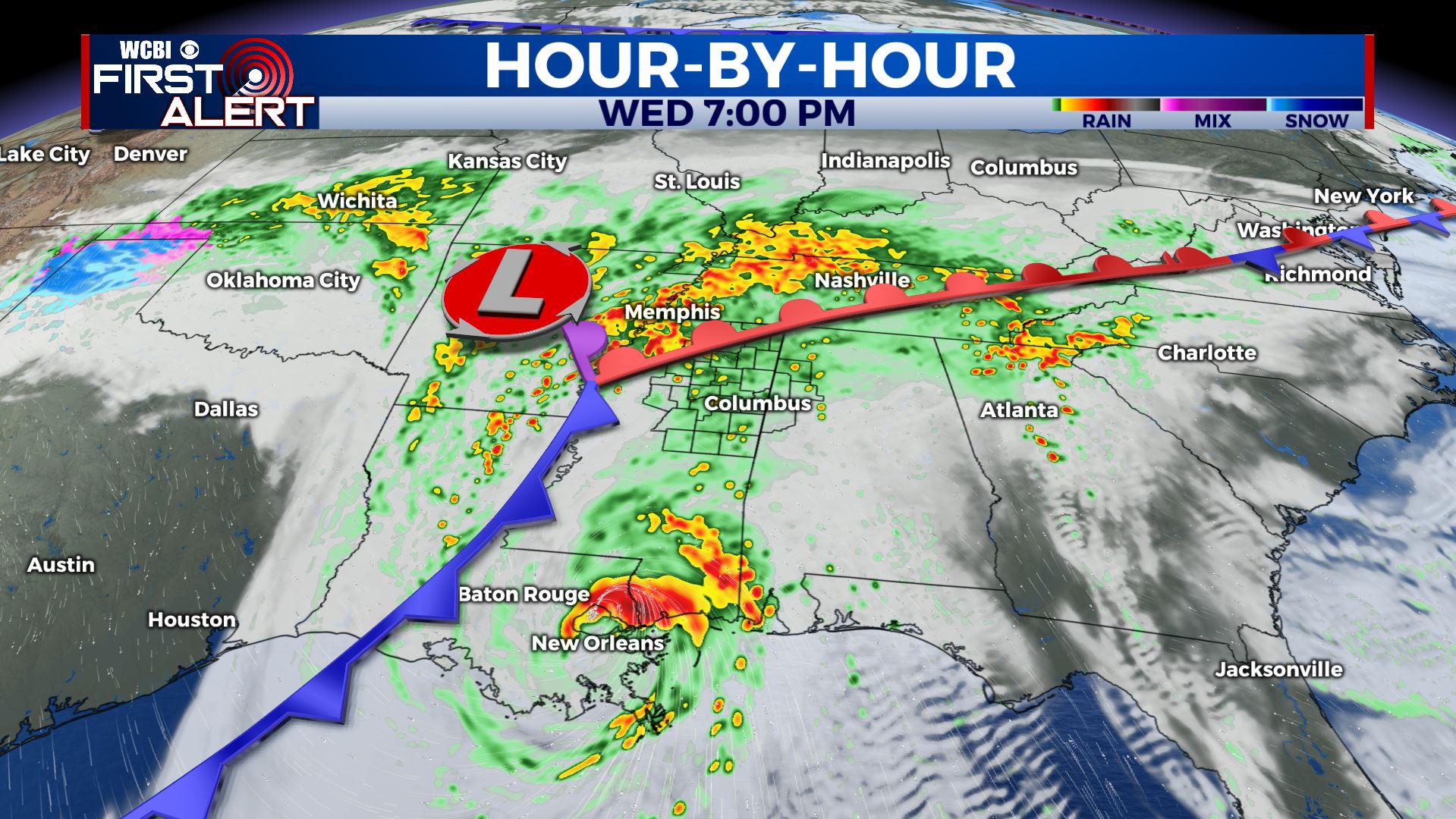
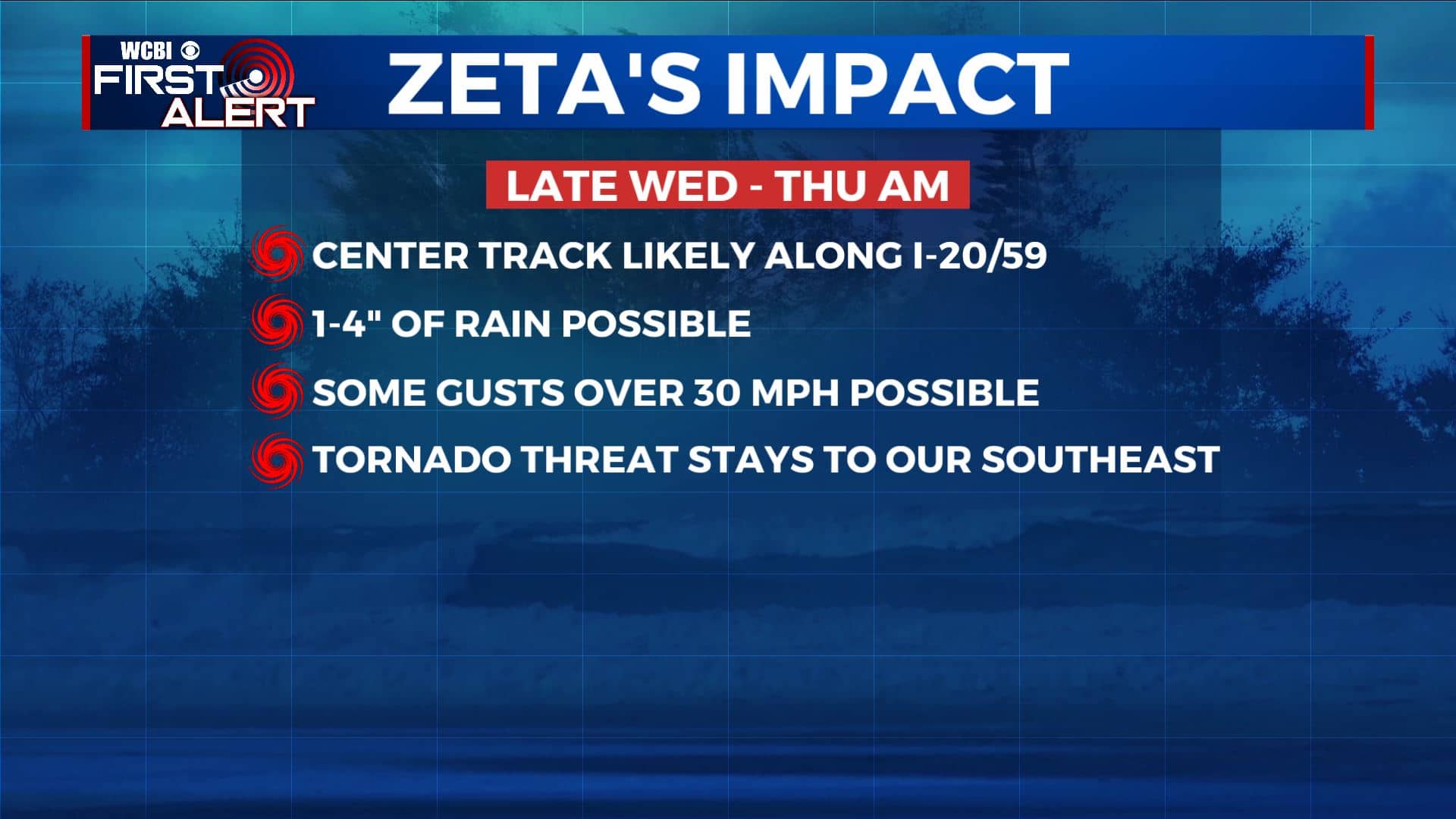
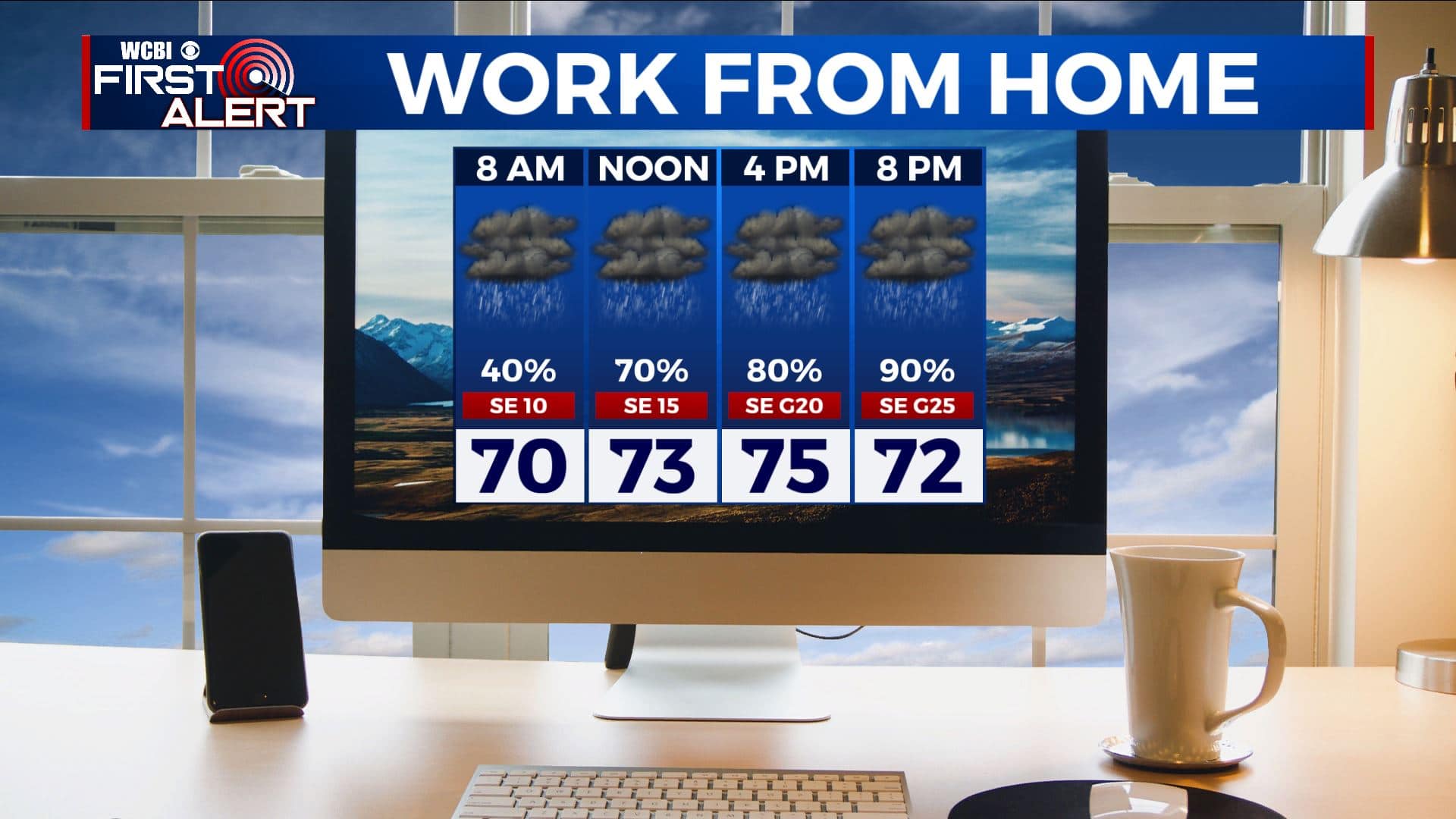
WEDNESDAY: Rain has been moving in to north Mississippi & west Alabama overnight and will continue throughout the morning into the afternoon & evening hours. Some rain may be locally heavy at times. 1-4 inches of rainfall is possible through Thursday. Highs in the 70s. Winds SE 10-15 mph with some higher gusts. up to 20-25 mph.
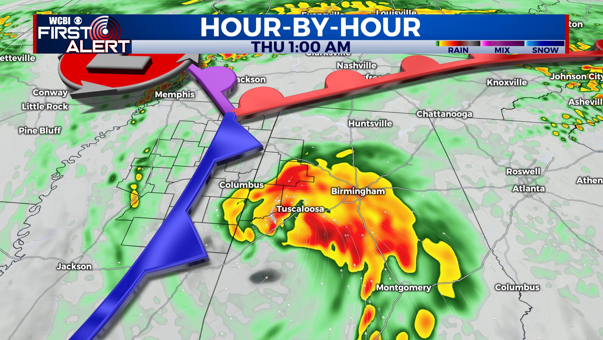
WEDNESDAY NIGHT: Windy conditions with widespread rain. Wind gusts could be over 30 mph as the remnants of Zeta swirl through along the I-20/59 corridor. The highest winds and the isolated tornado threat currently looks to be along and south of the I-20/59 corridor Wednesday night and Thursday morning.
THURSDAY: Morning clouds and showers give way to some afternoon clearing behind a cold front. Breezy SW to NW winds 10-25 mph, with some gusts up to 25 mph. Highs upper 60s to near 70.
THURSDAY NIGHT: Mostly cloudy. Overnight lows in the mid 40s to lower 50s.
FRIDAY: Morning clouds with widespread sun taking over during the afternoon. Cooler highs in the low 60s. No issues expected for high school football this week.
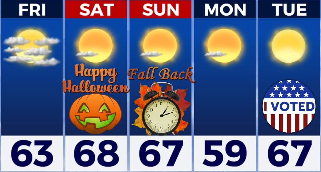
WEEKEND: The weekend will be drier, mostly sunny and boo-tiful which is good news for any Halloween plans you may have. Remaining cool with highs in the upper 60s Halloween Saturday & Sunday. Overnight lows in the 40s. Reminder that we fall back one hour 2am Sunday.
NEXT WEEK: Staying mostly sunny. Expect highs in the upper 50s to near 60 on Monday with 60s by Tuesday with overnight lows in the upper 30s and 40s. There won’t be any weather worries for Election Day on Tuesday.
Stay connected with @WCBIWEATHER on Facebook, Twitter, Instagram, and the WCBI News App


Leave a Reply