Weather-Aware Tuesday
COLUMBUS, Mississippi (WCBI) – We will need to be weather-aware and keep a close eye on the radar tomorrow.
TONIGHT: Warm and windy. Southerly winds could gust as high as 30 mph! Low near 67° with overcast skies. A few isolated showers will develop across the region, and a rumble of thunder is possible, but widespread severe weather is not a concern tonight. Chance of rain: 20%.
TUESDAY: Warm and windy. High near 74°. Chance of rain: 100%.
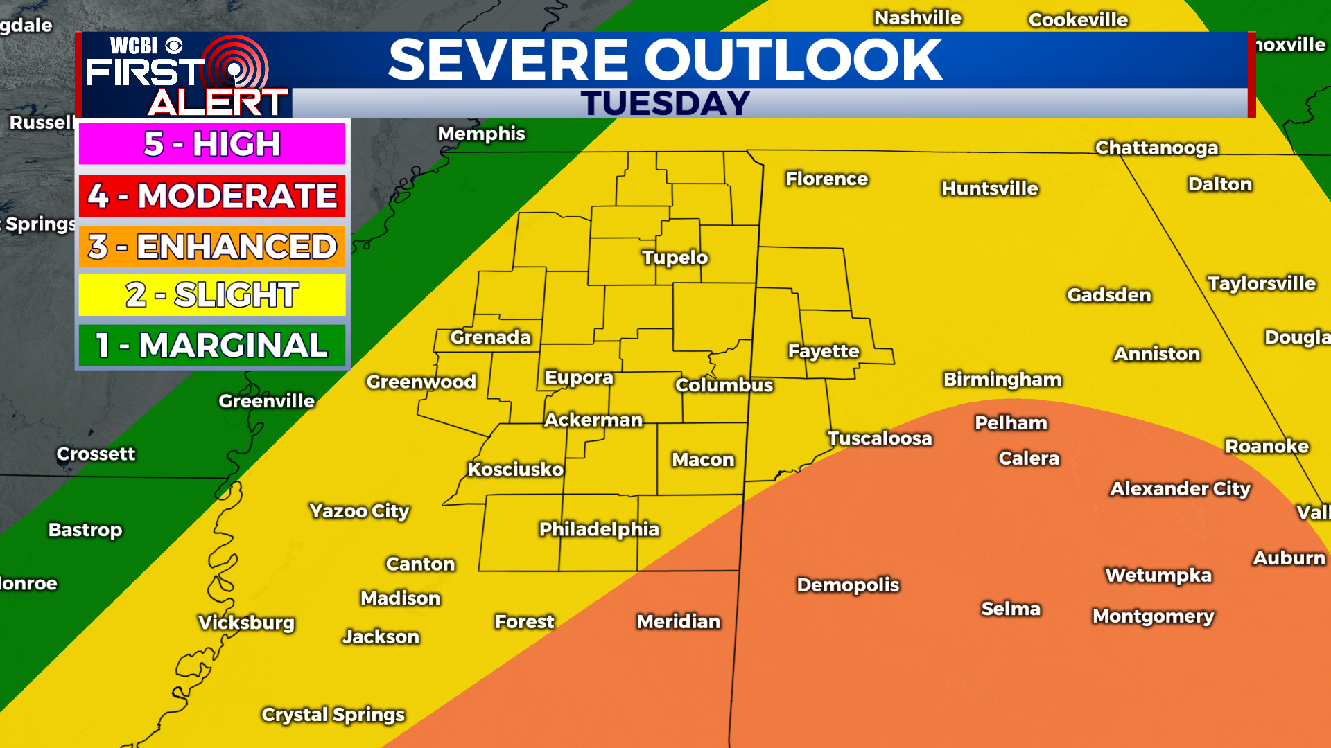
TUESDAY SEVERE STORMS: Our severe weather risk looks to be increasing. A weakening line of storms will move in from the west during the morning and could contain embedded damaging wind gusts and a spin-up tornado (time frame: 7 AM to 11 AM). After that line weakens and moves out, warm air and moisture will begin to surge back into the region once. This will provide extra fuel for new storm development as the cold front approaches. These scattered storms in the afternoon/evening are the ones we have to watch closely. Any storm that forms will have the possibility of rotating. Damaging wind gusts, small hail, and tornadoes are possible (time frame: 12 PM to midnight). For now, most of the area is under a level 2 out of 5 “slight” risk for severe weather, with a level 3 out of 5 “enhanced” risk to our south. I wouldn’t be surprised if the level 3 risk got expanded northward and included some of our area in future updates. Regardless, we want you to be weather-aware. We’ll make it through these storms, just as we have the other ones!
WEDNESDAY: The cold front will have passed and skies will clear throughout the day. High near 66° with lots of sunshine! Breezy at times.
Have a great night!


