Wednesday night storm threat
COLUMBUS, Mississippi (WCBI)- What a pleasant start to the week! Monday was filled with sun and today continued the mild temperatures. Wednesday will bring in a shift to our weather.
TUESDAY NIGHT: Temperatures today made it into the middle 70s! Cloud coverage will continue to fill in ahead of the next system moving into the Deep South. Along with the clouds, there may be a few spotty showers across Mississippi. Temperatures tonight are going to be pleasant, in the middle 50s.
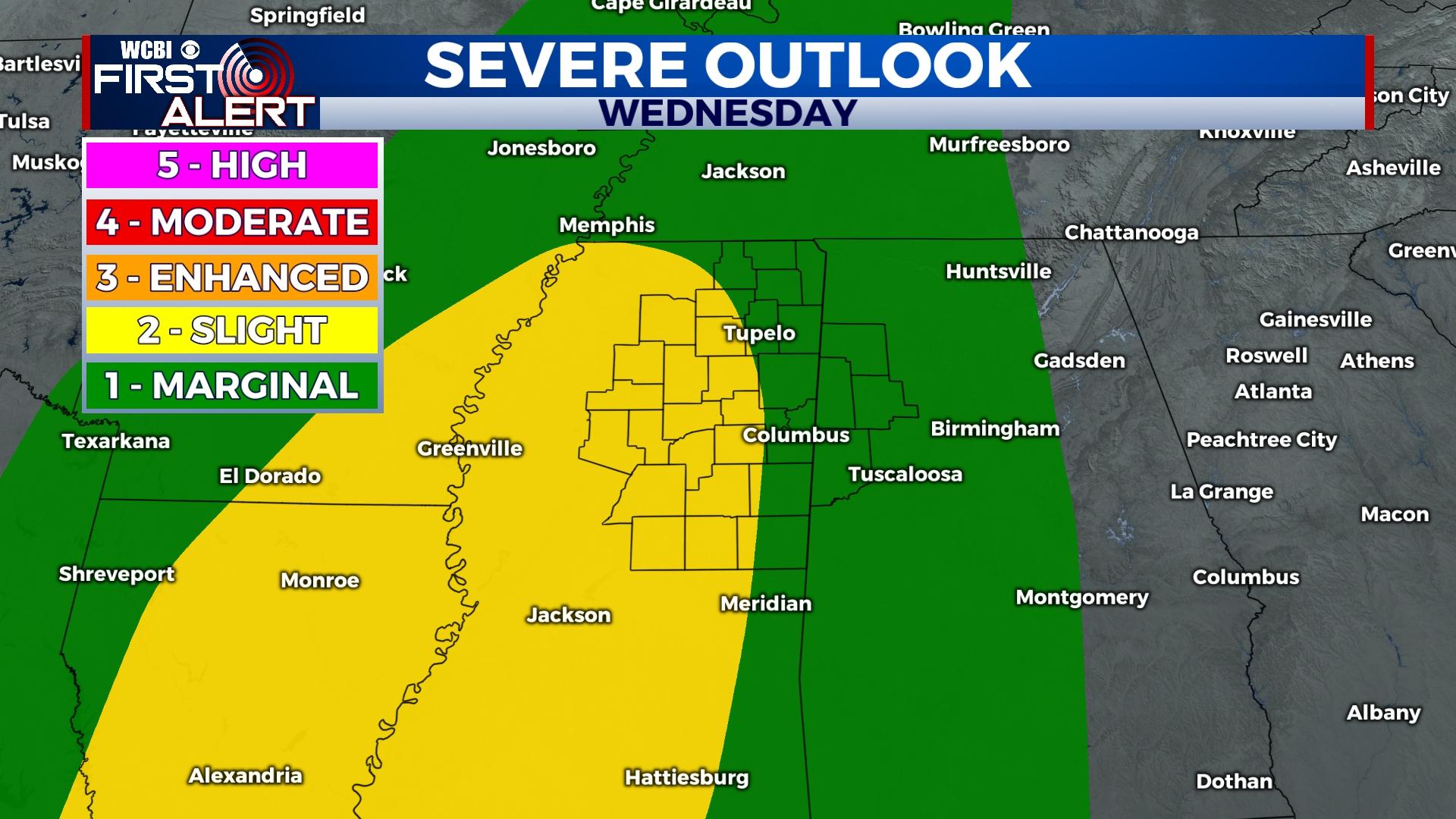
WEDNESDAY: High temperatures on Wednesday will be back in the lower 70s. There is a chance of seeing a few more spotty showers throughout the day, the main line of the system will push into Mississippi after sunset. The timeline has looked to shift a little later into the evening/morning, between 9pm-3am. Showers and storms will develop and will be bringing potential for severe weather. The Storm Prediction Center has Mississippi split between a Level 1-Marginal and Level 2-Slight risk for severe weather. Damaging wind gusts and a tornado threat will be the main threats with these storms, so make sure to have multiple ways to receive weather information!
THURSDAY: Into the very early morning hours, rain may continue. Going further into the day, rain showers and cloud coverage will begin clearing out. High temperatures will be mild in the middle 60s. Overnight temperatures will be in the low to middle 40s.
FRIDAY: The cloud coverage will build back up throughout the morning and afternoon. Temperatures are going to be a little cooler, in the middle to upper 50s. There is going to be a light rain chance throughout the afternoon and evening. Overnight temperatures will be in the middle 30s.
WEEKEND: Temperatures are going to be cooler, back into the 50s. The sky is going to be clear and sunny once again. Overnight temperatures will range between the upper 20s and the middle 30s.


