Wet & stormy through Wednesday night
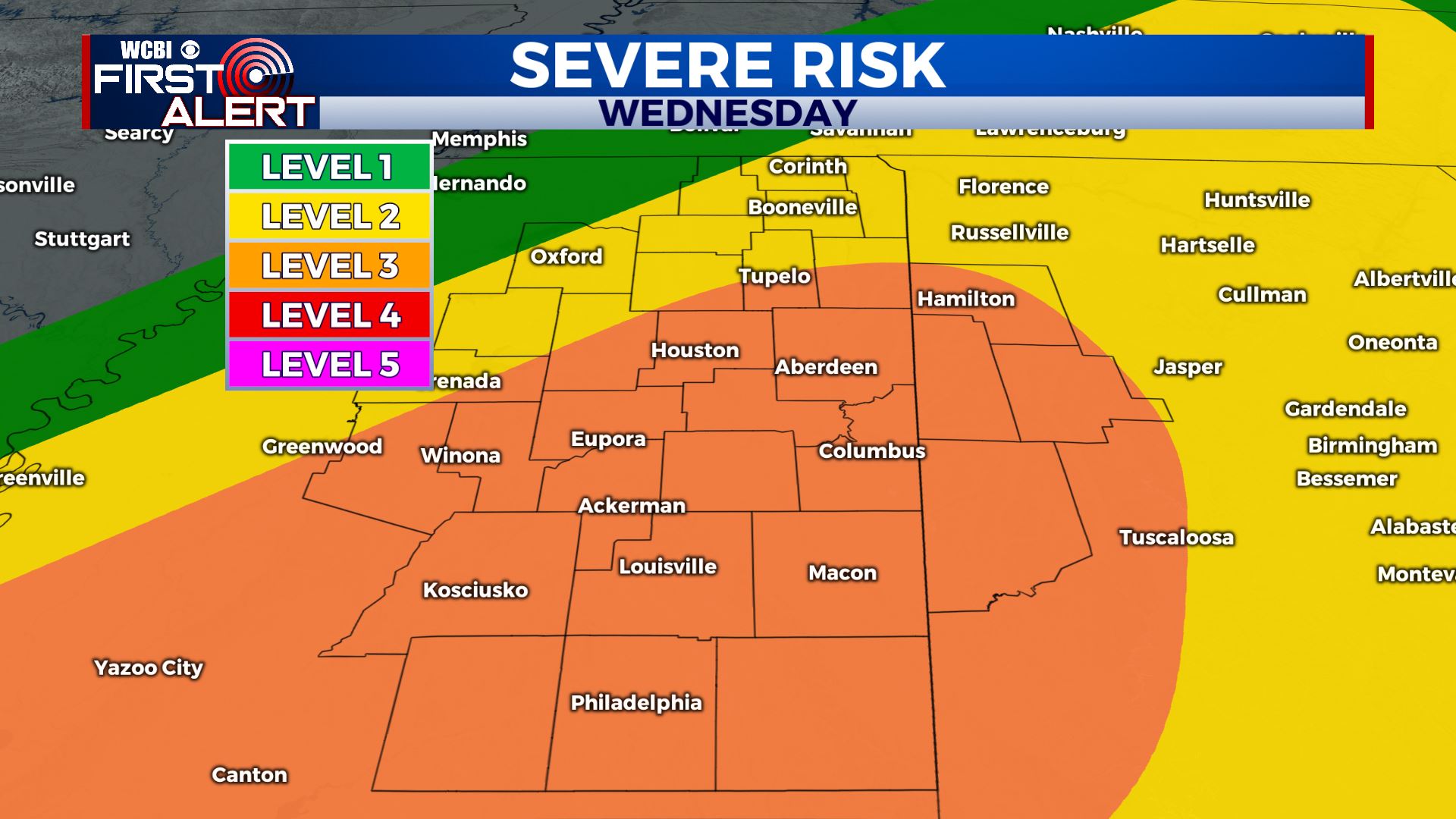
SUMMARY: An additional 1 to 6 inches of rain will continue to pose a flooding threat through Wednesday night. Strong to severe storms are possible Wednesday afternoon and evening. Cooler and drier air is slated to return for the end of the week before wet weather returns by Saturday night and Sunday.
MONDAY NIGHT: Areas of rain. Heavy at times. A few storms are possible and we can’t totally rule out a strong storm with gusty wind and small hail. Lows will range from the mid 40s north to the mid 50s and low 60s southeast.
TUESDAY: Cloudy with areas of showers and rain. The intensity of rain won’t be as high as it was Monday. Plan on highs mainly in the 50s with northerly winds around 10 mph.
TUESDAY NIGHT: Cloudy with areas of showers and rain. Lows in the upper 40s to around 50.
WEDNESDAY: Warmer highs in the 60s to low 70s. The trade off will be a risk for strong to severe storms during the afternoon and evening, including strong wind gusts and even an isolated tornado or two. We’ll keep monitoring things going forward.
WEDNESDAY NIGHT: Areas of rain and storms. More heavy rain is likely. Lows near 50.
THURSDAY: Morning rain followed by drying. Highs in the low to mid 50s.
THURSDAY NIGHT: Clearing. Much colder lows around 30.
FRIDAY: Sunny and cool. Highs in the upper 40s to around 50.
FRIDAY NIGHT: Clear and chilly. Lows around freezing.
SATURDAY: A nice start with clouds increasing during the afternoon. A few showers are possible late in the evening but most of the day looks dry. Highs in the mid to upper 50.
SUNDAY-MONDAY: Areas of rain and thunder. Highs in the 60s.
Follow @WCBIWEATHER on Facebook, Twitter, Instagram, and the WCBI News App


Leave a Reply