Wet week ahead as moisture returns and early week cold front cools things down
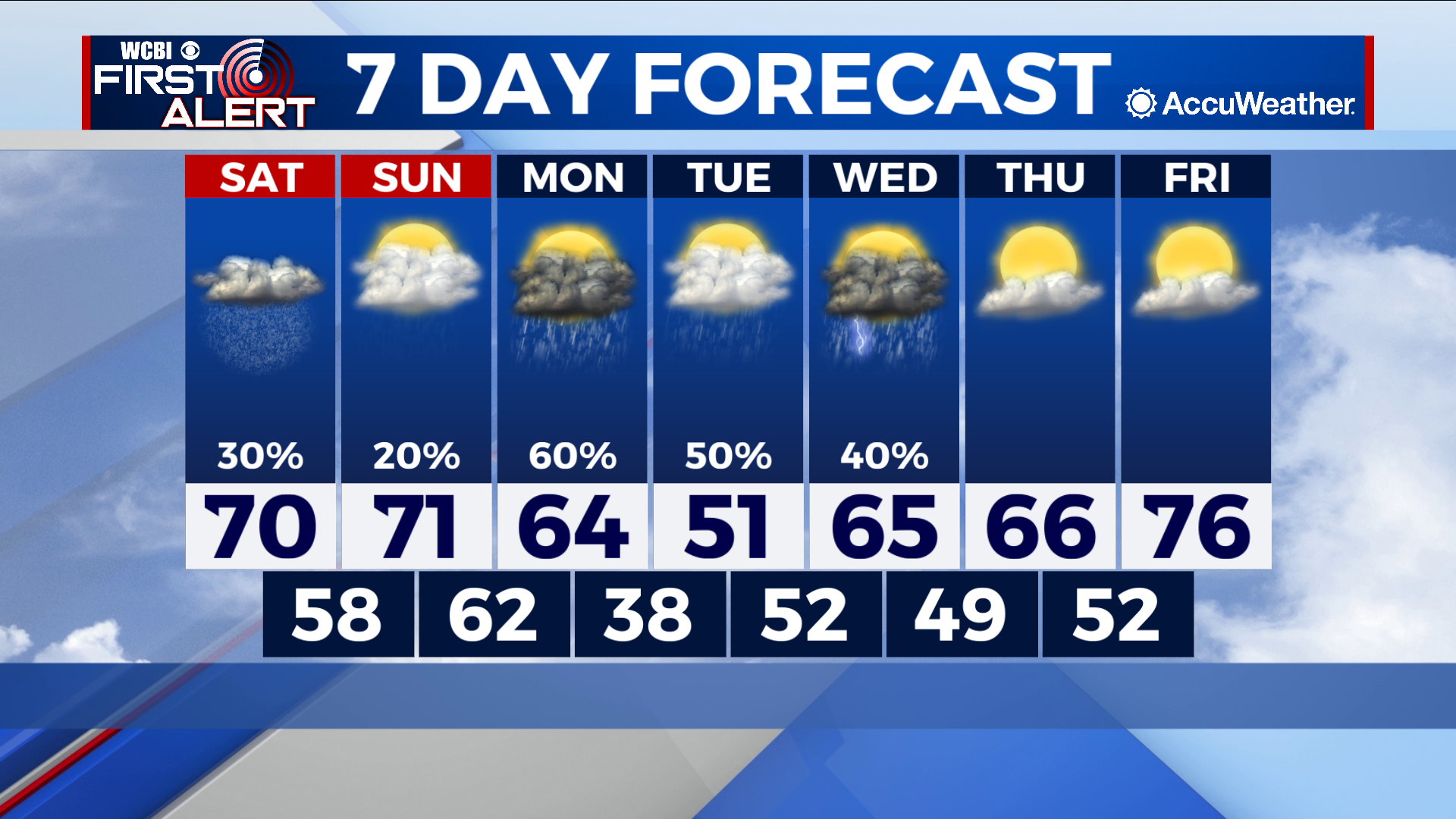
COLUMBUS – SUMMARY: Temperatures remain above average before an early week cold front knocks temperatures do to more winter-like levels. Rain chances return in force, with a chance for showers in the forecast every day until next Thursday. Clouds return as well and will keep the sun away for most of next week.
SATURDAY: Above average temperatures in the 70s continue to prevail. Some drizzle is possible as mostly cloudy skies are the order of the day. Overnight lows drop into the high 50s.
SUNDAY: Mostly cloudy skies remain as temperatures top out once again in the 70s. Lows continue a slight warming trend into the 60s. A stray shower or two cannot be ruled out throughout the day.
NEXT WEEK: The rain chances continue as another cold front sets up to pass through Monday around midday. Look for scattered showers and thunderstorms to accompany this front but nothing severe is expected. Lows will drop down into the high 30s overnight as the cooler air moves into the region. The rain does stick around for the next few days however, and until Thursday, showers and thunderstorms are a possibility throughout Tuesday and Wednesday. Temperatures do rebound after the front passes, and we can expect temperatures in the mid 70s again by Friday.