Winter Storm #2 Wednesday Into Thursday
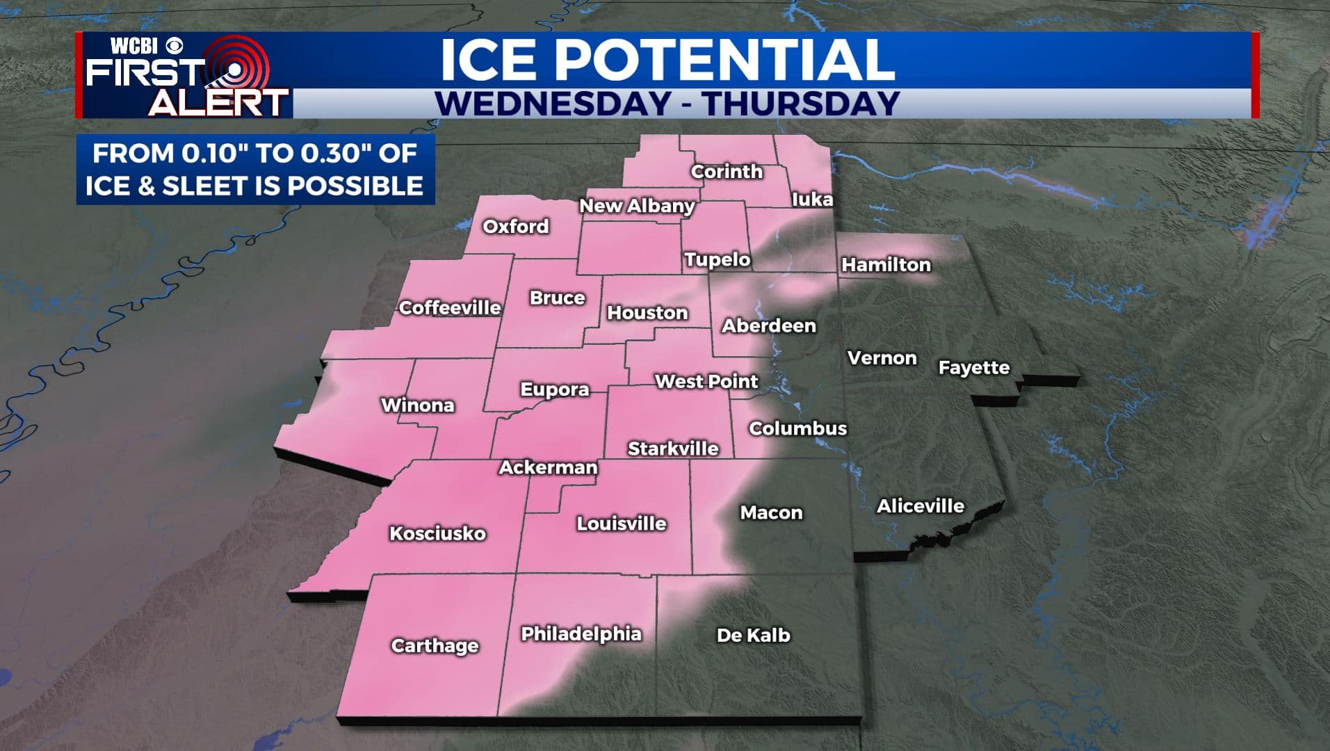
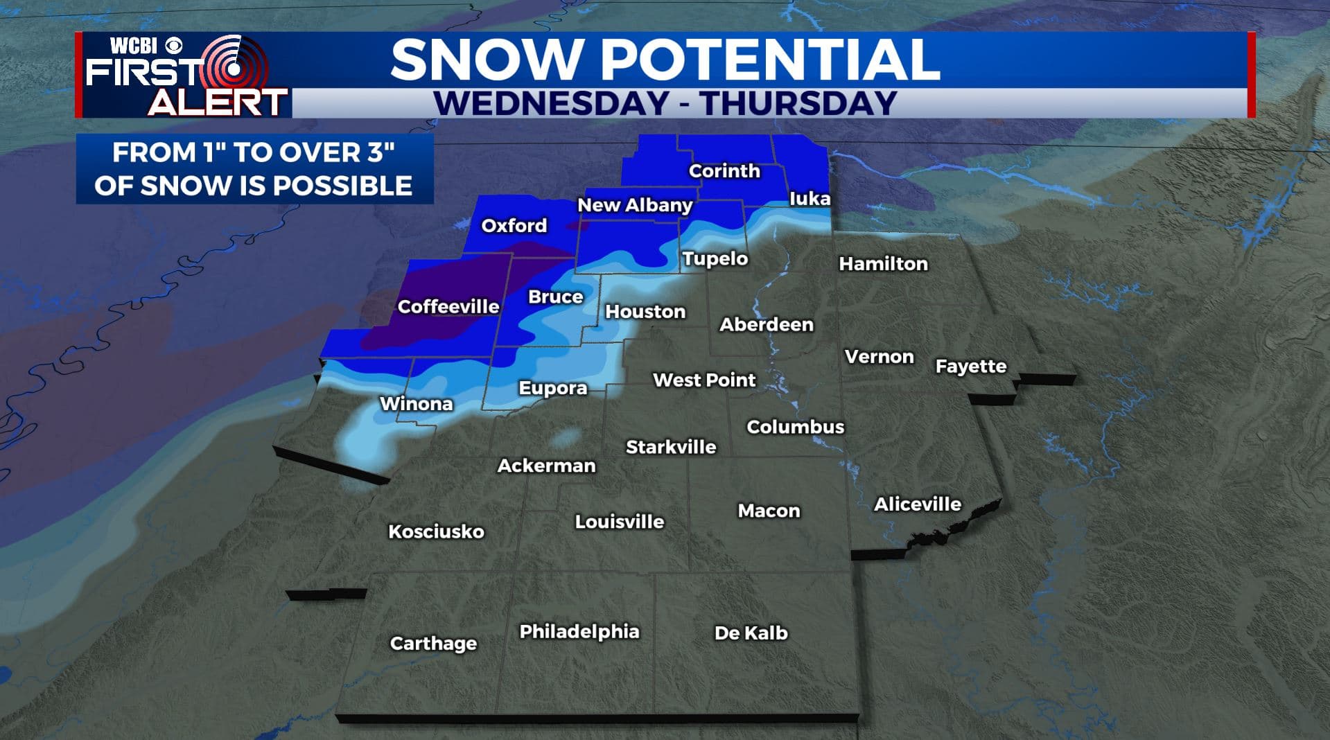
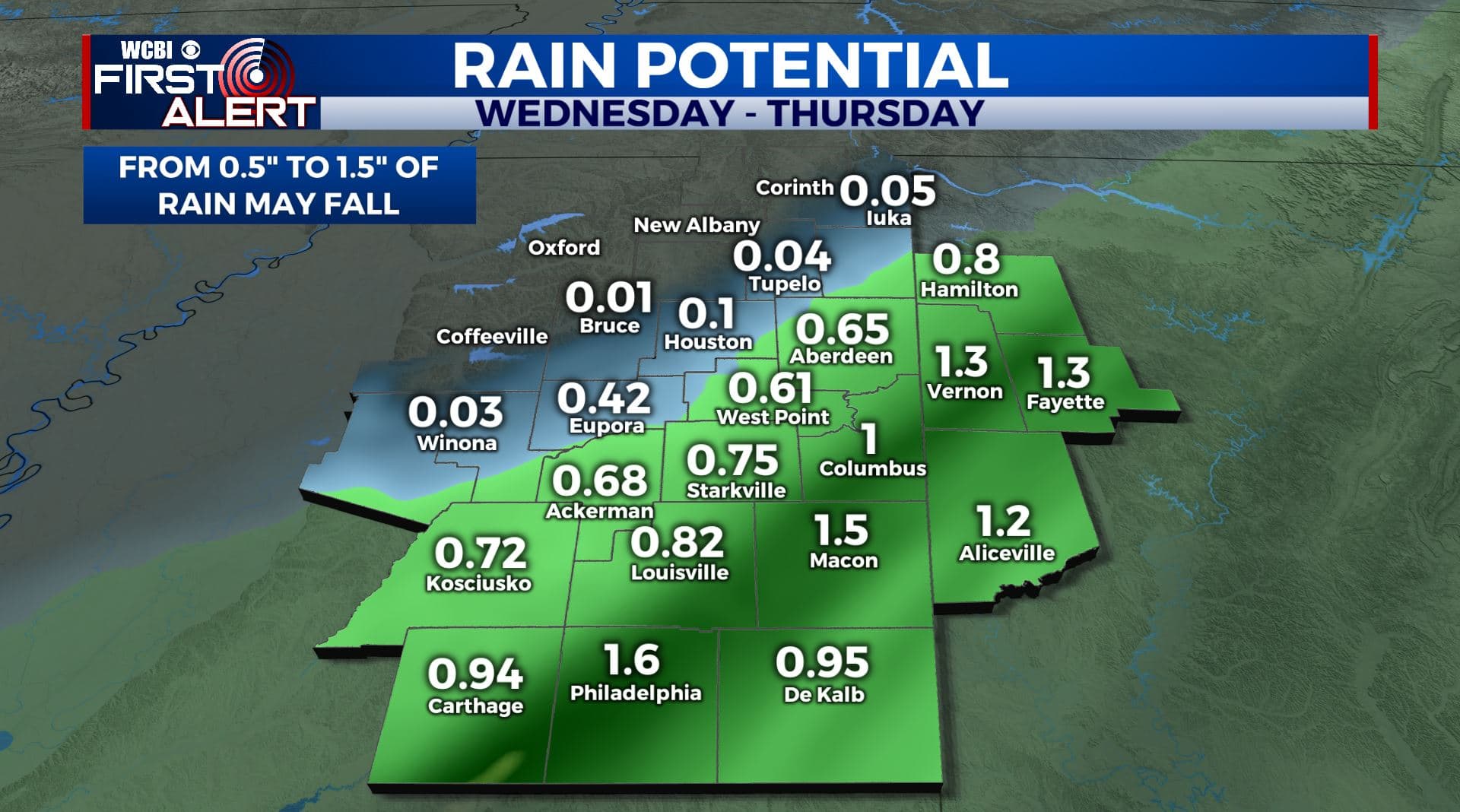
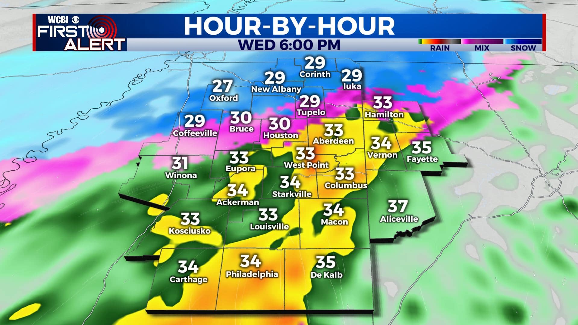
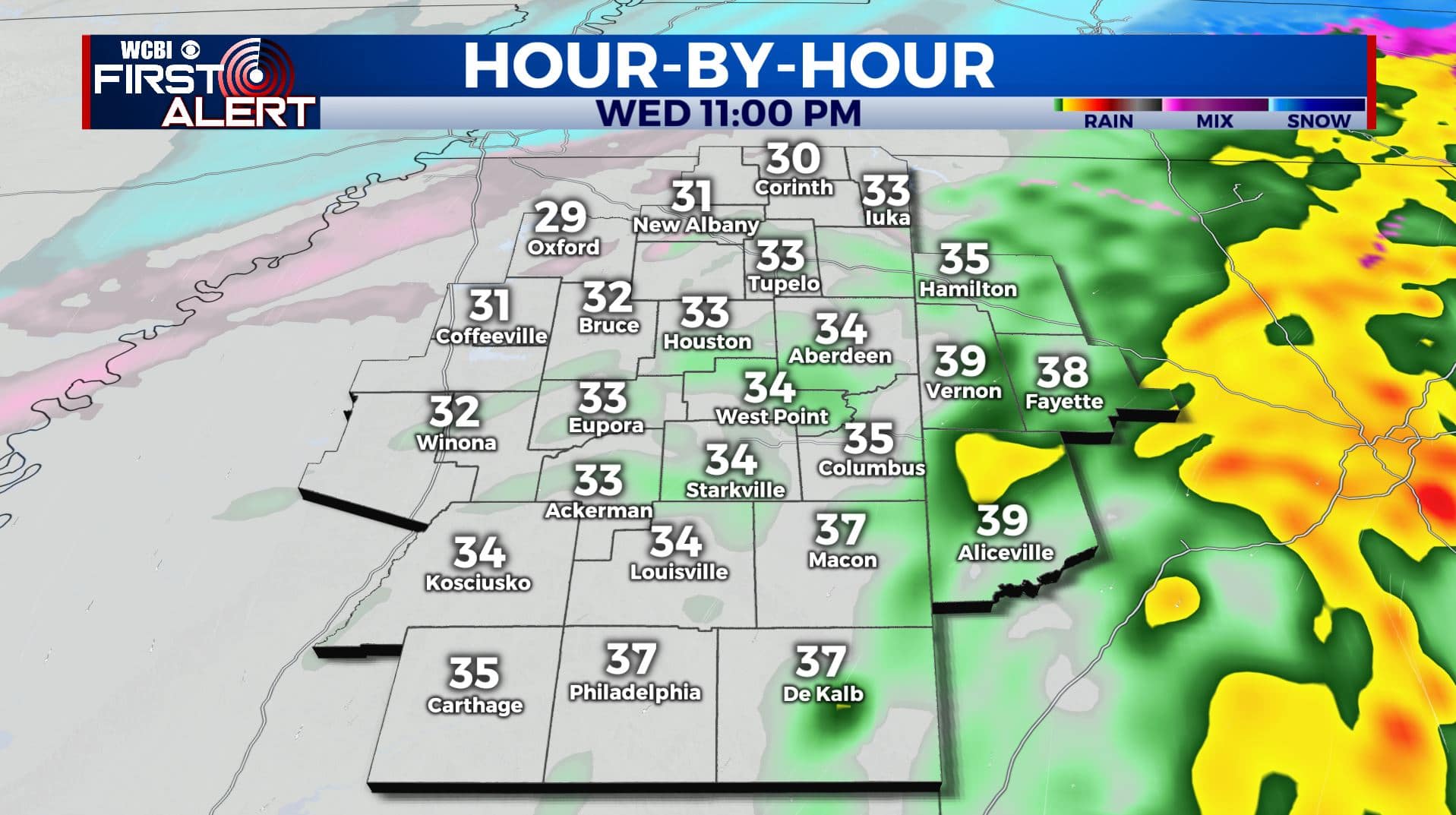
SUMMARY: The 2nd winter storm of the week will affect the area by late morning Wednesday continuing into Wednesday night and Thursday. The precipitation may start out as a mix of sleet, freezing rain, or snow then transition to a cold rain across our southeastern counties by late in the day as temperatures slowly warm. Wintry weather may continue across our northwestern counties Wednesday night and Thursday where temperatures stay a bit colder.
TUESDAY NIGHT: Increasing clouds and still very cold. Lows in the teens. Light NNE winds 2-7 mph. Wind chills in the low teens and single digits.
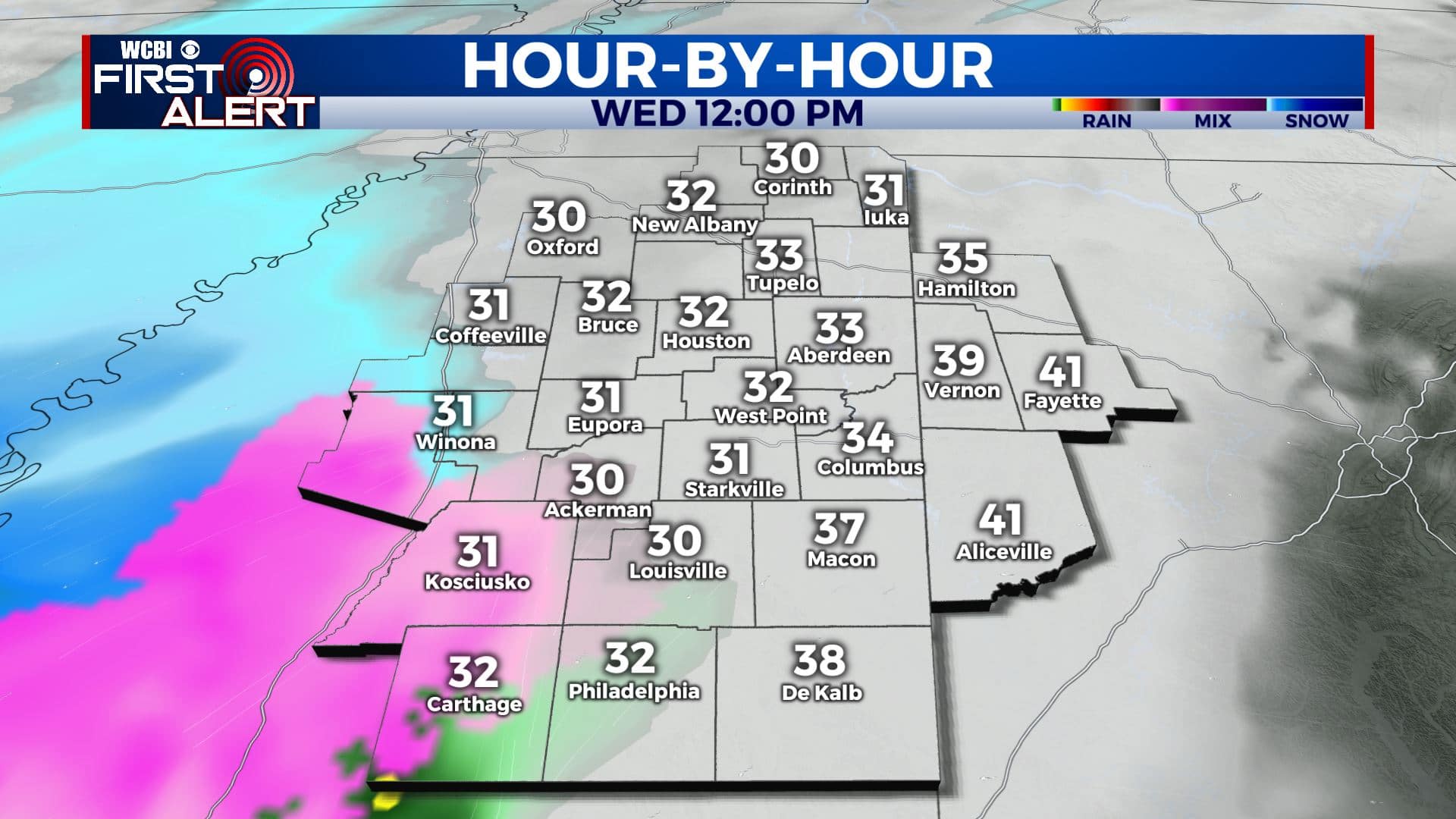
WEDNESDAY: Areas of sleet, freezing rain, and snow will build into our western counties by noon before spreading across the rest of the area during the afternoon. A transition to a cold rain is more likely from about Kosciusko to Columbus to Vernon by late in the afternoon and early evening. Locations to the northwest will probably hang onto the wintry mix later into the night and early Thursday morning. Afternoon highs in the low to mid 30s with the warmest air by early evening. Winds ENE 10-15 mph.
WEDNESDAY NIGHT: Areas of rain in our southeastern counties with a wintry mix of freezing rain, sleet, and snow more likely across our northwestern counties. Lows hovering in the low to mid 30s.
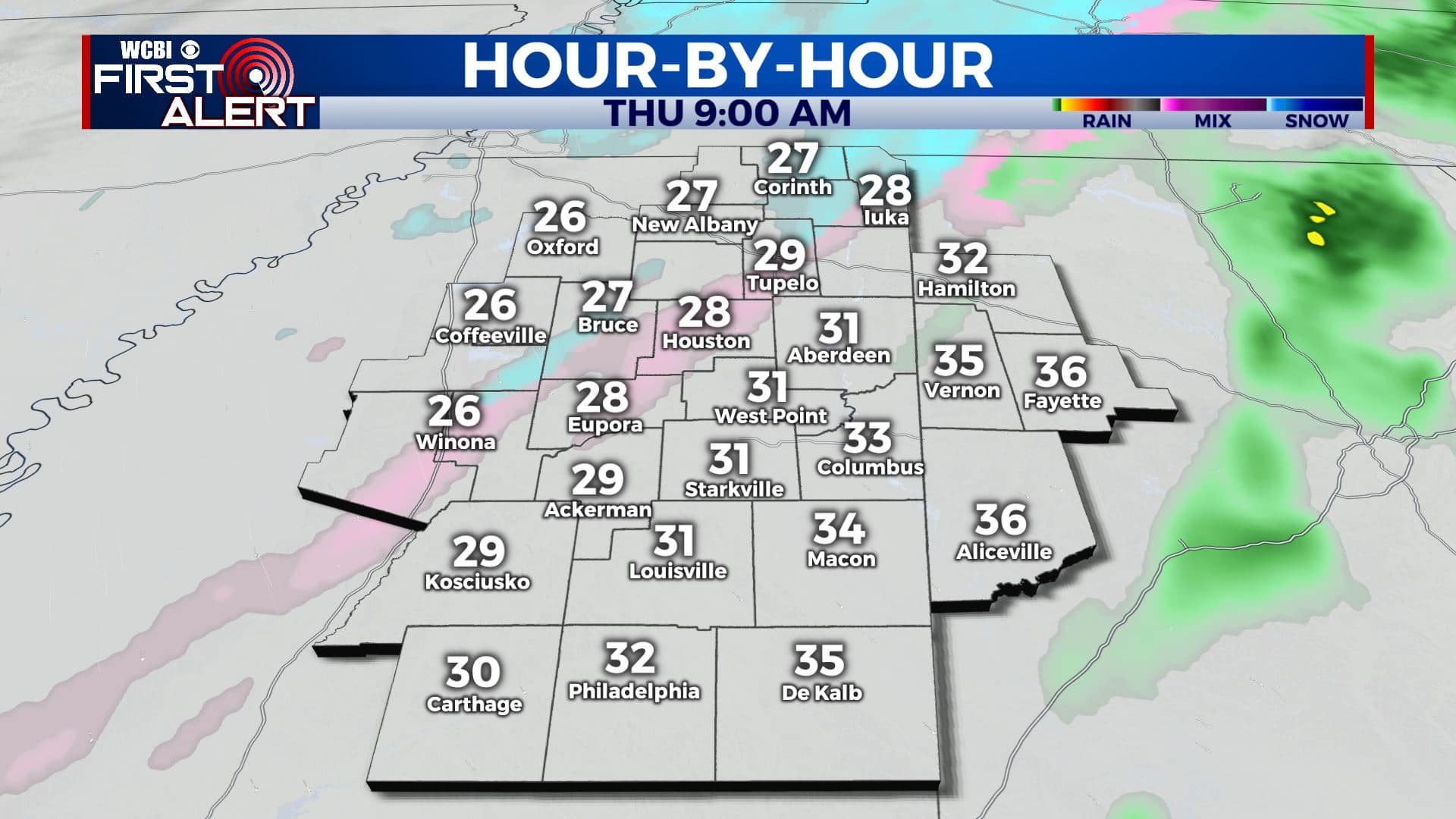
THURSDAY: Mostly cloudy with a light wintry mix still possible. Highs in the low to mid 30s.
THURSDAY NIGHT: Cold. Lows in the low 20s.
FRIDAY: Turning partly cloudy. Chilly highs in the upper 30s. Lows 20s Friday night.
SATURDAY: Mostly sunny. Highs in the low 50s. Low 30s Saturday night.
SUNDAY: Partly cloudy with a few late showers possible. Highs in the upper 50s.
MONDAY: Mostly cloudy. A 50% chance of rain showers. Highs in the low 50s.
TUESDAY: Mostly sunny. Highs in the low 60s.
Follow @WCBIWEATHER on Facebook, Twitter, Instagram, and the WCBI News App


Leave a Reply