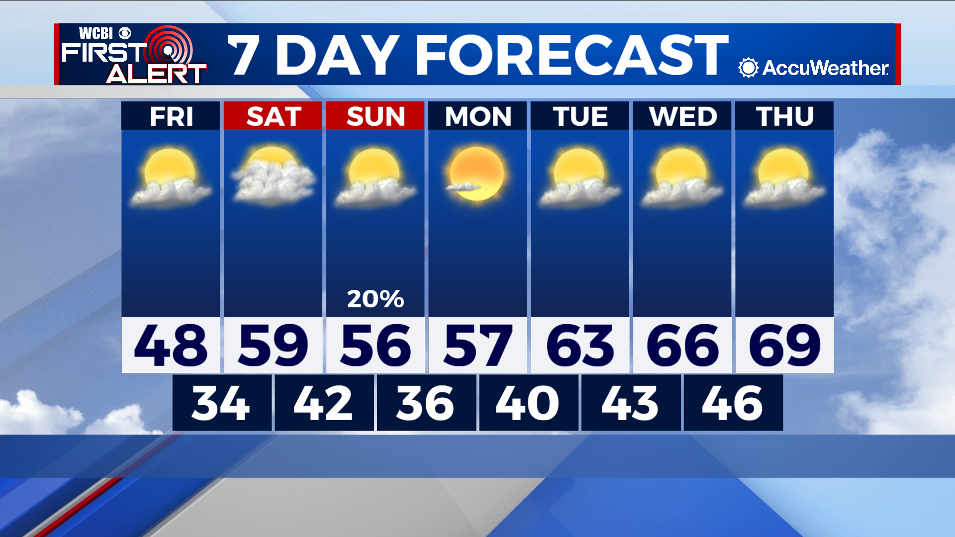
Yet another cold front Sunday stalls next week’s warming trend
COLUMBUS – SUMMARY: Temperatures slowly rebound into the high 60s by next week after a thanksgiving cold front knocked temperatures down in the low 30s. A cold front early Sunday hinders the warming trend a tad and brings a minor rain chance to the area. Skies remain partly cloudy to relatively clear.
FRIDAY: Some warming occurs, but overall temperatures are rather cold, in the mid to high 40s across the area. No rain chance with partly cloud skies prevail.
SATURDAY: More comfortable temperatures make their way into the area, topping out in the high 50s. Lows improve into the mid 40s although the clouds make their return with mostly cloudy skies expected. No rain chance is anticipated Saturday.
SUNDAY: The temperature increase across the area stagnates in the mid 50s while lows decrease into the high 30s as another cold front makes its way through the area early morning Sunday. Some rain is possible with the Sunday system but most of it should amount to isolated sprinkles and showers.
NEXT WEEK: Sunday’s cold front will put a damper on our trek to warmer temperatures, but improvements into the mid to high 60s are expected by the middle of next week. Other than the Sunday cold front no significant rain chance is expected. Cloud cover will remain partly cloudy for the early part of next week.