Tropical Storm Gordon Sets Sights on Gulf Coast
TROPICAL STORM GORDON: Tropical Storm Gordon looks to make landfall as a category 1 hurricane on Tuesday night on the Mississippi Gulf Coast. Hurricane Warnings are in effect for the Mississippi and Alabama Gulf Coasts.
MONDAY NIGHT: Look for mostly clear skies with temperatures falling into the low 70s overnight and south winds 5-10 mph.
TUESDAY: A typical late-summer pattern for our area, with highs in the low 90s, a heat index in the upper 90s and low 100s. We’ll increase the clouds as the day goes on and also look for a few isolated downpours after 6PM, particularly south of US-82.
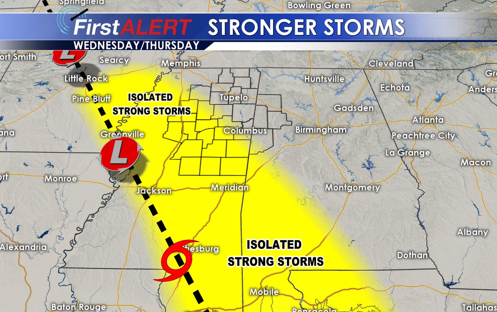
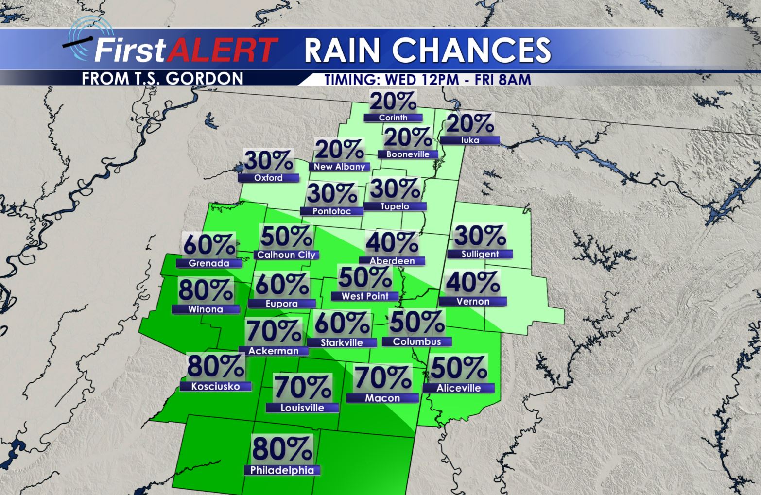
WEDNESDAY/THURSDAY: Cloudy skies and scattered tropical downpours will be likely as Tropical Storm Gordon makes landfall along the central Gulf Coast, and outer bands push across our area. Some spots may see some meaningful and significant rain, while other spots will stay left out. Temperatures will drop due to cloud cover and rain, into the low to mid 80s Wednesday and upper 80s and a few low 90s Thursday. There also could be a stronger storm with gusty winds. An isolated spin-up tornado cannot be ruled out. Be sure to keep up with this forecast, as any changes to Gordon’s strength and path could significantly change our forecast locally.
FRIDAY – MONDAY: As Gordon moves west, slightly more typical weather returns to our area. High temperatures return to the low 90s, with a few scattered showers and storms possible Friday into the weekend and early next week.
STAY WITH WCBI WEATHER ON FACEBOOK, INSTAGRAM, TWITTER AND SNAPCHAT FOR THE LATEST UPDATES ON THE FORECAST.


Leave a Reply