Quiet Weather Ahead, but More Storms by the Weekend
TODAY: The cold front passing through means winds will shift to the north and the west. We’ll keep things mostly cloudy through the day with some isolated showers/drizzle/mist possible. Look for highs in the upper 50s and low 60s, likely occurring in the morning with steady and falling temperatures through the day. An isolated shower can’t be ruled out before 7AM but we anticipate things to be dry during the day.
TONIGHT: temperatures drop into the upper 30s. We’ll see some clouds in the region but keep things dry.
THANKSGIVING DAY: We’ll advertise a mostly cloudy sky with some light and isolated showers in the region. No severe weather is expected. Look for highs in the upper 50s with a few slipping to the 60s. Thursday Night look for lows to fall into the upper 40s.
BLACK FRIDAY: With a mostly cloudy sky and some isolated showers, highs climb into the mid to upper 60s. Lows Friday Night fall into the mid to upper 50s.
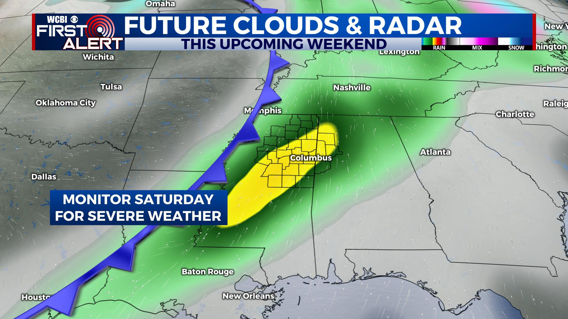
SATURDAY: Another strong system is poised to slide into the region. Right now we’ll advertise rain and storms sometime during Saturday and into Saturday Night, with a few showers possibly lasting into Sunday morning. Some severe weather is possible given impressive atmospheric dynamics. Ahead of the front, we’ll be in the 60s, while temperatures behind the front fall into the 50s during the day and into the 30s at night. We’ll keep you advised with the first alert.
SUNDAY – EARLY NEXT WEEK: Once the second front passes through, we’ll see cooler weather with a mix of sun and clouds. Highs on Monday are likely in the upper 40s and maybe low 50s. Lows at night generally are in the low 30s and even upper 20s.
STAY WITH @WCBIWEATHER ON FACEBOOK, INSTAGRAM, TWITTER AND ON THE WCBI MOBILE APP.


Leave a Reply