Another Nice Day, Severe Storms Likely Into the Weekend
TONIGHT: A mostly clear sky and calming winds allows us to fall into the low 30s, with a few spots perhaps in the upper 20s not out of the question. By morning look for light south winds under 5 mph.
WEDNESDAY: Look for abundant sunshine with highs generally in the upper 50s and low 60s. Winds will be light under 5 mph from the south. Wednesday Night lows fall into the upper 30s and low 40s with south winds picking up. Look for clouds to increase overnight, with a mostly cloudy sky by morning expected.
THURSDAY: Look for a mostly cloudy sky and temperatures rising into the low 60s. Winds will be out of the south, perhaps a bit breezy at times. Showers work in after sunset Thursday into Thursday Night, but the bulk of the rain holds off until later.

Uncertainty remains in how storms progress to the area, so stay tuned for updates on WCBI.com and on your WCBI Mobile App.
FRIDAY: We’ll see temperatures rising into the upper 60s and low 70s with breezy south and east winds likely. Look for a mostly cloudy day with some scattered showers and storms, though it looks like we’ll hold off on strong storms in the area during the day. A few stronger storms can’t be ruled out, but odds are much better to our west in the ArkLaTex region during the day into the night. This line of storms will approach us and bring us the chance for storms as early as late Friday Night, but more than likely into the daytime hours on Saturday.
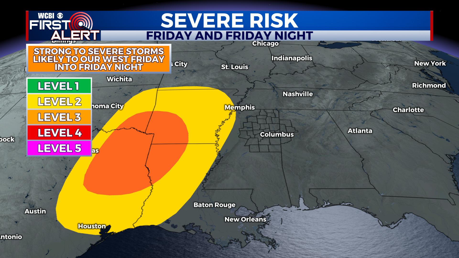
A level 3 risk covers areas to our west. We’ll stay quiet during the daytime but could see storms approach as early as late Friday Night.
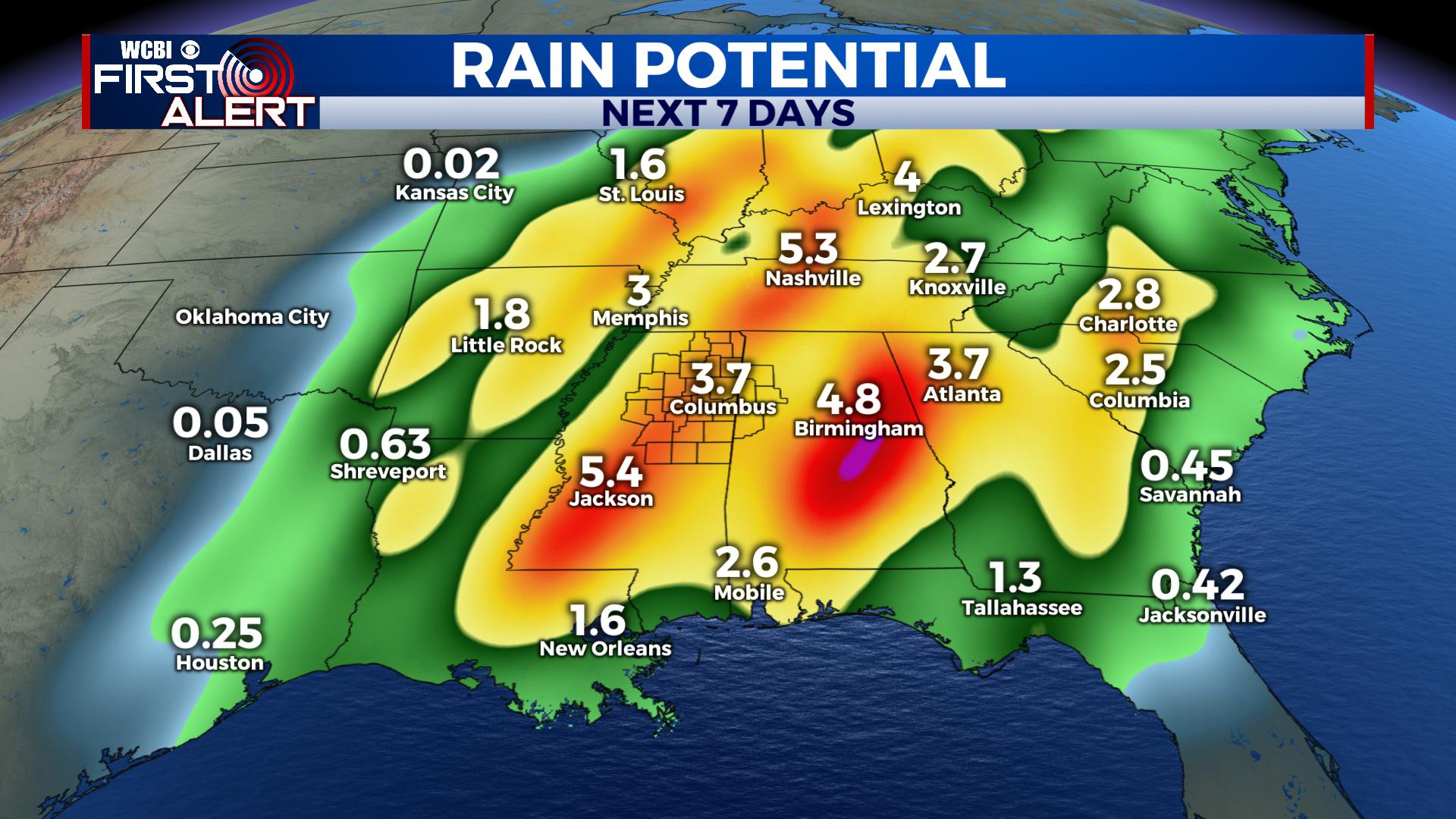
SATURDAY: It seems most likely that showers and thunderstorms will occur area wide on Saturday. Some of these storms will be strong to severe, with all modes of severe weather possible. Timing still remains a bit uncertain, and the severity isn’t nailed down yet either. Still, we already have a level 3 risk for strong to severe storms from the Storm Prediction Center for our viewing area. Showers and thunderstorms will also have the potential to produce very heavy rain. Flooding is a big concern with this system and subsequent rain into next week.
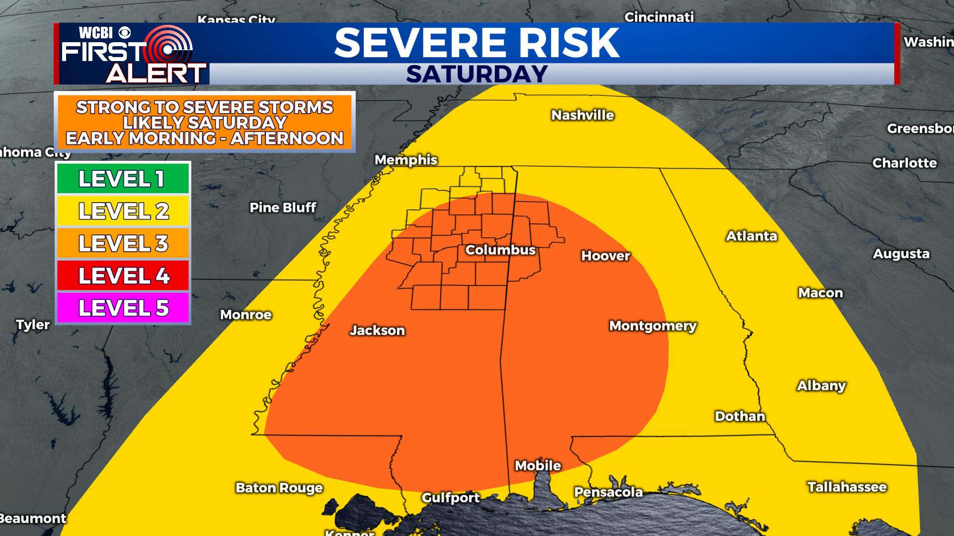
Our area is under a level 3 risk for severe storms on Saturday. All modes of severe weather are possible.
SUNDAY: Right now we anticipate storms to roll out of the area by Saturday Night meaning we’ll trend dry with a mix of sun and clouds on Sunday. A few showers can’t be ruled out before sunrise with highs in the upper 50s and low 60s. There still remains some uncertainty, which depends on how the Friday-Saturday time period works out.
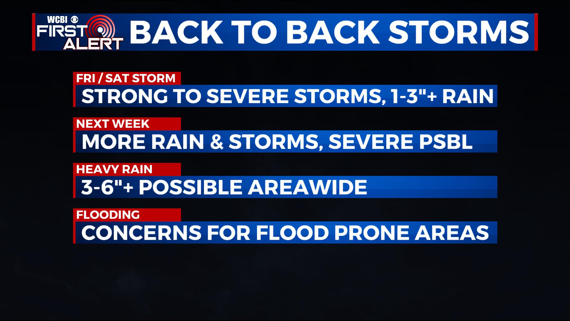
MONDAY – TUESDAY: Another system looks to follow closely behind bringing more scattered showers and storms. It’s a bit far off for specifics, but more heavy rain and severe weather can’t be ruled out.
STAY WITH @WCBIWEATHER FOR THE LATEST ON FACEBOOK, INSTAGRAM, TWITTER AND ON THE WCBI MOBILE APP.


Leave a Reply