The sunshine makes a return for Friday; A nice weekend ahead
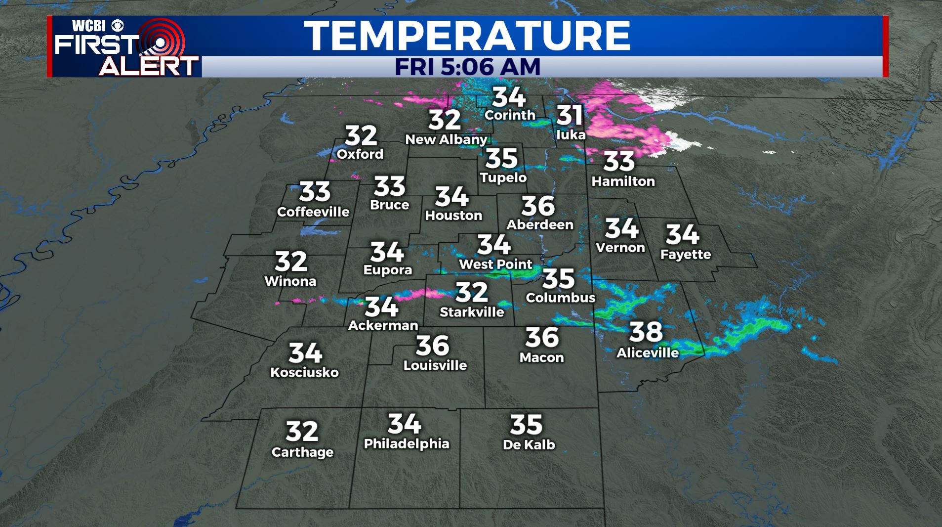
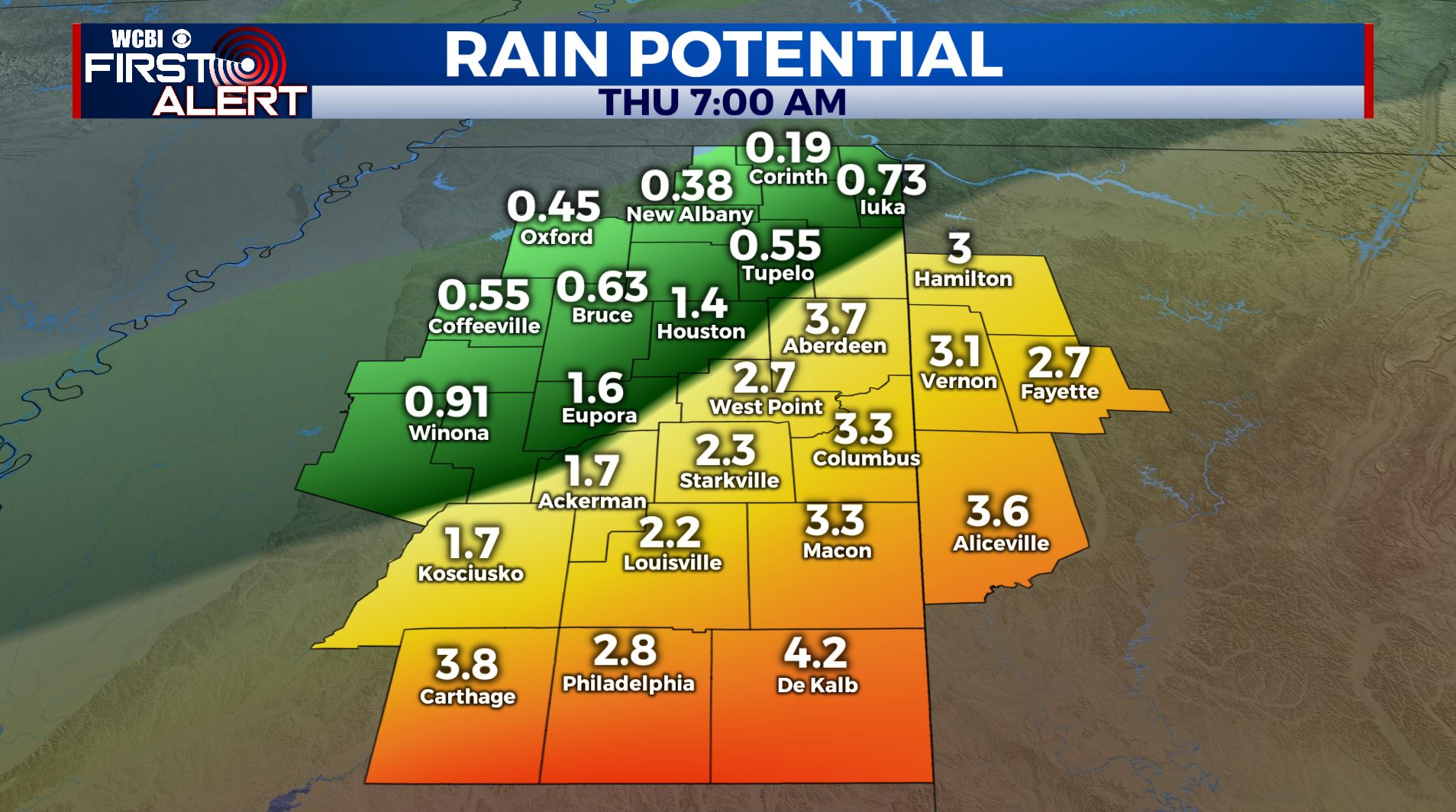
SUMMARY: Areas of light rain and snow is gradually tapering off this Friday morning. Accumulations will be minor and mainly confined to grassy and elevated surfaces. Ground temperatures are very warm and they should keep roads mainly wet. The exception could be some bridges so be careful going into far northern MS and west TN. The sunshine will make a return on Friday. Some isolated light rain showers on Friday night as a weak disturbance is pushing through. A fairly decent weekend is ahead for us with warmer temperatures and sunshine before more showers and thunderstorms return to the forecast next week.
FRIDAY: Mostly cloudy to start with developing sunshine during the afternoon. Highs in the upper 40s. Winds WSW 5-10 mph.
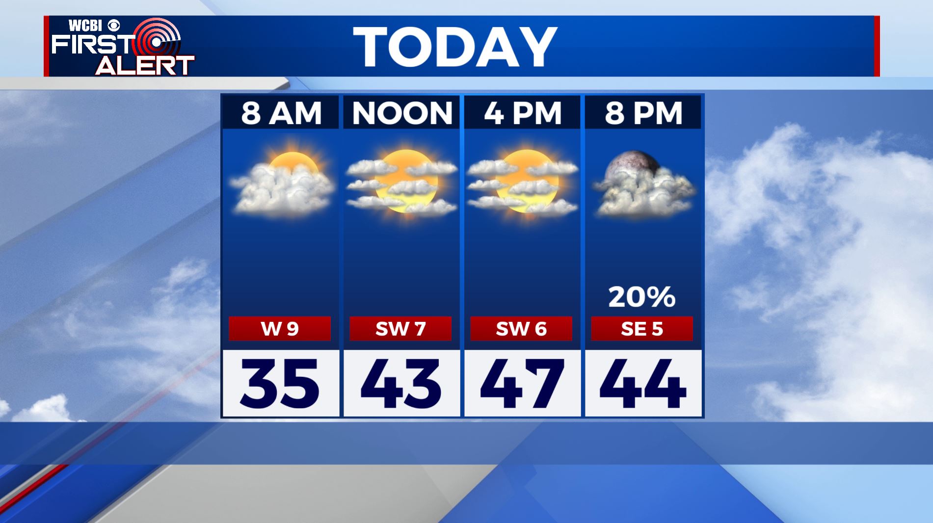
FRIDAY NIGHT: Partly to mostly cloudy with the chance of an isolated shower or two. A few showers could develop. Lows in the mid 30s. SE 5-10 mph.
SATURDAY: Mostly sunny skies as high pressure moves into the region. Highs near average in the lower to mid 50s. SW 5-10 mph.
SATURDAY NIGHT: Partly cloudy. Lows in the mid 30s.
SUNDAY: Mostly sunny and warmer. Highs in the mid 60s.
MONDAY-TUESDAY: Areas of heavy rain and thunder return to the region. Highs look to be in the mid 60s Monday with upper 50s to near 60 returning on Tuesday.
WEDNEDAY-THURSDAY: Weather models are all over the place. Will it be cool and somewhat or warmer and somewhat stormy? We’re going to spit the difference for now but do expect changes in one direction or the other going forward.
Follow @WCBIWEATHER on Facebook, Twitter, Instagram, and the WCBI News App.


Leave a Reply