Heavy Rain and Severe Storms Likely This Week
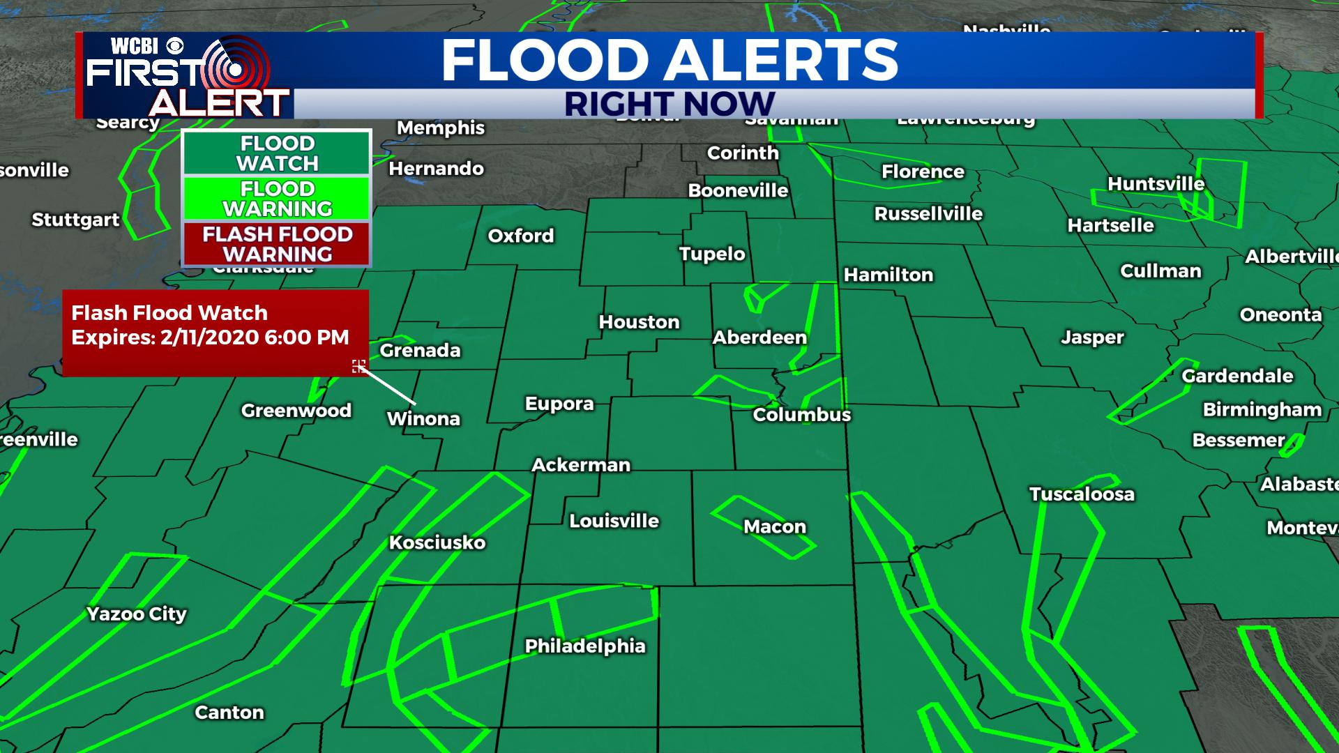
FLASH FLOOD WATCH IN EFFECT THROUGH TUESDAY NIGHT.
TONIGHT: Clouds increase and we likely see some showers and thunderstorms approach the area by midnight. Areas of rain with a few embedded storms are possible, but no organized severe threat is anticipated right now. Temperatures fall only into the 50s.
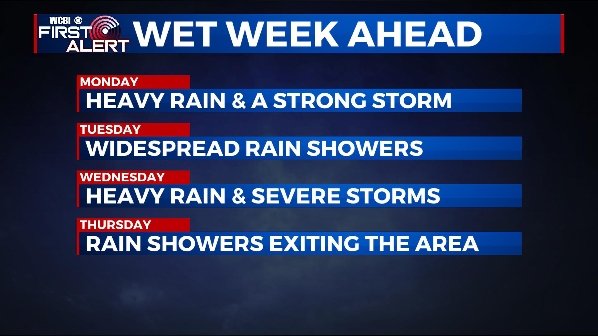
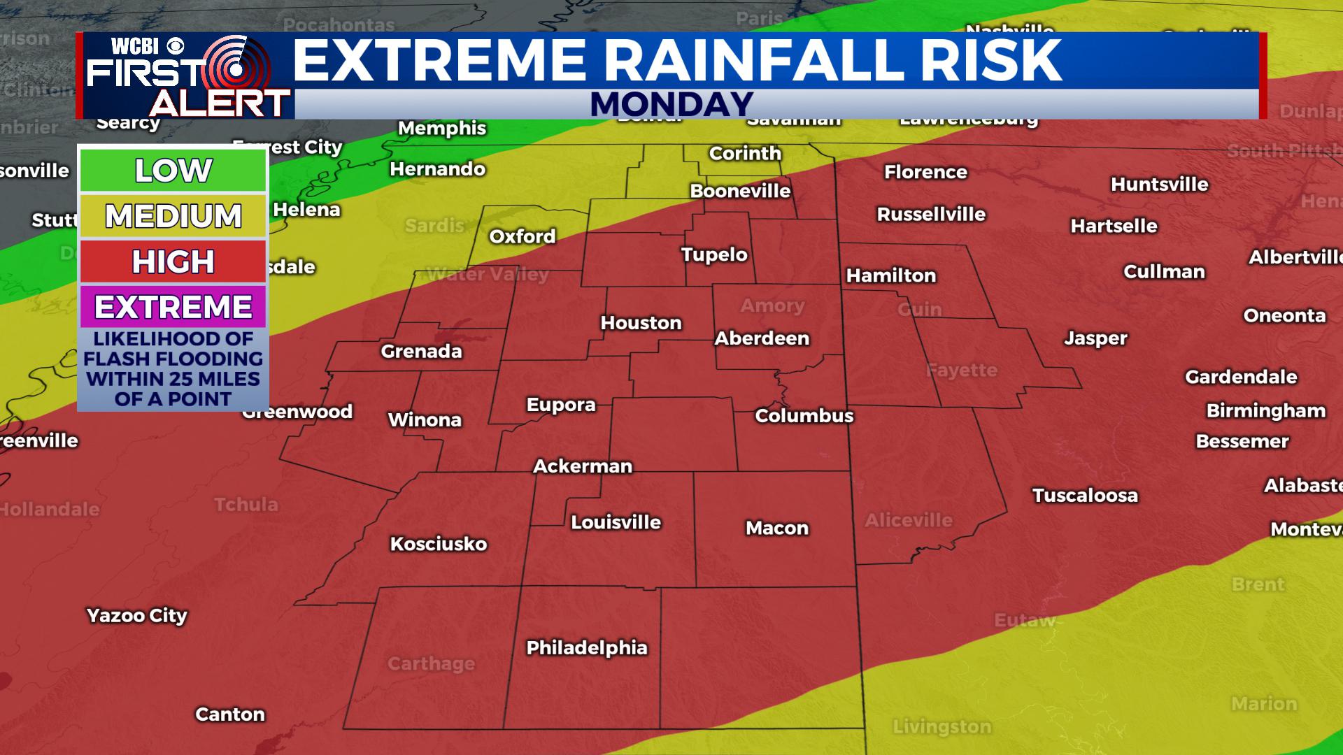
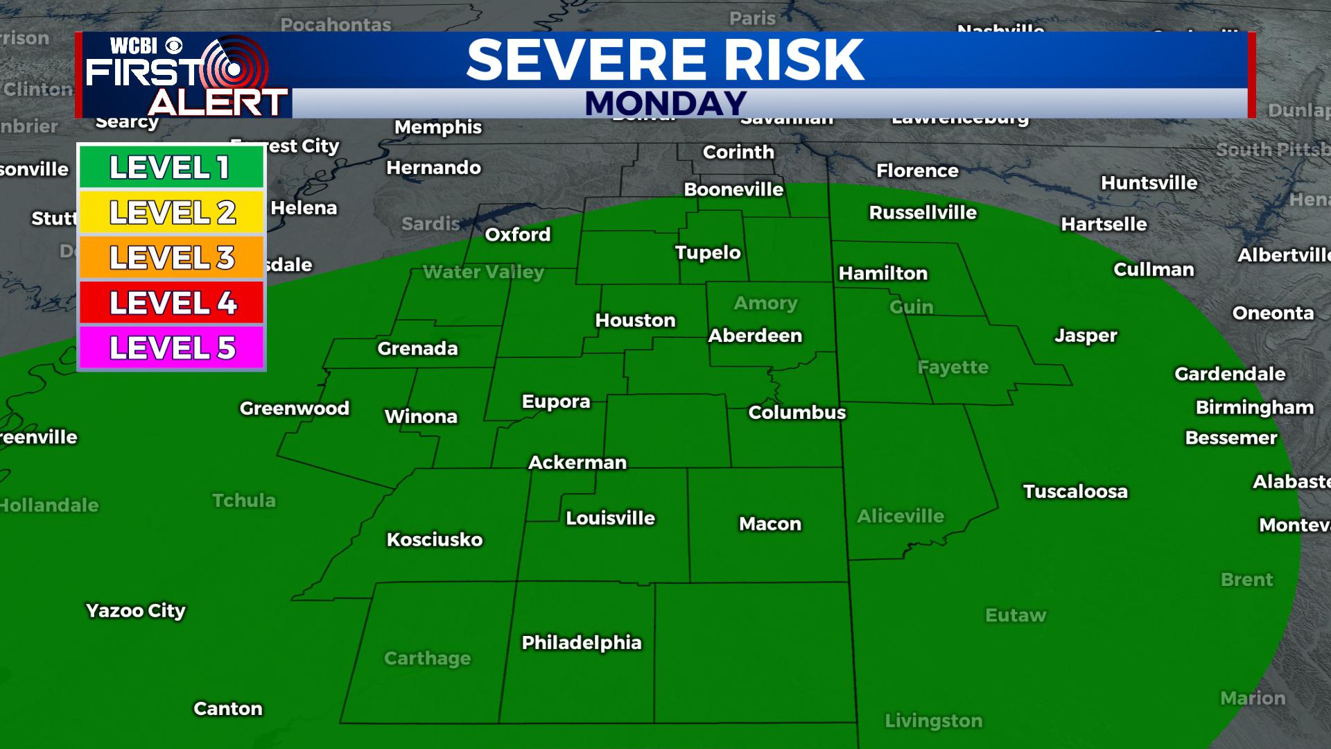
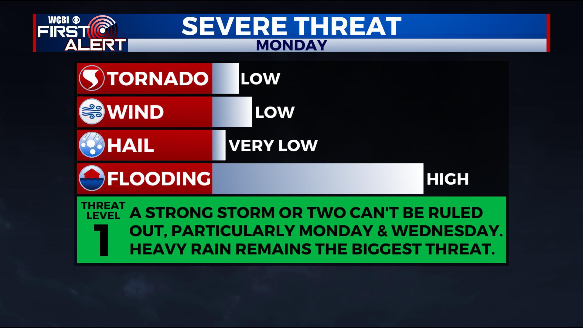
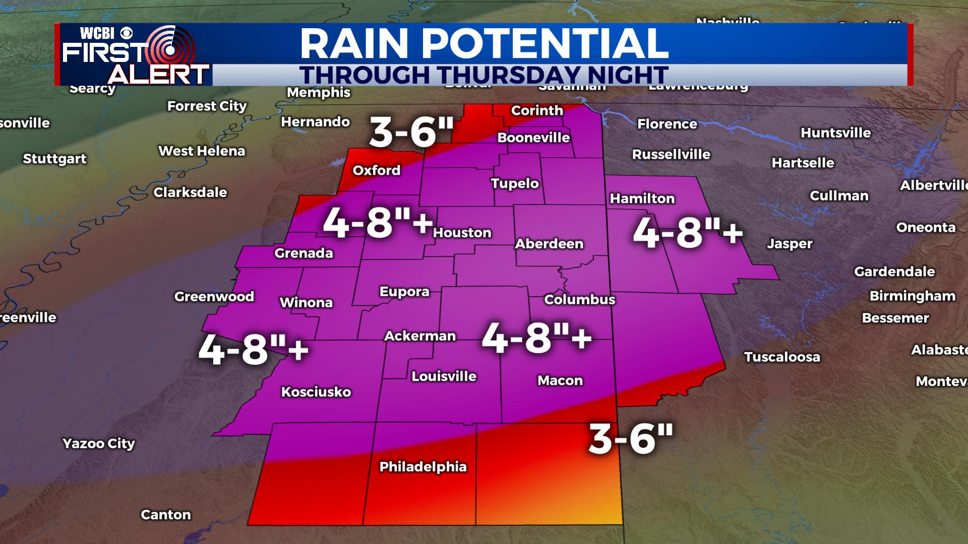
MONDAY: Areas of widespread rain and and storms are expected with highs in the mid 60s. Heavy rain is the main threat with any stronger storm, though a strong storm or two is possible. A level 1 threat is covering the WCBI area. 2-4 inches of rain may fall across the region into Monday Night. Lows Monday night fall into the 50s again with rain and storms continuing.
TUESDAY: The boundary will push to the south and bring us more widespread rain showers. While the whole day doesn’t look soaking wet, flooding will likely be a threat, but severe weather is not expected. Look for highs in the 50s to perhaps low 60s in a few spots, though the day will trend cooler and rainy. Lows fall into the 40s and 50s.
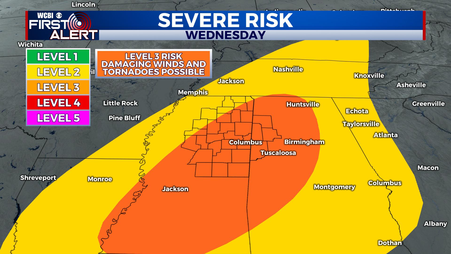
WEDNESDAY: More widespread showers and storms will roll in, bringing the chance for severe weather. A level 3 threat is already covering our region, with damaging winds and a few tornadoes the main threat. Look for highs in the 60s to mid 70s in a few spots as the boundary lifts north through the area. This unstable air helps fuel storms along a cold front, where a damaging squall line is likely, but supercells can’t be ruled out. Another 2-4″ of rain are possible Wednesday into Wednesday Night before storms clear out.
THURSDAY: There may be some storms pushing through early Thursday morning before sunrise, but the front is likely to already be through by sunrise, meaning we’ll be cooling off with showers exiting the region through the morning. By Thursday afternoon into Thursday night, the rain will be done the region. River flooding will likely be ongoing.
FRIDAY – SATURDAY: Sunshine returns with some clouds in the area. Look for highs in the 50s and lows in the 30s. River flooding will likely be ongoing into the weekend. Saturday Night, more rain approaches.
SUNDAY – EARLY NEXT WEEK: The potential is there for another round of heavy showers and thunderstorms. Stay up-to-date for the latest information.
STAY CONNECTED WITH THE FIRST ALERT FORECAST ON FACEBOOK, TWITTER AND INSTAGRAM, AND ON THE WCBI MOBILE APP.


Leave a Reply