Morning showers will give way to a cloudy & warm Tuesday
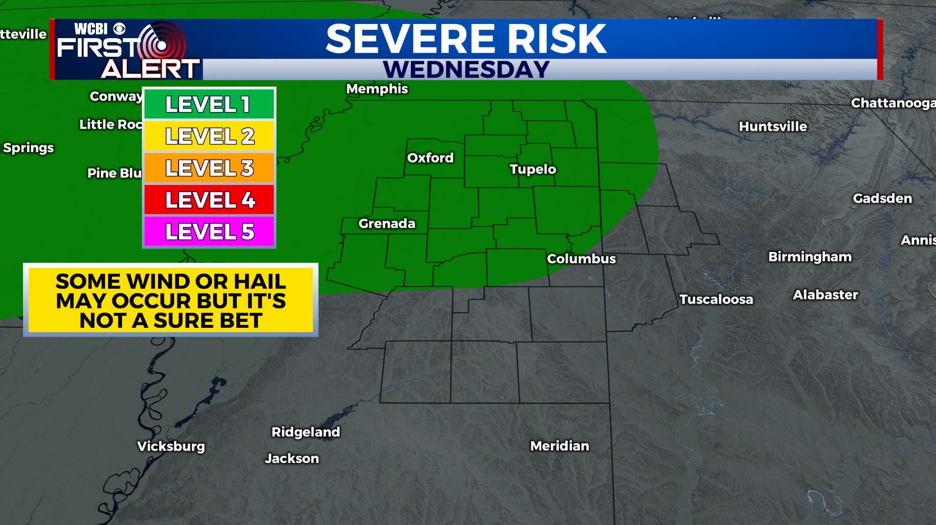
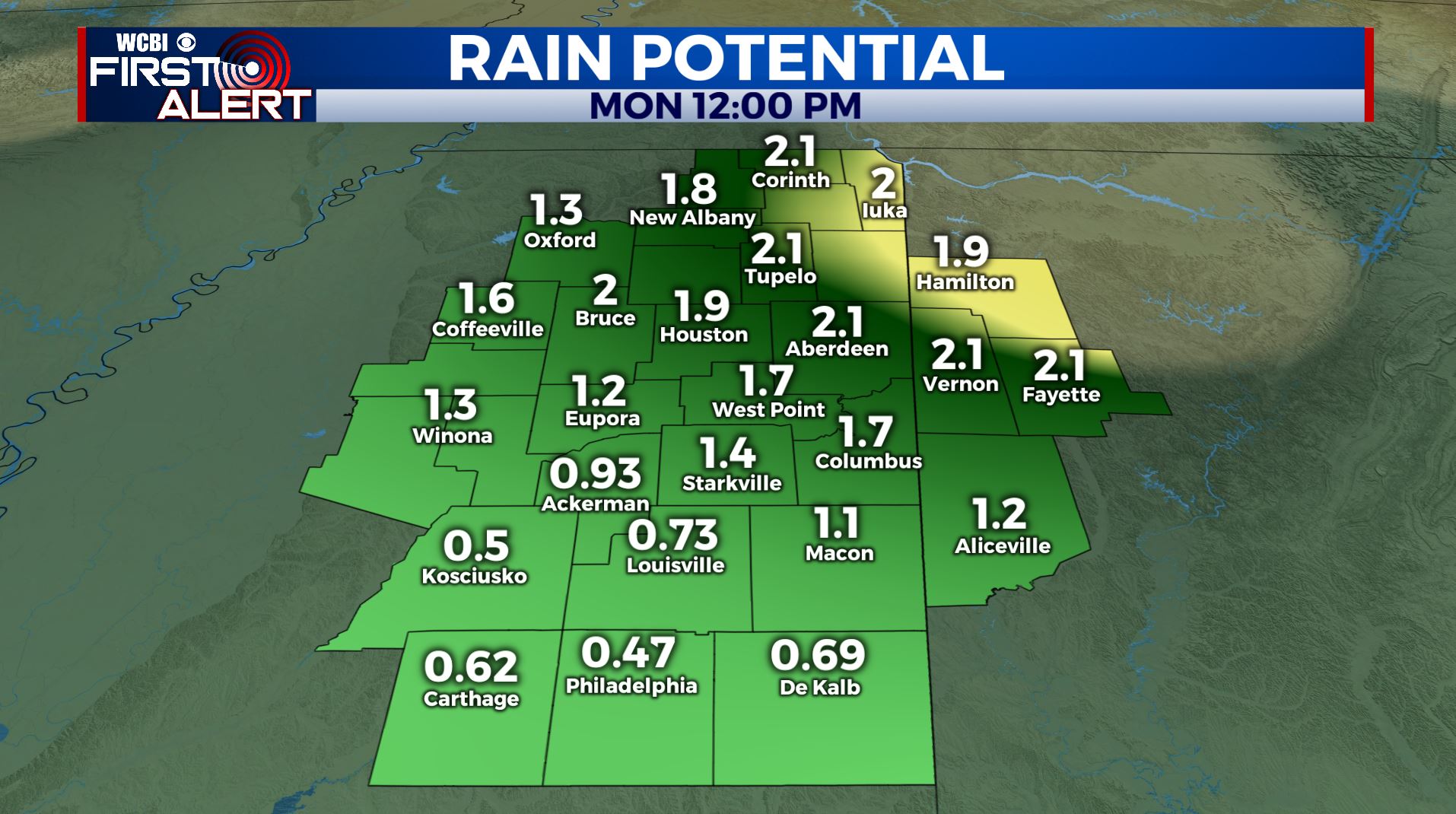
SUMMARY: A stalled front and a few weak disturbances moving through the region will keep things unsettled & wet all week long into early next week. A few strong storms are possible Wednesday afternoon and evening but things remain uncertain. Something we’ll continue to keep our eyes on. Rainfall projections over the next week suggest another 1-2” may fall across the area. We’ll remain warm & above average with highs in the upper 60s to the 70s.
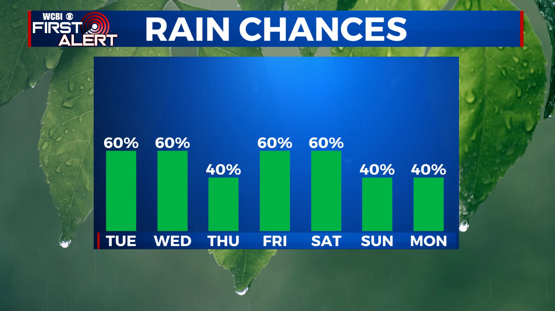
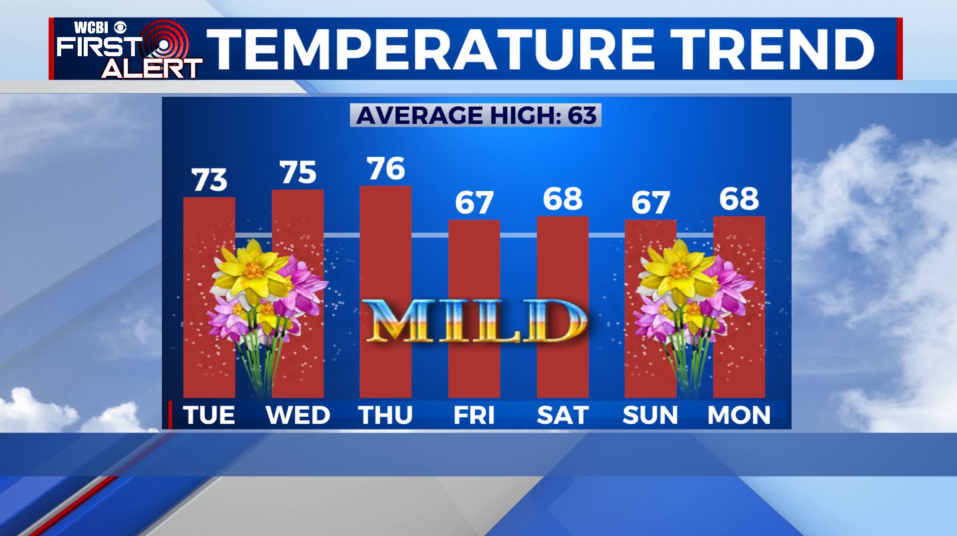
TUESDAY: It’s Primary Election Day in Mississippi! We’re waking up to showers this morning across the region. It will be a bit more dry & cloudy in the afternoon & evening. Highs in the lower 70s. Winds SW 5-10 mph.
TUESDAY NIGHT: Mostly cloudy. Lows mainly in the 50s.
WEDNESDAY: Warmer with highs in the mid 70s. Afternoon and evening showers and storms are possible. It’s still uncertain whether we get any strong storms, but if they do some gusty wind and hail can’t be ruled out. We’re right now under a Level 1 for Wednesday. We’ll keep you updated!
THURSDAY: A mix of sun & clouds with a scattered chance of showers and storms. Highs in the mid 70s.
FRIDAY: Mostly cloudy with another likely chance of rain. Highs in the upper 60s.
SATURDAY: Variably cloudy with a chance of rain and thunderstorms. Highs in the upper 60s to lower 70s.
SUNDAY: Another chance of scattered showers. Variably cloudy. Highs in the mid to upper 60s.
MONDAY: A few more showers are possible. Highs in the upper 60s.
Stay connected with @WCBIWEATHER on Facebook, Twitter, Instagram, and on the WCBI News App


Leave a Reply