Unsettled weather pattern continues this Friday and weekend
SUMMARY: A bit cooler with scattered rain chances on Friday as a cold front is pushing through. We have a bit of a roller coaster ride with temperatures this weekend. Daily rain and storm chances are going to continue through next week while the warm, above average temperatures look to return as well.
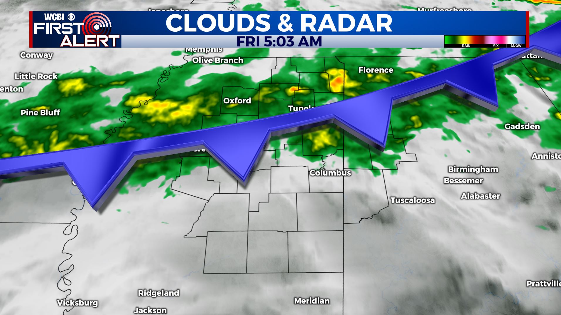
FRIDAY: A cold front is pushing through the WCBI Viewing Area this Friday morning. We’ll see mostly cloudy with areas of rain and showers. Highs are expected to be cooler today in the mid 60s. Winds will be from the NE 5-10 mph.
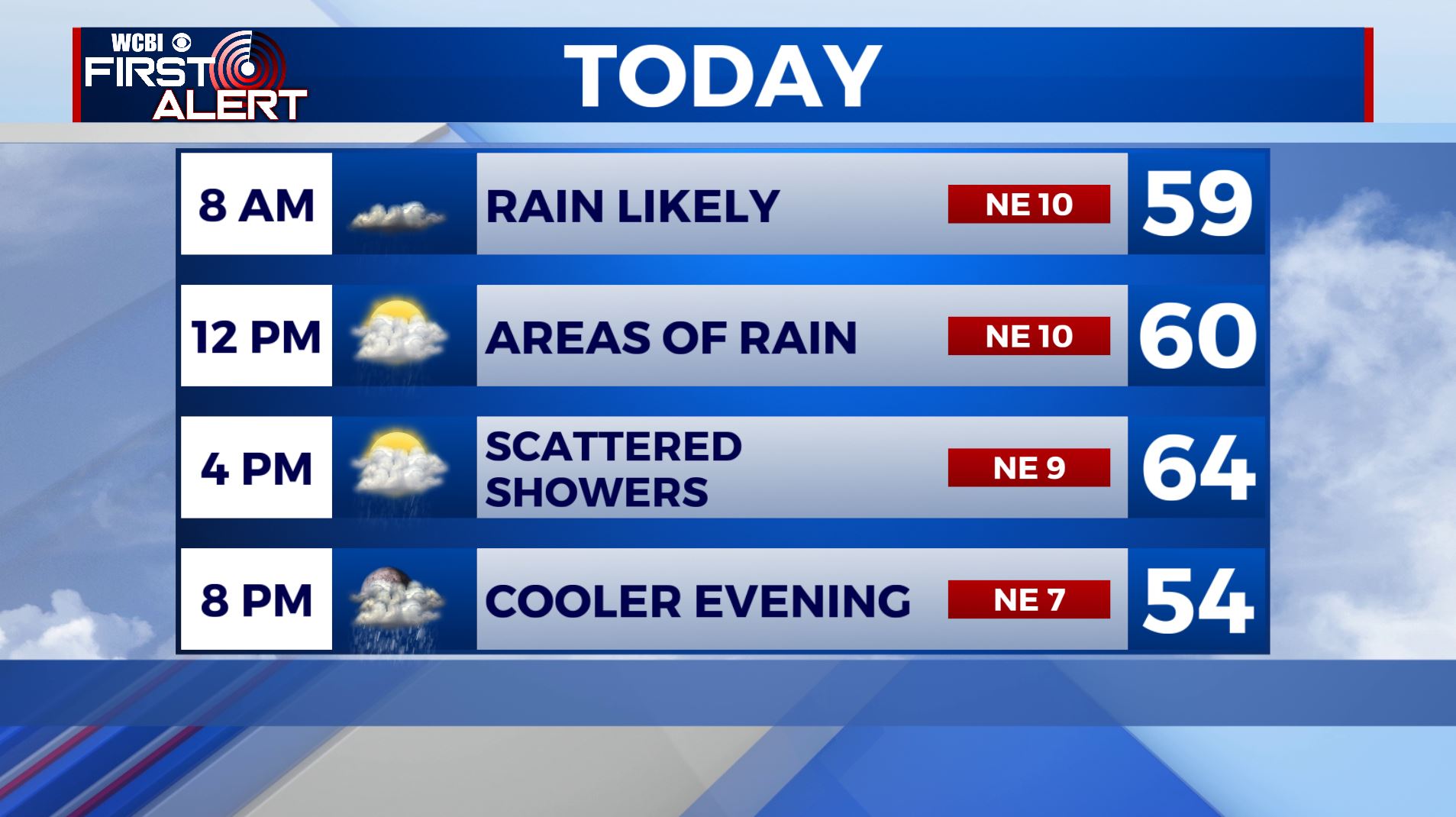
FRIDAY NIGHT: Mostly cloudy with a slight chance of a shower. Lows in the 50s and 40s.
SATURDAY: Morning clouds with developing sunshine as the day wears on. Much warmer highs in the mid 70s. A few late day and evening showers and storms are possible once again.
SUNDAY: Mostly cloudy with areas of rain and showers. Highs in the lower 60s.
MONDAY: A few more showers are possible. Highs in the upper 60s.
TUESDAY-THURSDAY: We’re going to keep the threat of rain and storms going through the entire work week. Highs will be well into the upper 70s by the end of the week if not back up to around 80. There are some signs of potential strong to severe storms late in the week but it’s still a bit too far off to be for sure.
Stay connected with @WCBIWEATHER on Facebook, Twitter, Instagram, and the WCBI News App


Leave a Reply