A warm & nice day overall for Wednesday
SUMMARY: Temperatures will be warming up to near 80 over the next few days but rain chances are going to remain low and very scattered. The best chance for widespread, heavy rain and perhaps some storms is looking to be Friday as a cold front presses into north Mississippi and Alabama. Cooler air settles back in for the weekend with more on/off again rain chances.

WEDNESDAY: Partly sunny skies and warmer. Maybe a slight chance of a stray shower, but not expecting much. Highs ranging from the upper 70s to lower 80s thanks to a strong south wind as a warm front lifts north, 5-15 mph gusting up to 20.
WEDNESDAY NIGHT: A quiet night overall with cloudy skies and mild conditions. Overnight lows in the 60s.
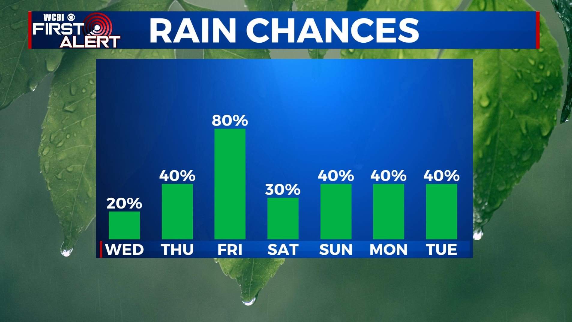
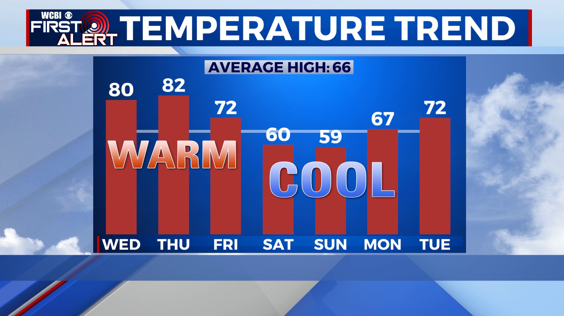
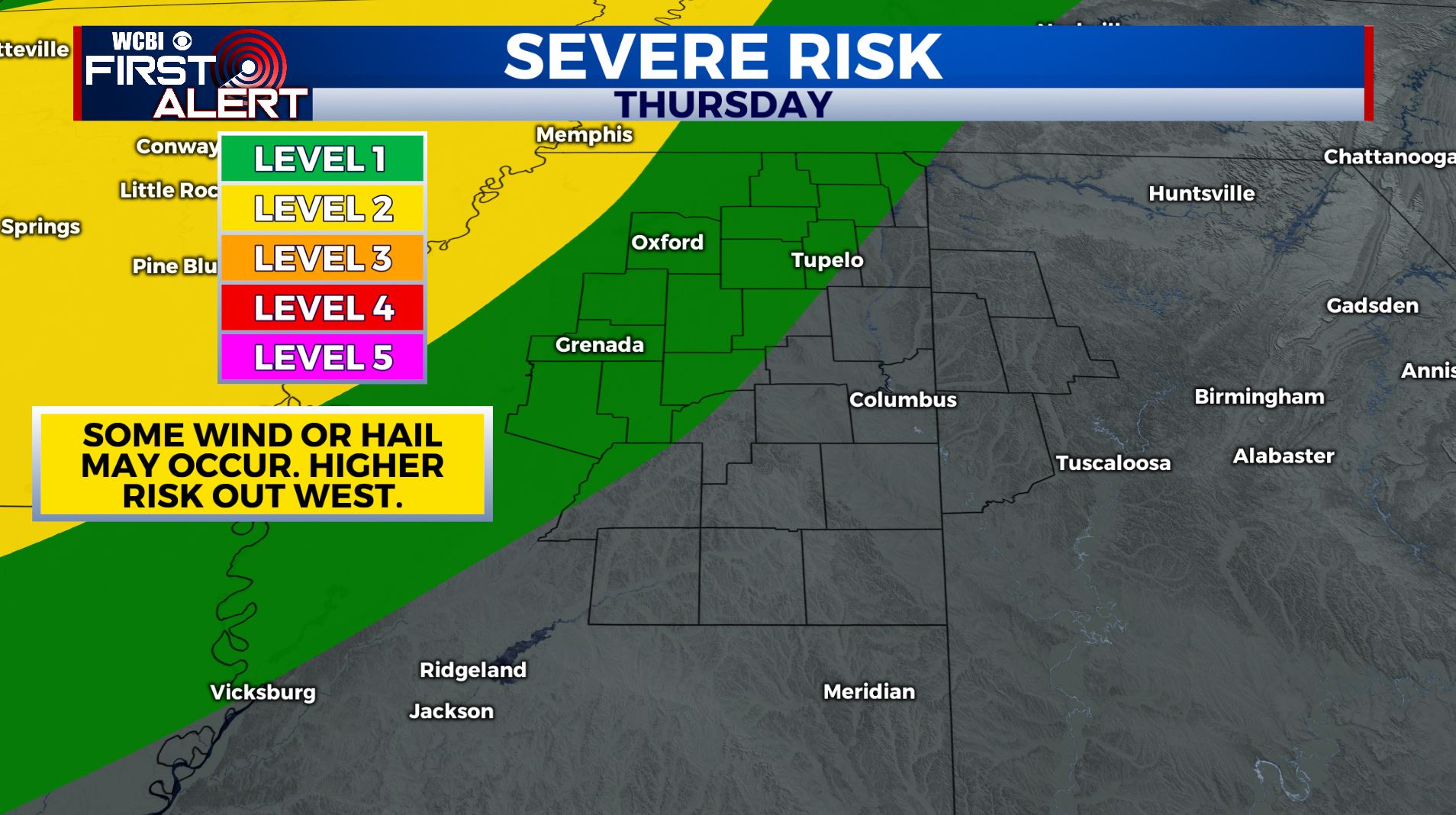
THURSDAY: Partly to mostly cloudy and warmer. Highs still above average and warm into the lower 80s. Rain chances are going to be reasonably low but we can’t rule out a few isolated showers and storms, especially out to our west in the evening to overnight hours as a line of storms over the Central Plains will move into the Mississippi Delta/River area. Some strong storms are expected in that area.

FRIDAY: Staying mild with highs in the lower to mid 70s. A cold front moving through the region will produce a good chance for showers and storms. A few strong storms can’t be totally ruled out but it doesn’t appear to be a major severe weather producer at this point. We’ll keep watching.
THE WEEKEND: Yet another batch of scattered showers and storms will continue through the weekend. Highs will be cooler with temperatures in the mid to upper 50s both Saturday and Sunday. Morning lows will be in the 40s on Saturday and Sunday mornings.
MONDAY: Mostly cloudy with another chance of on/off again rain chances. Highs back up into the mid 60s.
Stay connected with @WCBIWEATHER on Facebook, Twitter, Instagram, and the WCBI News App


Leave a Reply