A cool and sunny day ahead for Wednesday
SUMMARY: Temperatures will start to warm up to the 70s as we end the week along with lots of sunshine. Some frost is possible again on Thursday. Rain chances are still possible for the weekend.
WEDNESDAY: It’s a chilly & frosty start to our Wednesday. A sunny day is ahead as high pressure takes over with highs in the lower 60s.
WEDNESDAY NIGHT: Mainly clear and chilly for one more night. Lows in the mid to upper 30s. Areas of frost are possible once again.
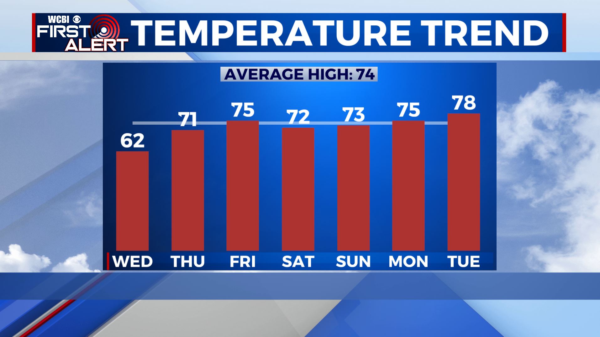
THURSDAY: Sunny skies. Milder highs in the upper 60s to lowers 70s as our winds start picking up from the SE at 5-10 mph..
THURSDAY NIGHT: Partly cloudy. Lows in the mid 40s.
FRIDAY: A mix of sun & clouds. Warmer. Temperatures warm up a bit with highs in the mid 70s.
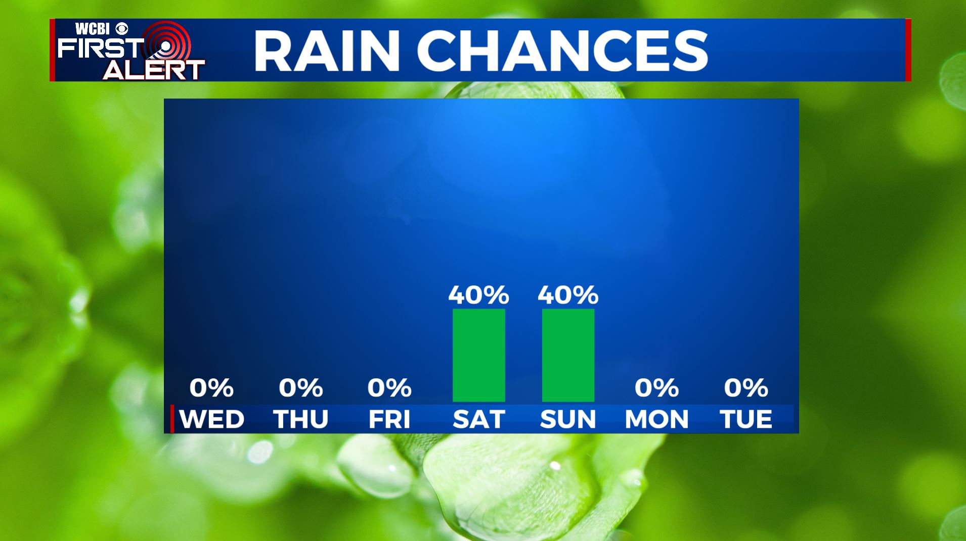
SATURDAY: Cloudy skies with a slight chance of a few showers in the morning as a weak cold front pushes through. Partly sunny but the afternoon. Highs in the lower 70s.
SUNDAY: Mostly cloudy with a chance of rain as another disturbance affects the region. Highs in the 70s.
EARLY NEXT WEEK: The new week will start off on a warm & sunny note. Highs in the middle to upper 70s.
Stay connected with @WCBIWEATHER on Facebook, Twitter, Instagram, and the WCBI News App


Leave a Reply