A nice & warmer day for Thursday
SUMMARY: Nice weather will continue as temperatures warm back up to the 70s to end the week. We’ll see some increased rain chances by the weekend. We’ll have to watch out for some thunderstorms on Sunday. We’ll dry out again to begin next week before another chance for rain and thunderstorms on Wednesday.
THURSDAY: After a clear and cold start, we’re in for a beautiful & sunny day for our Thursday with clear blue skies. Temperatures will warm back up to near 70. Winds will be out of the SE at 10-20 mph as high pressure moves off to our east.
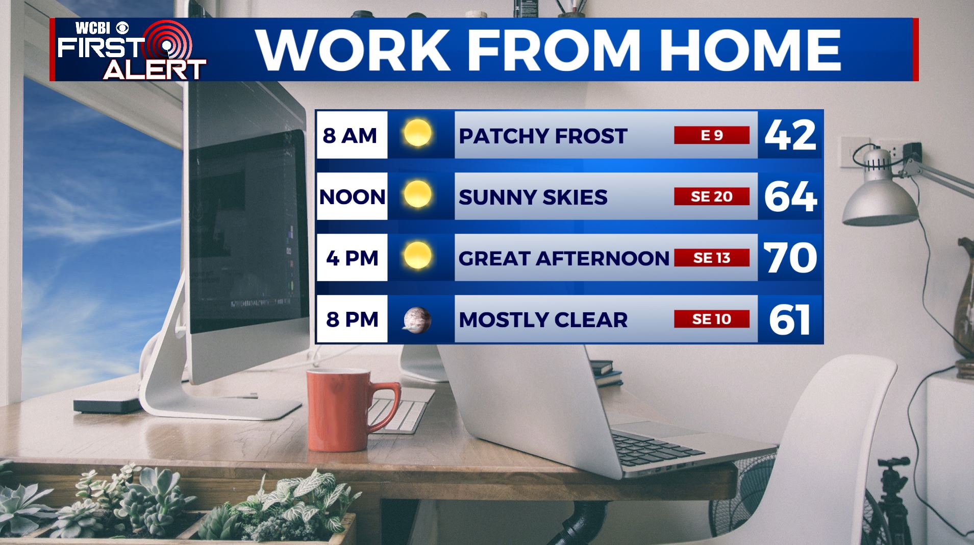
THURSDAY NIGHT: Mostly clear with not as chilly overnight lows in the 40s.
FRIDAY: Clouds increase through the day, but we will remain dry until after sunset. Highs in the mid 70s.
FRIDAY NIGHT: Rain chances increase heading into the overnight hours. Lows in the upper 40s to near 50.
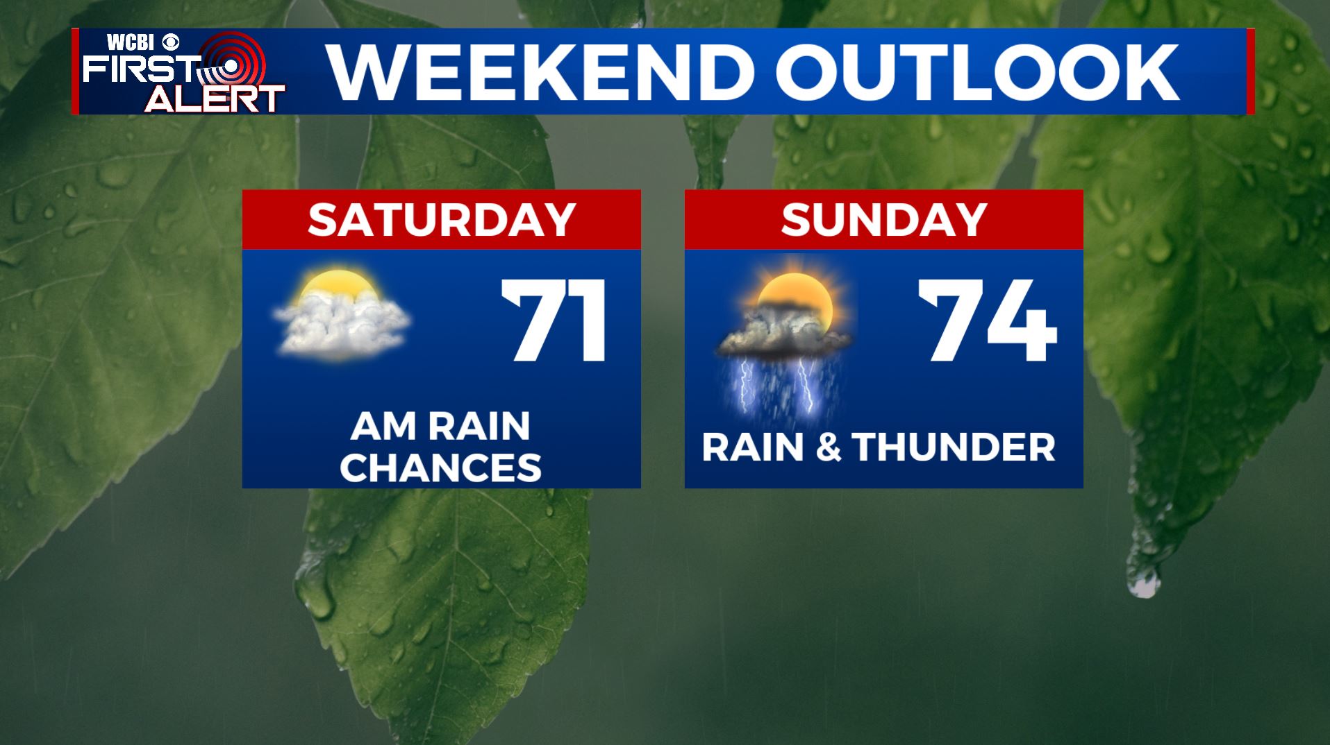
SATURDAY: Cloudy skies with a slight chance of a few showers in the morning as a weak cold front pushes through. Partly sunny skies by the afternoon. Highs in the lower 70s.
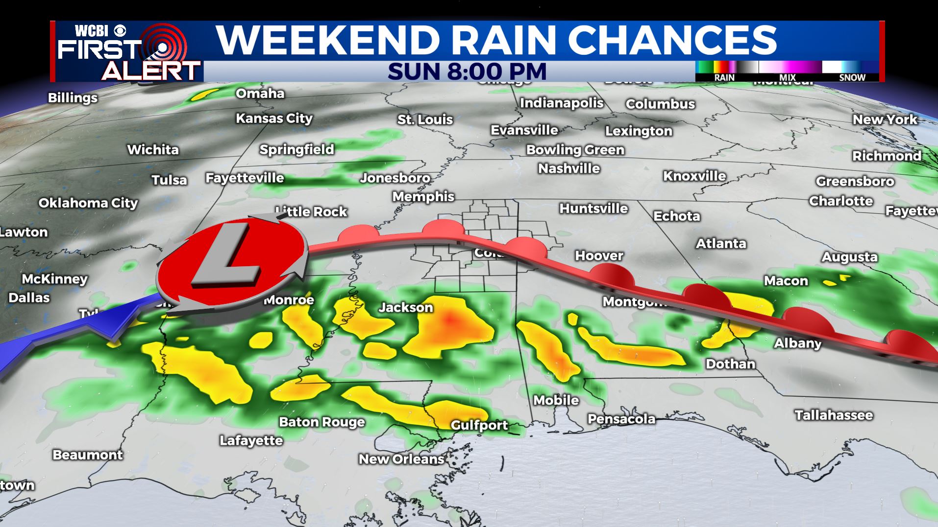
SUNDAY: Mostly cloudy with a chance of rain and possible thundershowers as another disturbance affects the region. We’ll be watching for some strong to severe storms to our south for Sunday as a warm front will be setting up over southern parts of Mississippi and Alabama, along and south of I-20. Something we’ll continue to watch. Highs in the 70s.
EARLY NEXT WEEK: The new week will start off on a warm & sunny note. Highs in the middle to upper 70s.
WEDNESDAY: Rain and thunderstorms look to be possible on Wednesday, but it’s a bit too far out to pin down specific timing or details with the possibility of strong to severe storms. We’ll keep an eye on things and refine the forecast as we get closer to time.
Stay connected with @WCBIWEATHER on Facebook, Twitter, Instagram, and the WCBI News App


Leave a Reply