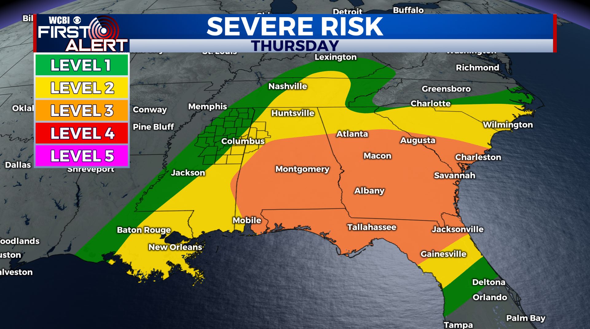
Some active weather as we end the week
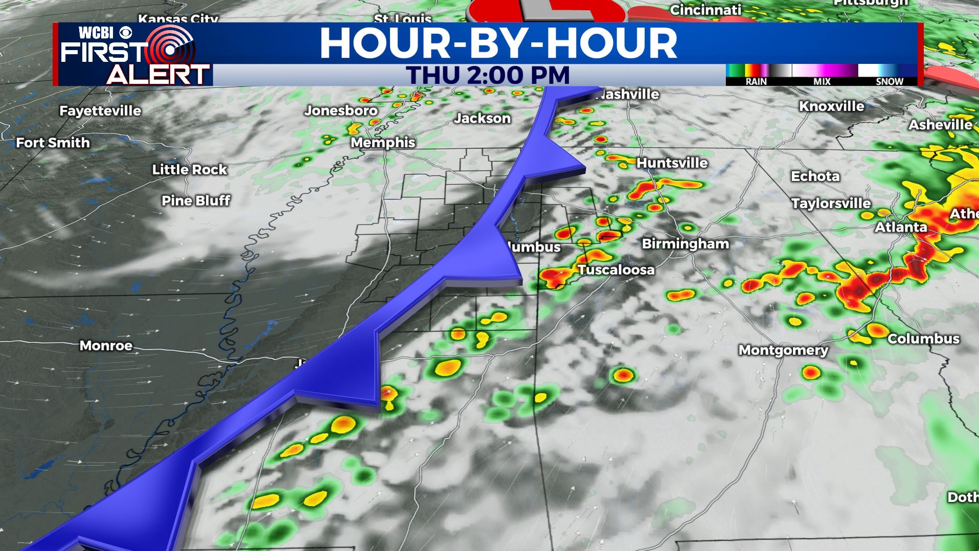
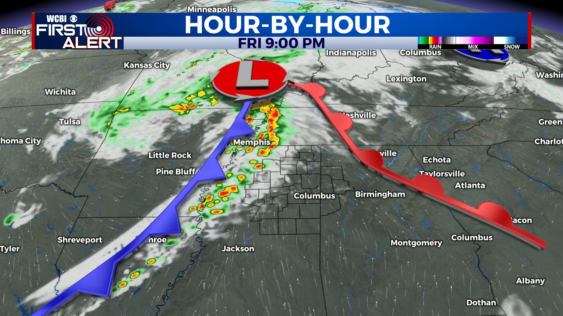
SUMMARY: A batch of rain and storms moving through the region this morning as the severe weather threat has remained along and south of I-20. Heavy rain and some gusty winds have been our main issues. About 1-2 inches of rain reported so far. Another chance of storms will come late Friday evening and early Saturday morning as a second cold front pushes through.
THURSDAY: Mostly cloudy with some lingering showers this morning before we see a bit of a break by midday. One thing we’ll have to watch out is for some storm redevelopment along the MS/AL border and points east by early afternoon. There may be some strong storms over in Alabama but we think they’ll stay JUST to our east. Breezy winds from the SE to SW 10-25 mph will help to dry things out. High temperatures in the lower 70s during the afternoon.
THURSDAY NIGHT: Partly cloudy and quiet. Lows in the low 50s.
FRIDAY: Mostly sunny and warm. Highs in the upper 70s to around 80.
FRIDAY EVENING/NIGHT: Scattered showers and storms. Some could be strong with gusty winds and hail. Lows in the upper 50s.
SATURDAY: Some showers in the morning with developing sunshine as the day wears on. Highs in the low 70s.
SATURDAY NIGHT: Mainly clear and cooler. Lows in the upper 40s.
SUNDAY: Sunny skies. Highs in the lower 70s.
EARLY NEXT WEEK: Staying mostly sunny & dry Monday into Tuesday. Highs will warm up into the mid to upper 70s.
MID NEXT WEEK: Another round of storms may come our way Tuesday night into Wednesday. We’ll continue to monitor that.
Stay connected with @WCBIWEATHER on Facebook, Twitter, Instagram, and the WCBI News App


Leave a Reply