Some storms on Friday night but a decent weekend is ahead
SUMMARY: A decent Friday is ahead for us before another batch of showers and storms affect our area Friday night but they are expected to weaken as they move in. Aside from the chance of a few morning showers Saturday the weekend is looking great for a change. A cold front next Tuesday night into Wednesday morning looks to bring our next batch of heavy rain and storm chances.
FRIDAY: We’re waking up to mostly sunny skies this Friday morning. We’ll see a mix of sun & clouds by the afternoon. Highs in the mid to upper 70s. Winds from the NW to the SE at 5-10 mph as a warm front lifts north.
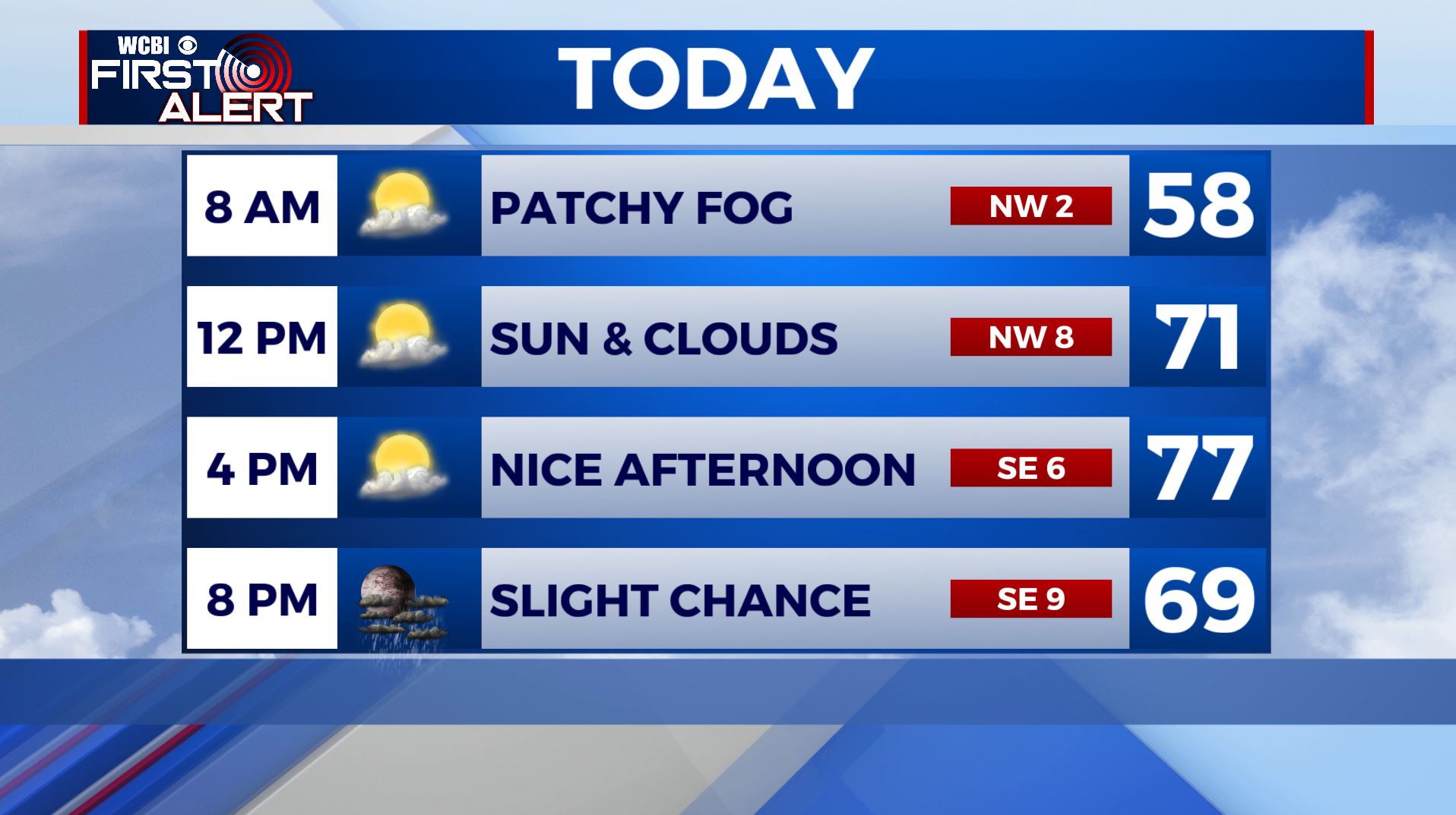
FRIDAY NIGHT: A chance of showers and storms as a cold front pushes through the region. While a few strong storms may occur in eastern Arkansas and the Mississippi Delta, we expect whatever develops to our west to be in a weakening phase as it approaches our area. Lows in the upper 50s.
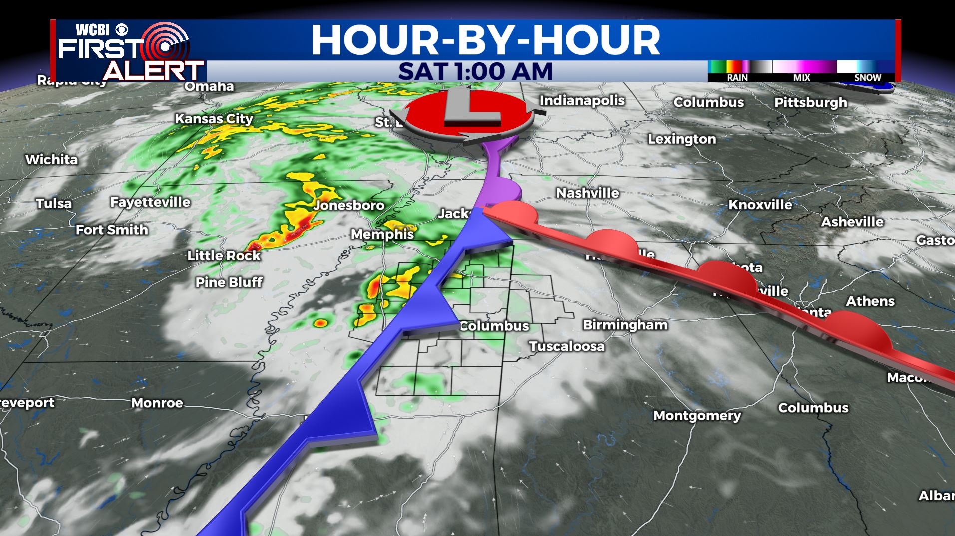
SATURDAY: A small chance of morning showers or thundershowers with developing sunshine and breezes by the afternoon. Highs in the mid 70s. West winds 10-20 mph.
SATURDAY NIGHT: Mainly clear and cooler. Lows in the upper 40s to near 50.
SUNDAY: Picture perfect so enjoy it! Lots of sunshine with highs a bit cooler in the lower 70s.
SUNDAY NIGHT: Clear and cool. Lows in the mid 40s.
MONDAY: Mostly sunny and quiet as we begin a new week. Highs in the mid 70s.
TUESDAY: Partly sunny with evening storms possible as our next storm system pushes through. Still some uncertainty with severe weather but we’ll watch it. Highs in the upper 70s.
WEDNESDAY: Areas of morning rain and storms. Afternoon clearing. Highs in the upper 70s.
THURSDAY: Mostly sunny skies. Highs in the mid 70s.
Stay connected with @WCBIWEATHER on Facebook, Twitter, Instagram, and the WCBI News App


Leave a Reply