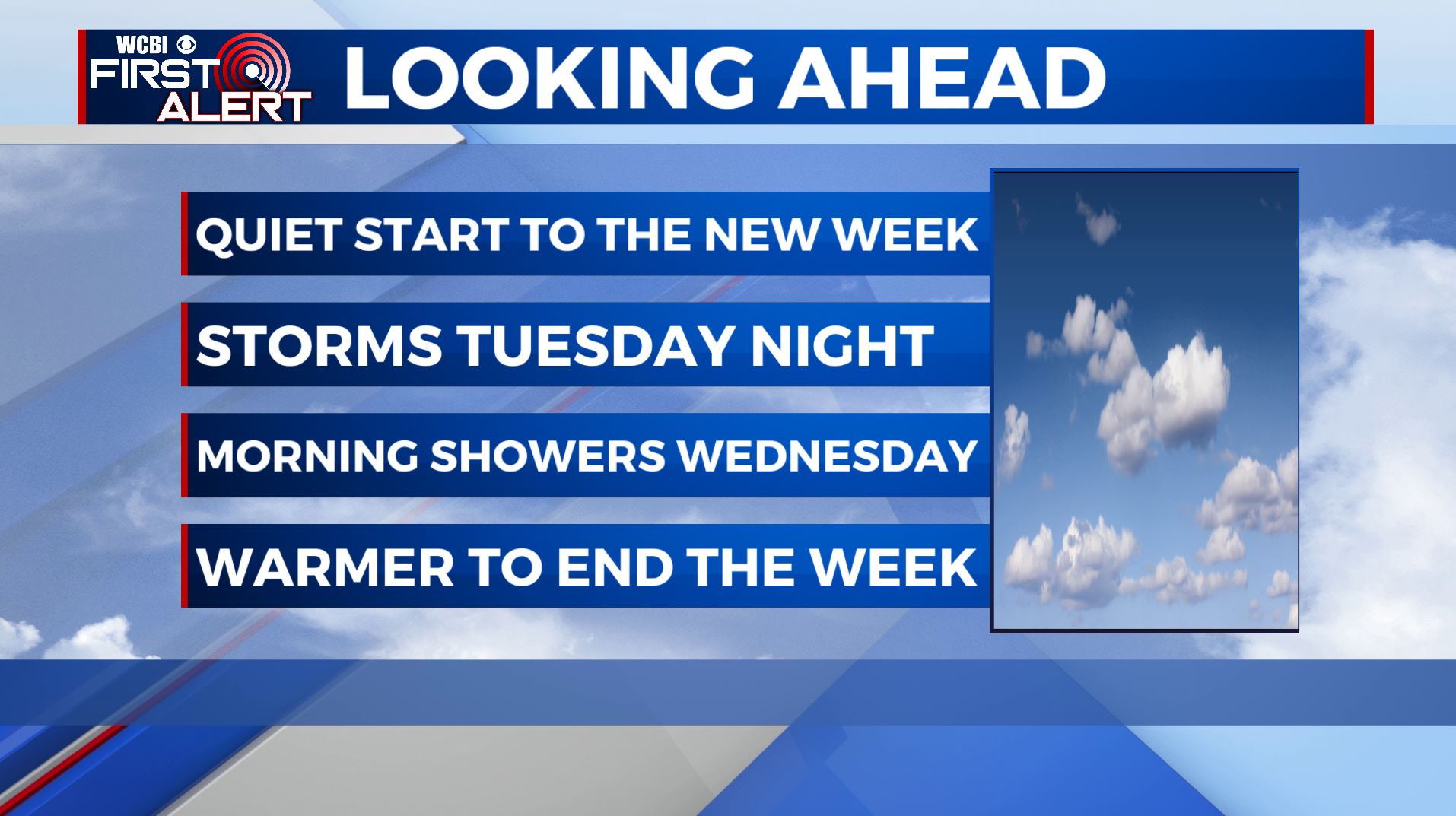
A quiet next week ahead with some storm chances midweek
SUMMARY: The next week is looking pretty quiet & decent with plenty of sunshine and highs in the 70s. We will have some showers and storms overnight Tuesday into early Wednesday, but no widespread severe weather is expected. The 80s will make a comeback by the weekend.
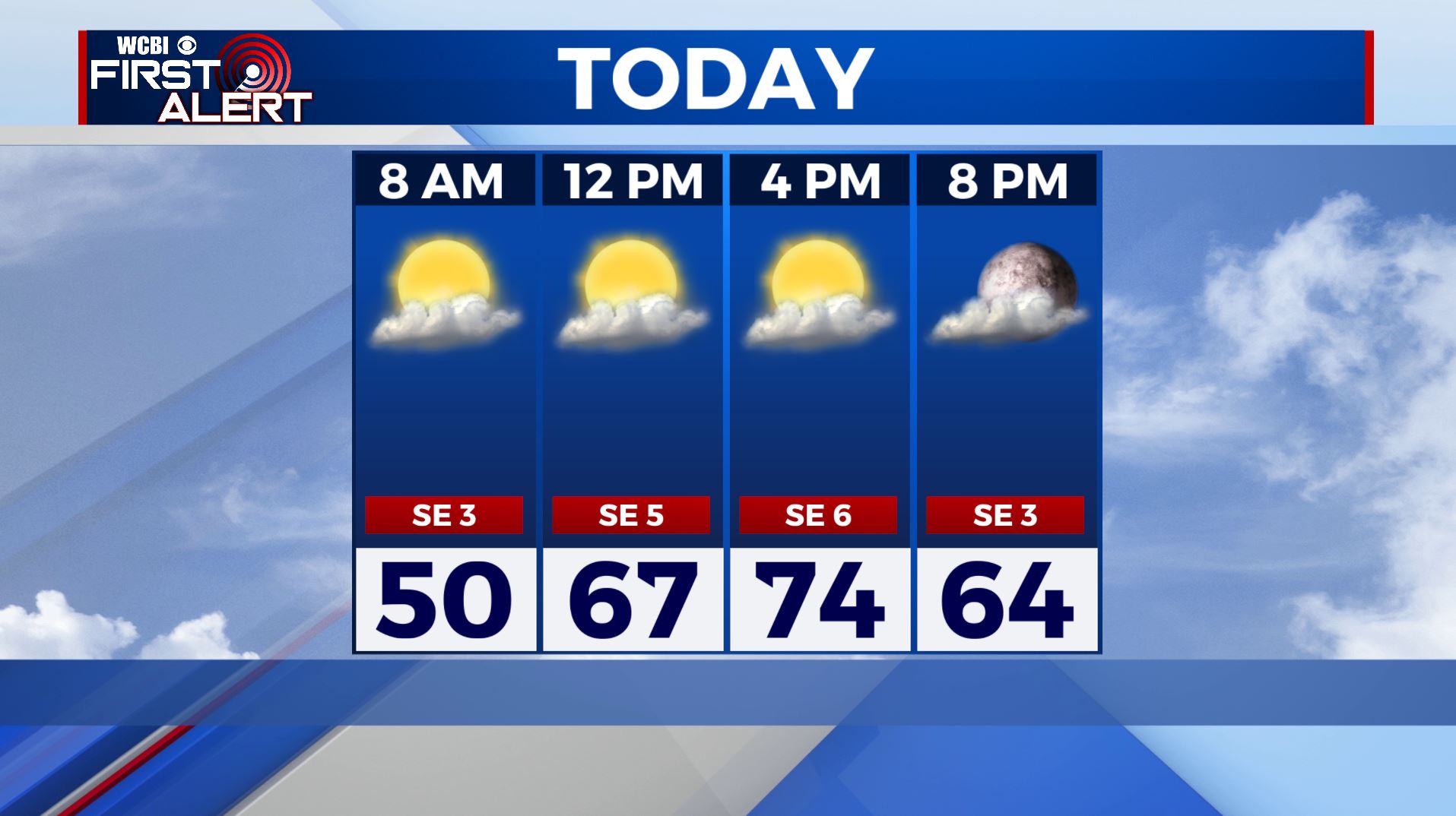
MONDAY: We’re waking up to mostly clear and calm conditions this Monday morning. We’ll see a few passing clouds as a disturbance moves to our north, but we’ll still see some sunshine. Temperatures will climb into the mid 70s by the afternoon.
MONDAY NIGHT: A quiet night overall with partly cloudy skies. Overnight lows in the 50s.
TUESDAY: Most of the day Tuesday will be dry and mostly cloudy. Highs in the upper 70s.
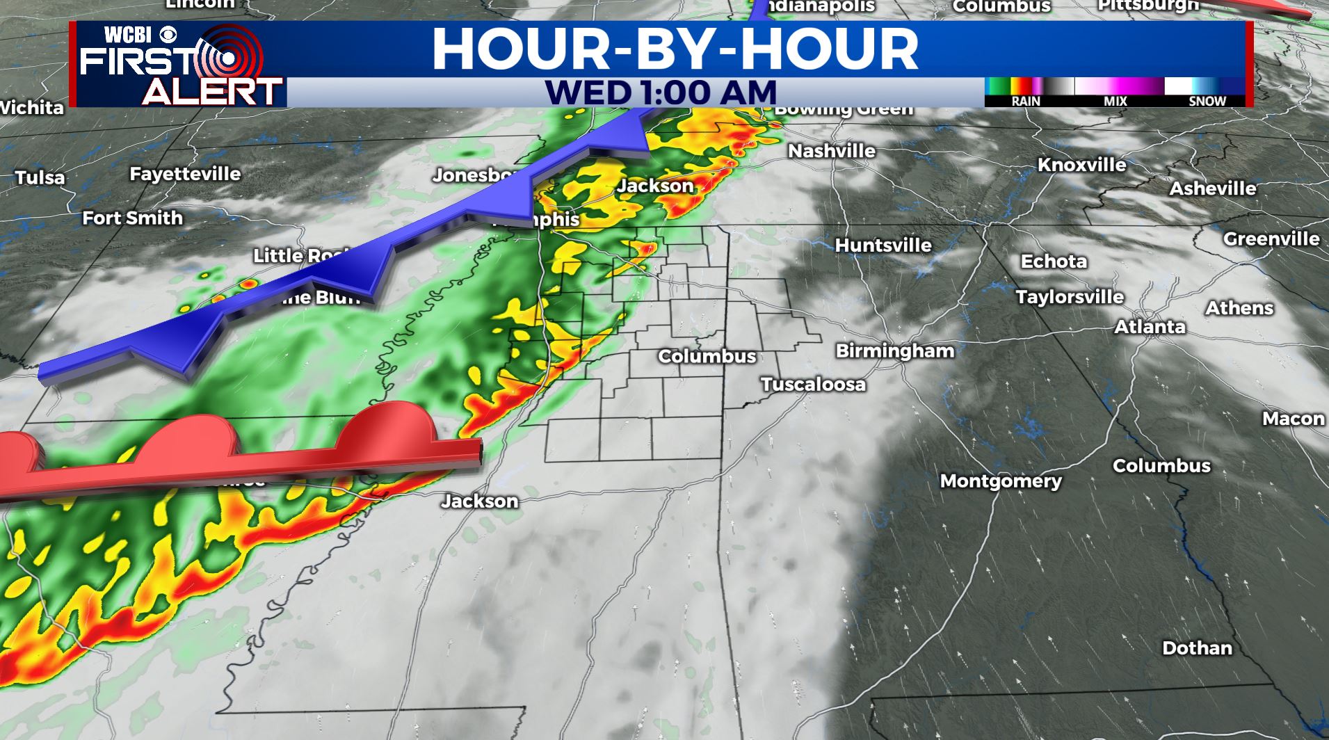
TUESDAY NIGHT-WEDNESDAY: Showers and storms will move through the area overnight Tuesday into Wednesday morning as our next cold front pushes through. These storms could produce some heavy rain and gusty winds, but we’re not currently expecting anything too significant in terms of severe weather. We’ll clear out through the day on Wednesday, leaving us with a few peeks of sunshine by the afternoon. Afternoon highs will be in the mid 70s with overnight lows in the 60s.
THURSDAY-FRIDAY: Mostly sunny weather returns for the end of the week. Highs remain in the 70s. Overnight lows will be in the 50s.
THE WEEKEND: Temperatures will steadily increase this upcoming weekend with afternoon highs into the mid and possibly upper 80s. Staying dry with lots of sunshine and a few clouds.
Stay connected with @WCBIWEATHER on Facebook, Twitter, Instagram, and the WCBI News App


Leave a Reply