A cool start but temperatures will warm back up this week
SUMMARY: We’ll start off the new week on a cool note with highs near 70 on Monday. The 80s will make a comeback this week as temperatures warm up late week into the weekend. Rain chances will be on & off at times but we’ll remain dry with mostly to partly sunny skies.
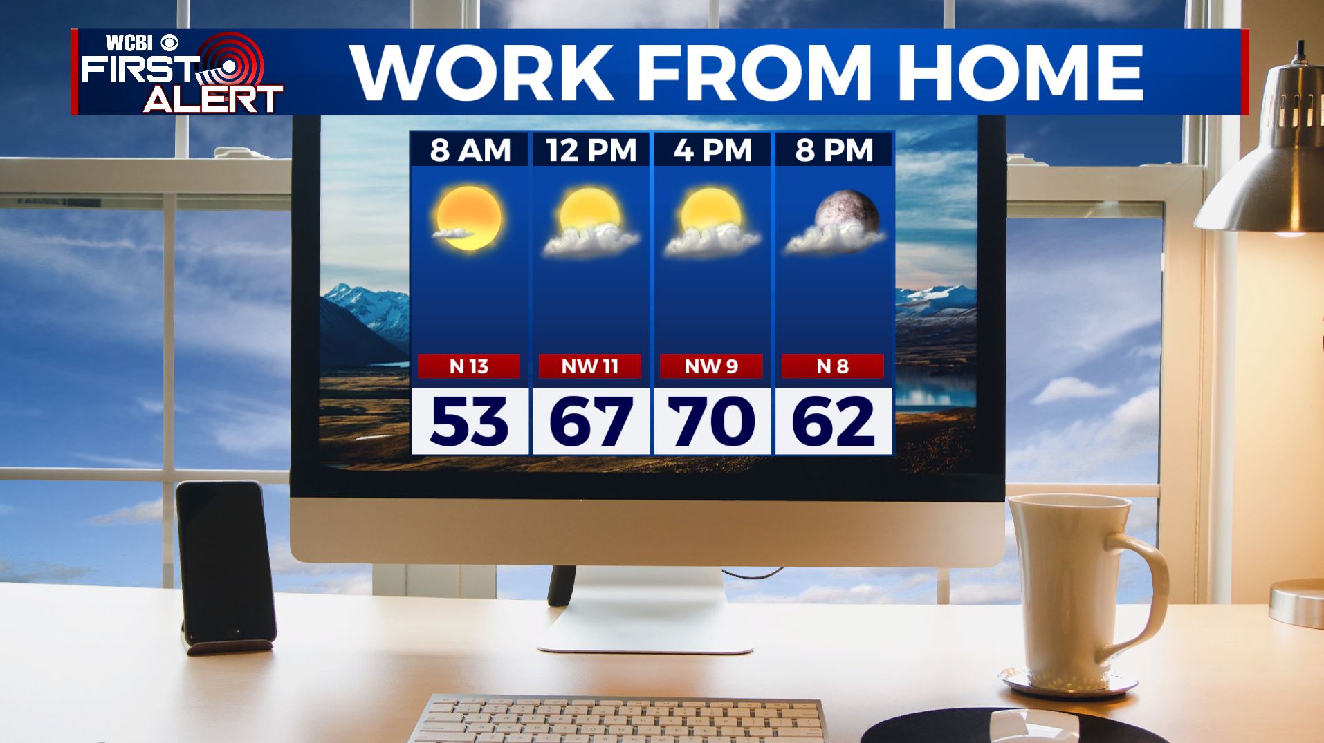
MONDAY: A mostly clear start this Monday morning as high pressure moves into the region. A few more clouds will be building in by the afternoon, but we’ll still have the sunshine. Highs still cool & below average in the upper 60s to lower 70s thanks to a breezy NW wind 10-15 mph.
MONDAY NIGHT: Partly cloudy skies but a quiet night. Overnight lows in the mid to upper 40s.
TUESDAY: A warming trend begins as highs get into the mid 70s for Tuesday as our winds switch up to the south. A mix of sun & clouds ahead of a disturbance in the Central Plains.
TUESDAY NIGHT: Overnight lows in the lower to mid 50s. Mostly cloudy with a very slight chance of a stray sprinkle.
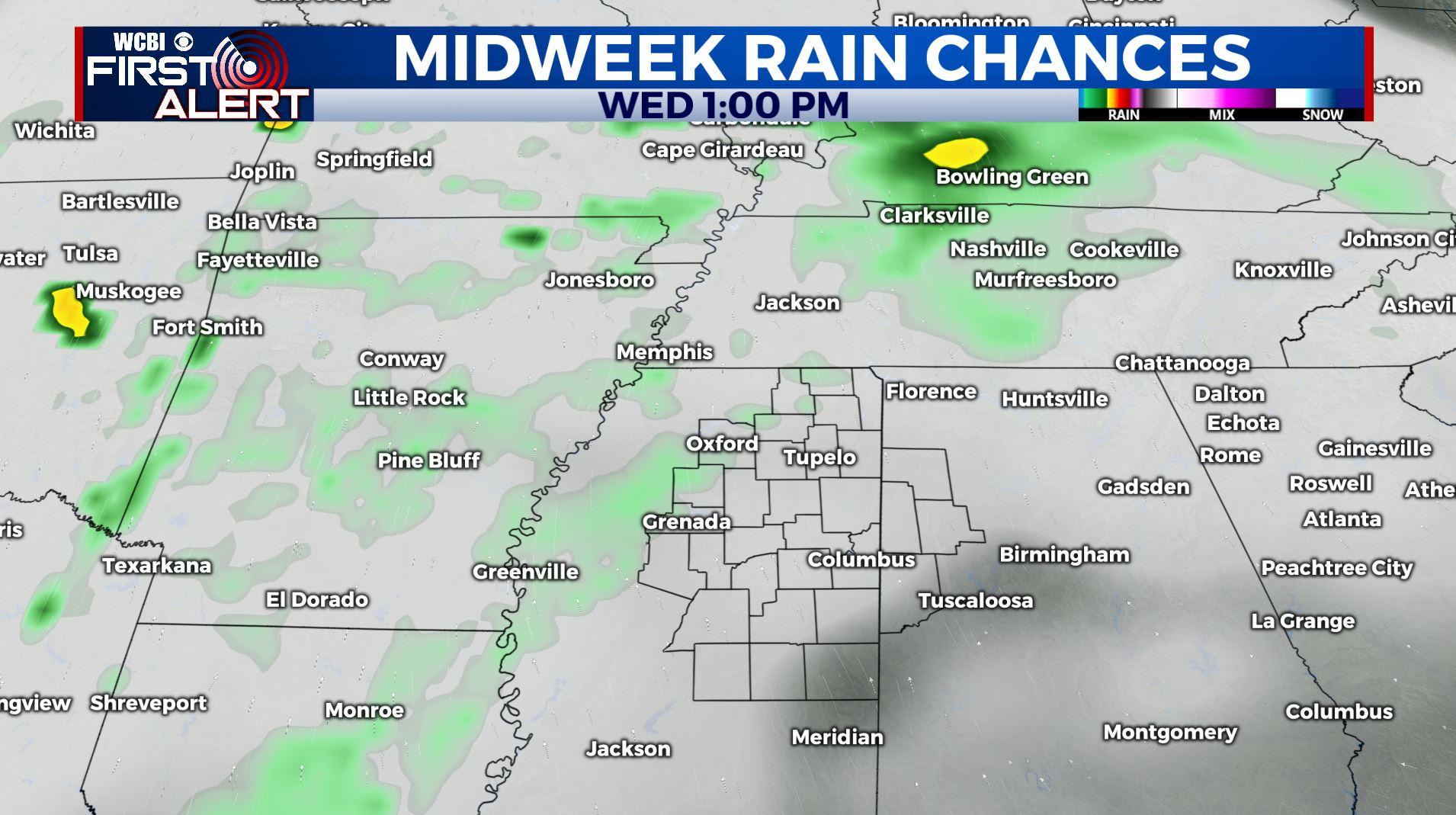
WEDNESDAY: A mix of sun and clouds with the chance for a few showers. Highs back up to near average at 80 degrees.
THURSDAY: Mostly sunny skies. Temperatures will reach the mid 80s by the afternoon.
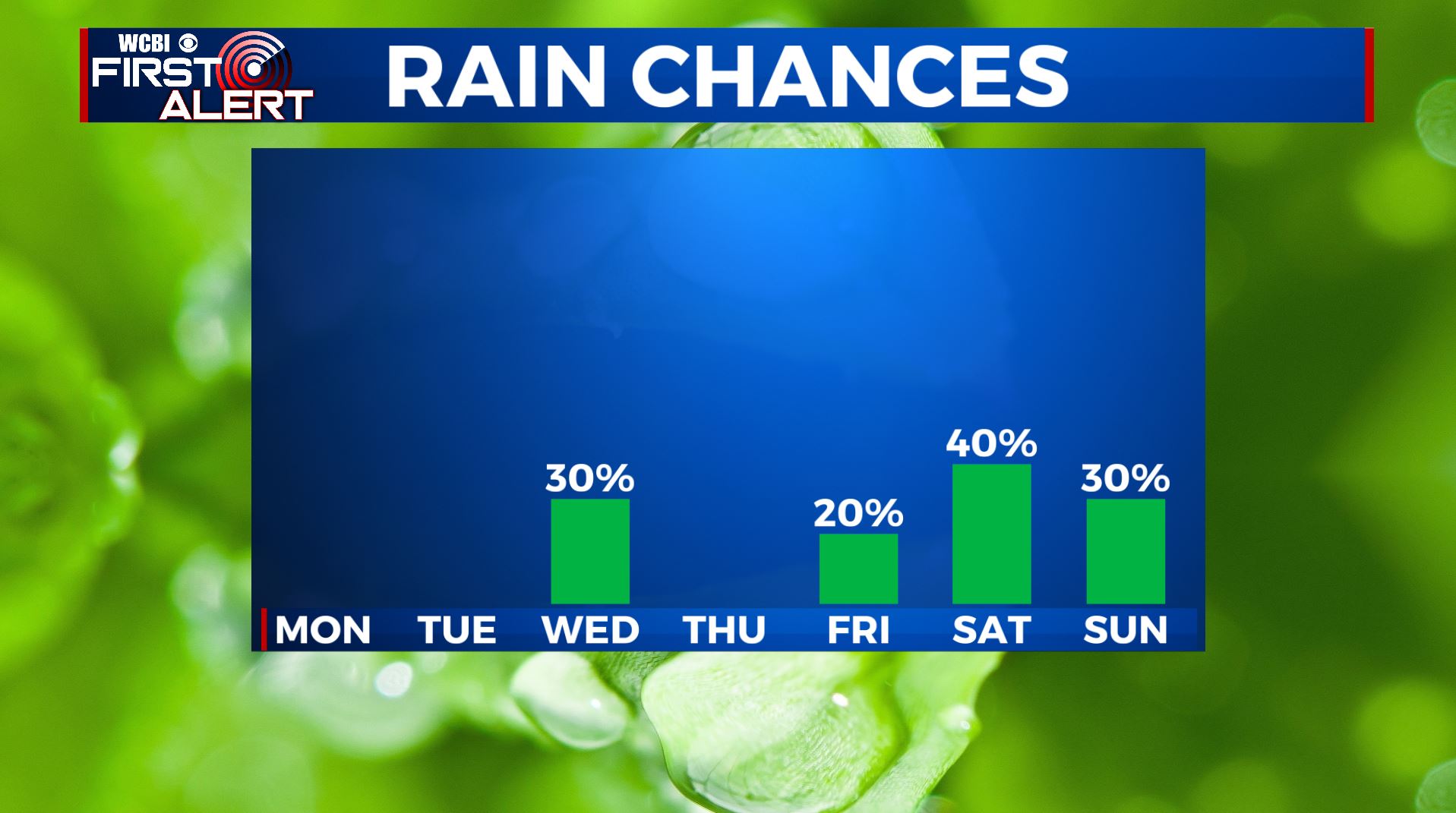
FRIDAY-SUNDAY: Clouds will return for the end of the week and into the weekend with a few showers. Some scattered storms are possible Saturday, but no severe weather is expected. Highs remain warm in the mid to upper 80s.
Stay connected with @WCBIWEATHER on Facebook, Twitter, Instagram, and the WCBI News App


Leave a Reply