Daily rain chances & a cool down then a warm up this week
SUMMARY: Low chances for isolated showers will continue for the next week with partly to mostly cloudy skies. Temperatures will be cooler as we begin the new week thanks to a cold front passing through this Monday. We’ll quickly warm back into the 80s by the end of the week with the possibility of our first 90 degree day of the year this Memorial Day weekend.
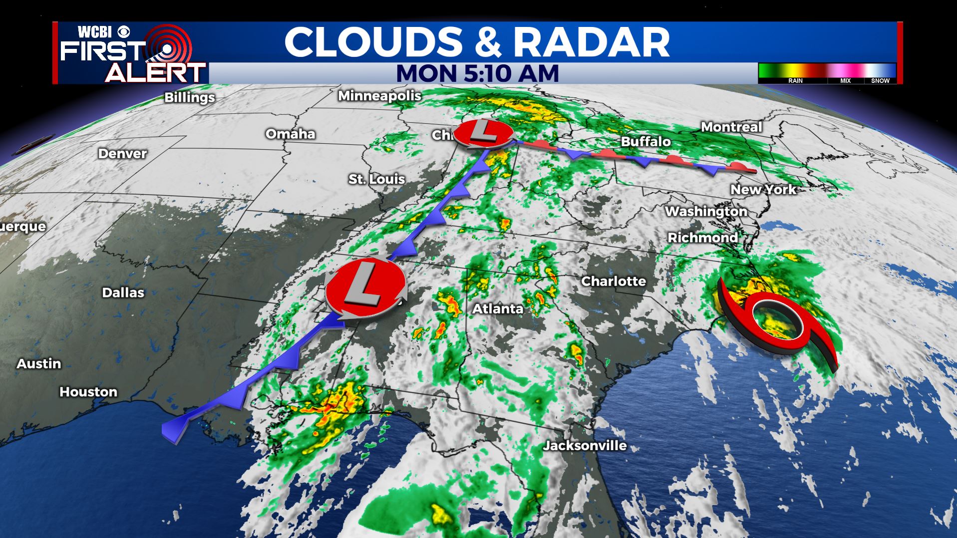
MONDAY: A low pressure system continues to exit to our east, along with a cold front that will pass through the area this Monday morning, switching our winds to the NW at 5-15 mph and help us to cool down a bit. Some morning showers are possible with mostly cloudy skies before we see some clearing by the late afternoon. Highs will be in the upper 70s to near 80.
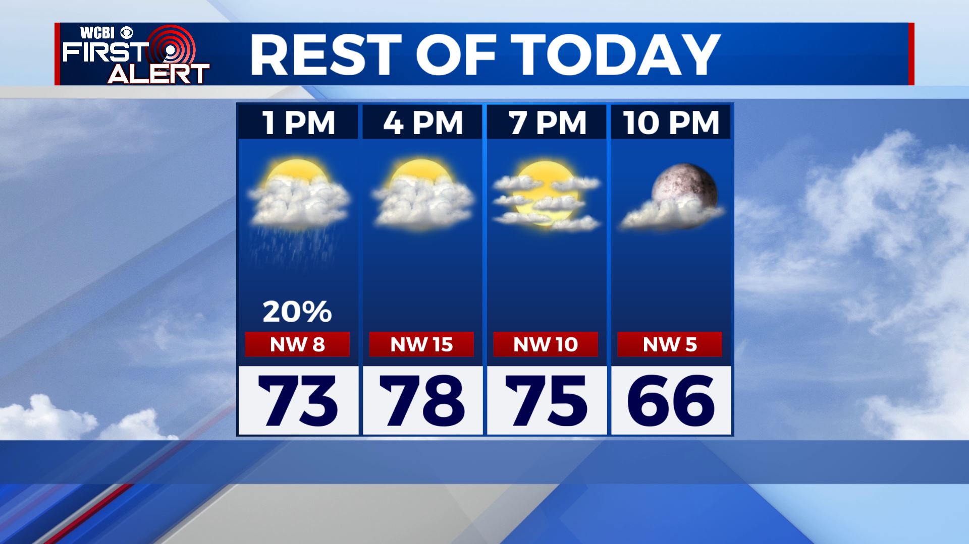
MONDAY NIGHT: Partly cloudy skies. Overnight lows in the mid to upper 50s.
TUESDAY-WEDNESDAY: The cooler temperatures will continue with highs in the mid to upper 70s. We’ll see a mix of sun and clouds with the slight chance for a stray shower or two.
THURSDAY-FRIDAY: Temperatures will warm up for the end of the week. Highs will be near 80 on Thursday then into the mid and upper 80s for Friday. Not much change with our weather pattern in terms of partly sunny skies and isolated rain chances continuing.
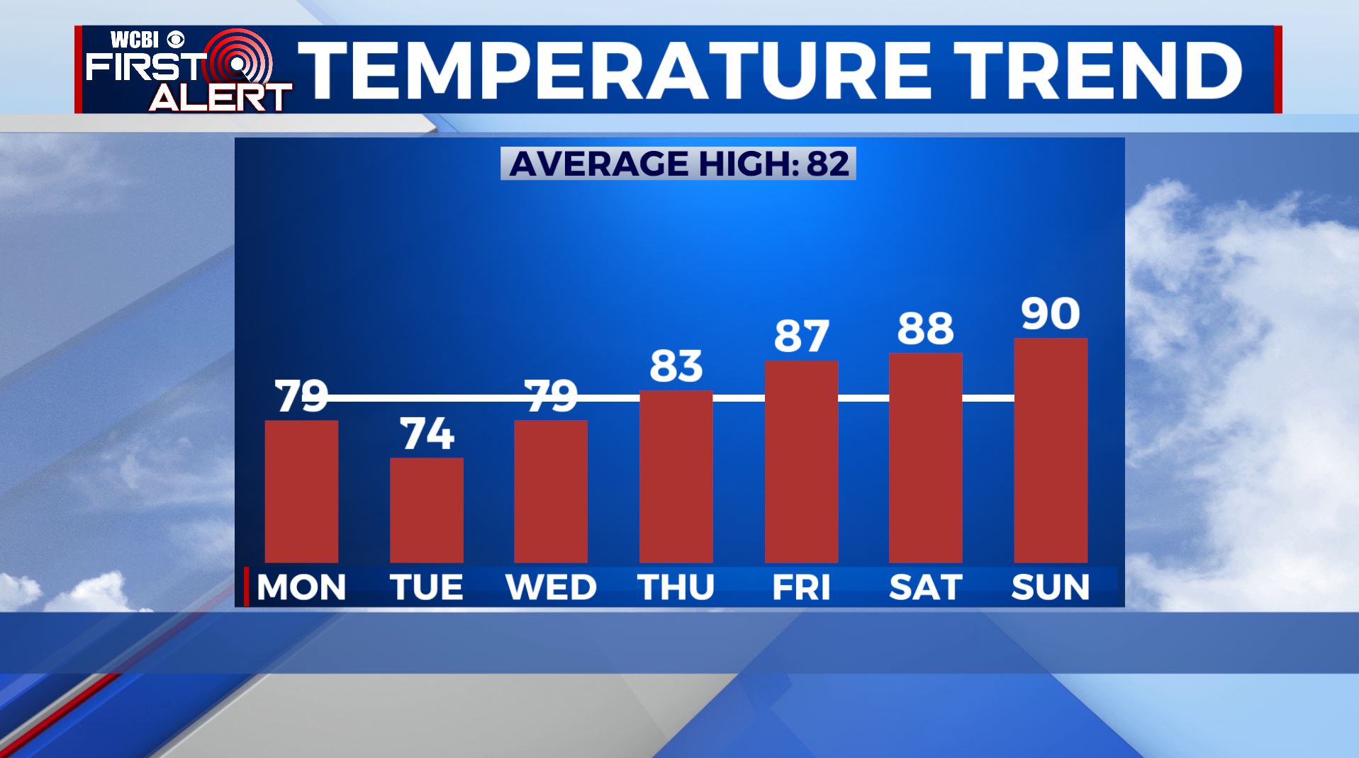
THIS WEEKEND: The Memorial Day weekend is known to be the unofficial start to summer and it will feel like it. High temperatures be in the upper 80s on Saturday and then maybe hit near or at 90 on Sunday. Mostly to partly sunny skies with some on and off again light showers.
Stay connected with @WCBIWEATHER on Facebook, Twitter, Instagram, and the WCBI News App


Leave a Reply