Storm chances Friday then a sunny & pleasant weekend
SUMMARY: A few scattered showers and storms are in the forecast for one more day on Friday as cold front will push through the Deep South. We’ll have sunny, pleasant and less humid conditions this weekend behind the front. It will be great weather for any outdoor plans you may have. Enjoy it because the 90s and the summer humidity will make a comeback next week.
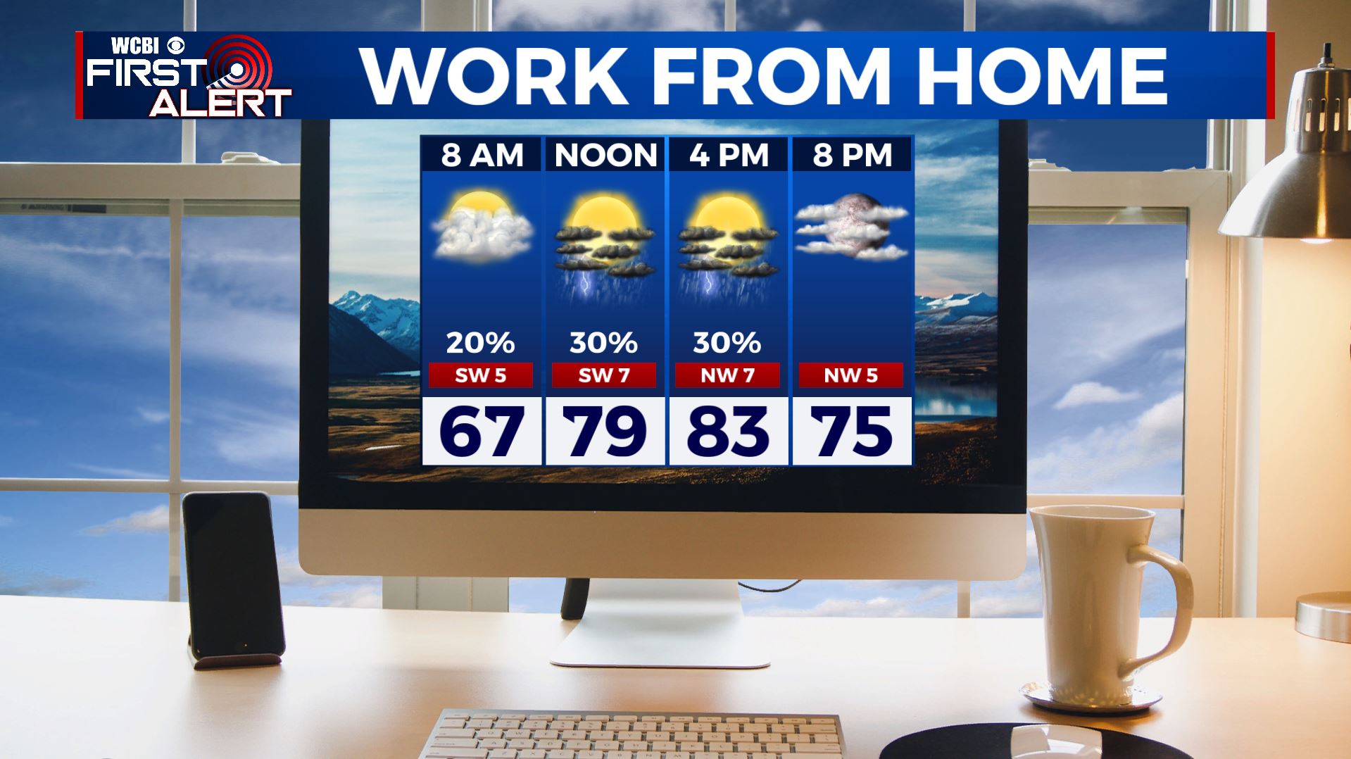
FRIDAY: Few lingering showers this morning with temperatures in the 60s. A chance of scattered showers and storms in the afternoon thanks to the heating of the day ahead of a cold front pushing through. Highs top out in the lower to mid 80s. Winds will switch from the SW to the NW 5-10 mph.

FRIDAY NIGHT: Skies will start clearing up. Quiet and calm night. Overnight lows in the 60s.
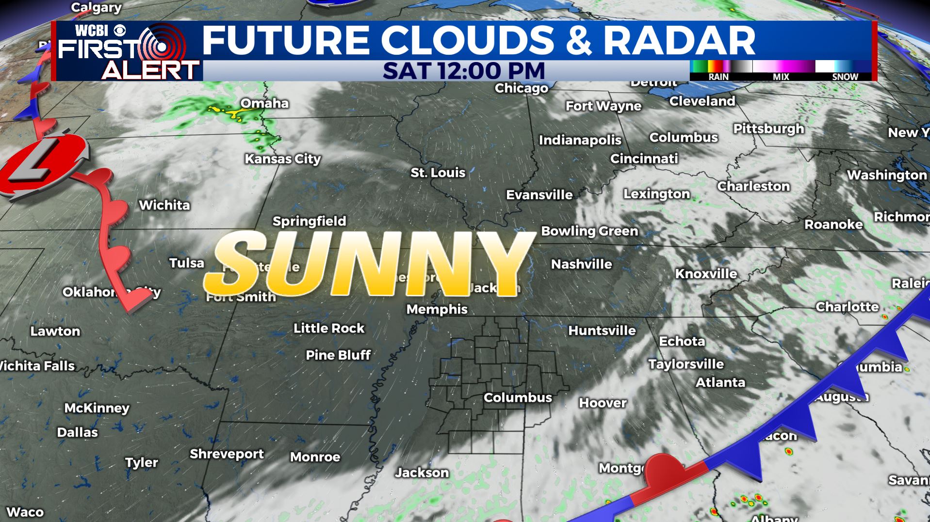
SATURDAY: The sunshine makes a full return with a few clouds and very pleasant. N winds 5-10 mph. Highs in the lower 80s but will be comfortable thanks to the lower humidity levels.
SATURDAY NIGHT: Another clear and calm night. A bit cool with overnight lows in the mid to upper 50s.
SUNDAY: Another sunny and beautiful late spring day as we end the month of May. Highs in the low 80s.
SUNDAY NIGHT: Clear skies. Another cool night with overnight lows in the upper 50s.
EARLY NEXT WEEK: Our drying trend continues as an area of high pressure moves in. Expect warm highs temperatures in the mid to upper 80s under sunny skies through at least Tuesday.
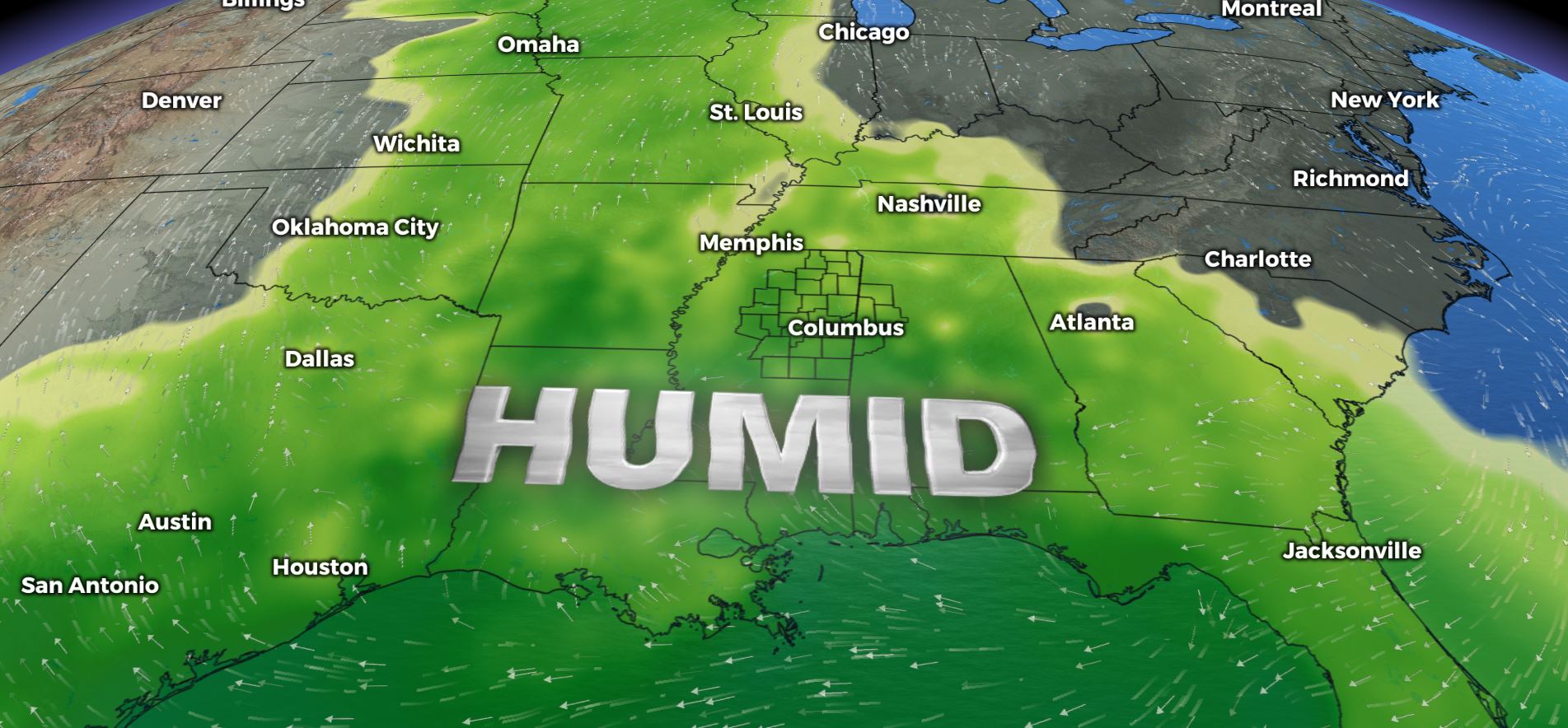
MIDWEEK: Mostly sunny skies but getting warmer and humid once again as high temperatures will be climbing to the lower 90s. We’ll also have a few spotty showers or storms possible late week.
Stay connected with @WCBIWEATHER on Facebook, Twitter, Instagram, and the WCBI News App


Leave a Reply