Cold night ahead, but temperatures rebound through the weekend
Cold night ahead, but temperatures rebound through the weekend
COLUMBUS, Mississippi (WCBI) – SUMMARY: Colder air has arrived, but we will quickly return to the mid-60s by the end of the weekend.
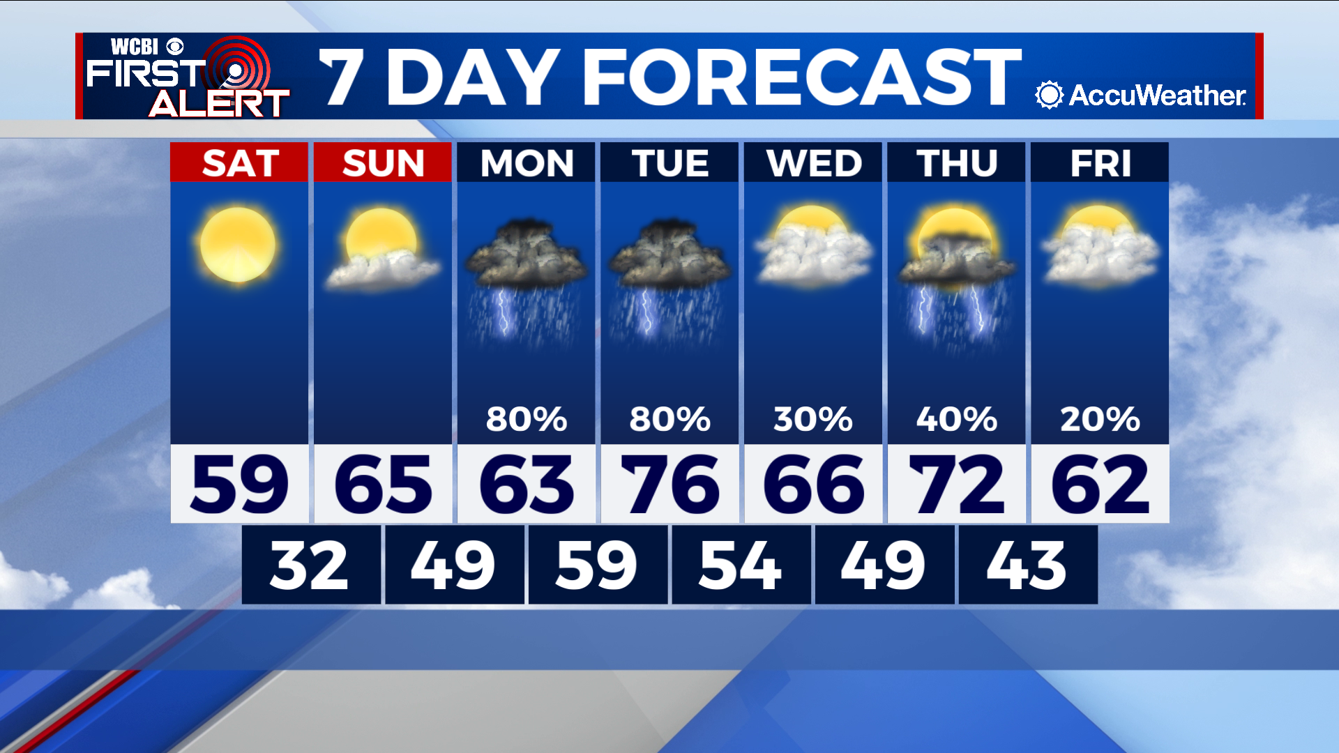
TONIGHT: Clear and cold with lows in the upper-20s. Calm wind.
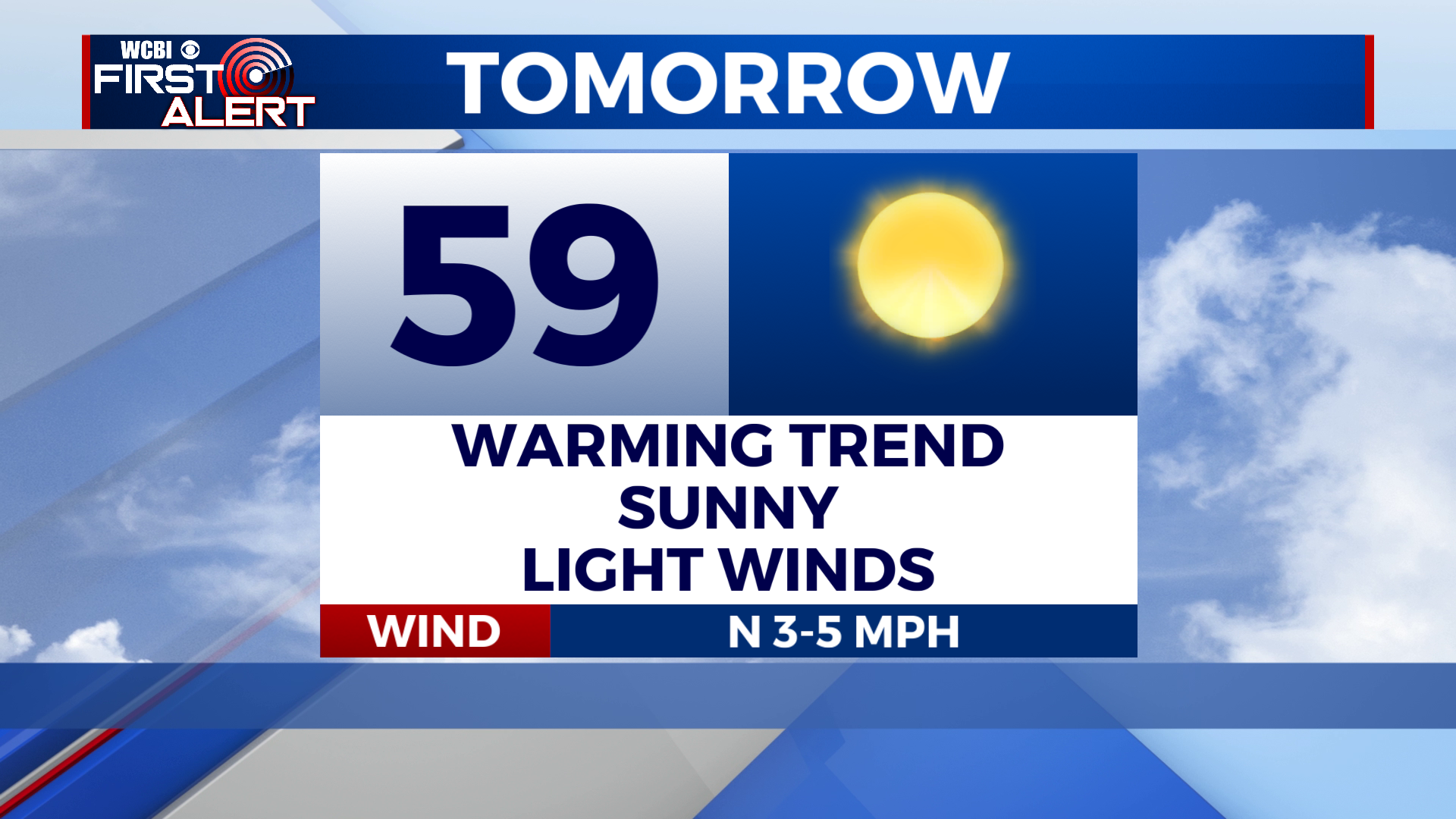
SATURDAY: Sunny and warmer with highs in the upper-50s. Calm wind.
SATURDAY NIGHT: Mostly clear with lows in the low-30s. Calm wind.
SUNDAY: Mostly sunny early, then a few afternoon clouds. High in the mid-60s. South wind, 5-10 mph.
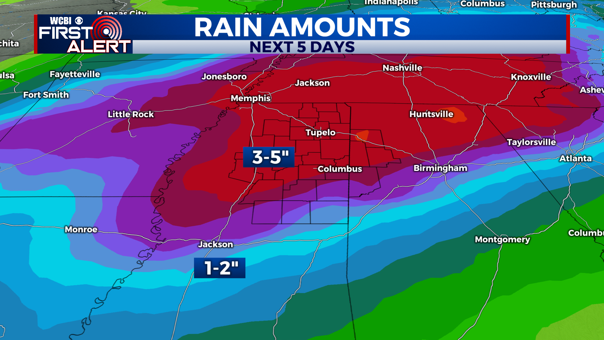
EXTENDED FORECAST: A warm front will lift through the region Monday, which will transport copious Gulf moisture along with it. Occasional showers and thunderstorms are likely Monday morning and through the day with with heavy rain possible. A series of systems will progress across the region next week, which will help maintain a consistent chance of rain through Thursday. There is a very low end threat of severe weather, but not high enough to warrant a severe weather outlook from the Storm Prediction Center. It is just something to monitor. Regardless, most of the region will receive beneficial rainfall. Locations north of Highway 82 are most likely to receive the heaviest rain, and may total 3-5”+. With that, there is some concern for flash flooding potential. Other than that, enjoy the weekend! We will keep you updated on next week’s active weather.


Leave a Reply