Soggy & Stormy Saturday, Lingering Showers Sunday
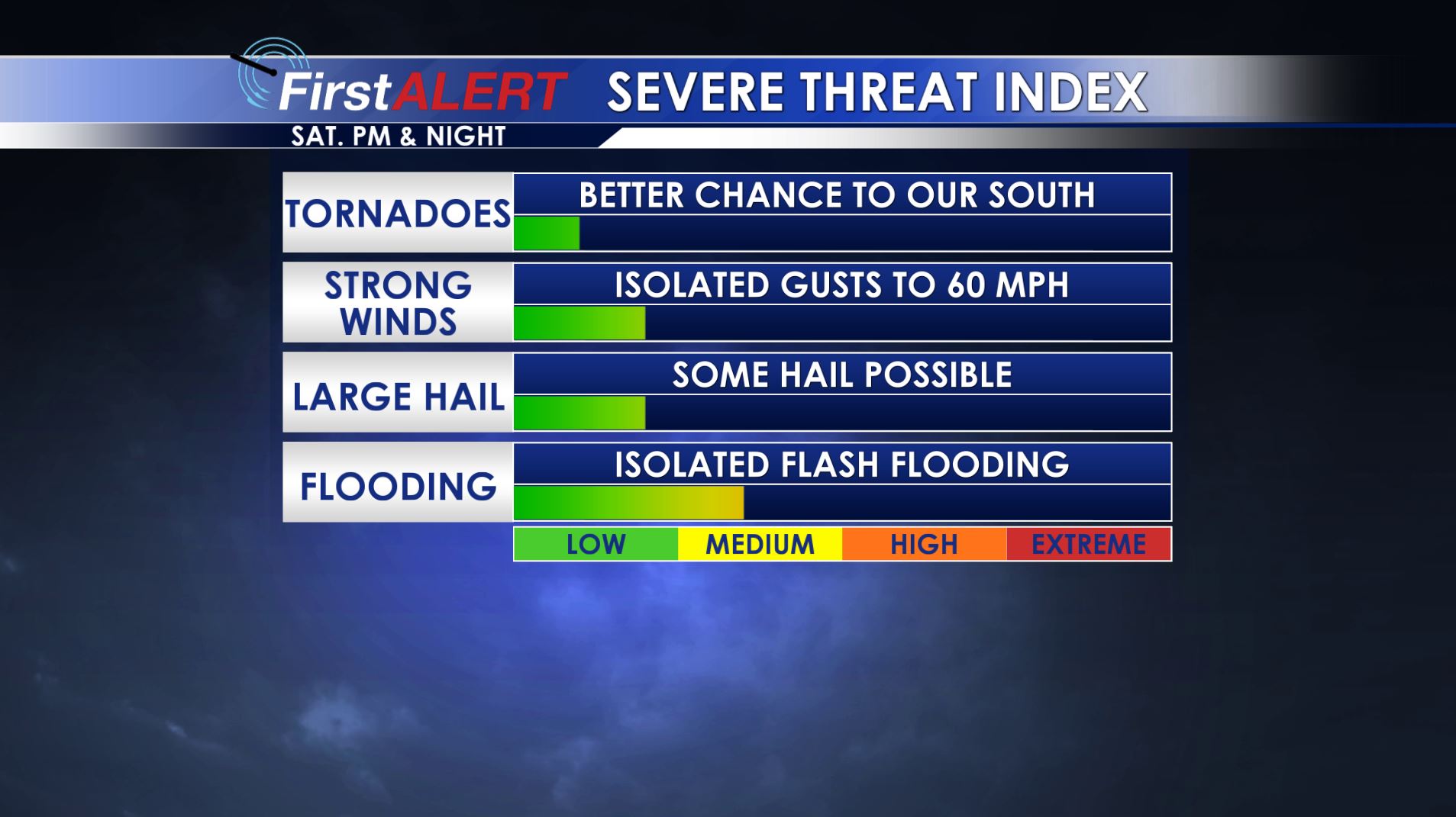
Severe Threat Index
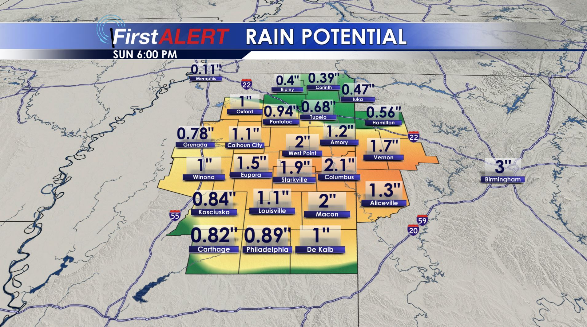
Weekend Rain Potential
SATURDAY: Areas of showers are possible during the first 1/2 of the day. Heavier rain and storms are more likely during the late afternoon, evening, and Saturday night time frame. Look for highs in the 60s. There is the chance of a few strong to severe storms Saturday afternoon and night, mainly SW of the Golden Triangle. Hail up to 1″ in diameter and damaging wind gusts could occur with any strong storm that manages to develop. The better tornado potential with this system looks like it’ll stay to our south but it bears watching.
SUNDAY: Highs stay in the 60s and there is a 30% chance of showers. Northwest winds between 10 and 20 mph develop. Don’t forget about the time change at 2 a.m. Be sure to set your clocks ahead 1 hour.
NEXT WEEK: A mainly sunny and cool spring break week appears on track. Highs Monday through Wednesday may only be in the 50s while overnight temperatures dip down to around freezing.
Follow @WCBIWEATHER on Facebook, Twitter, Instagram, and Snapchat


Leave a Reply