Cold Tonight, Warmer Thursday & Beyond
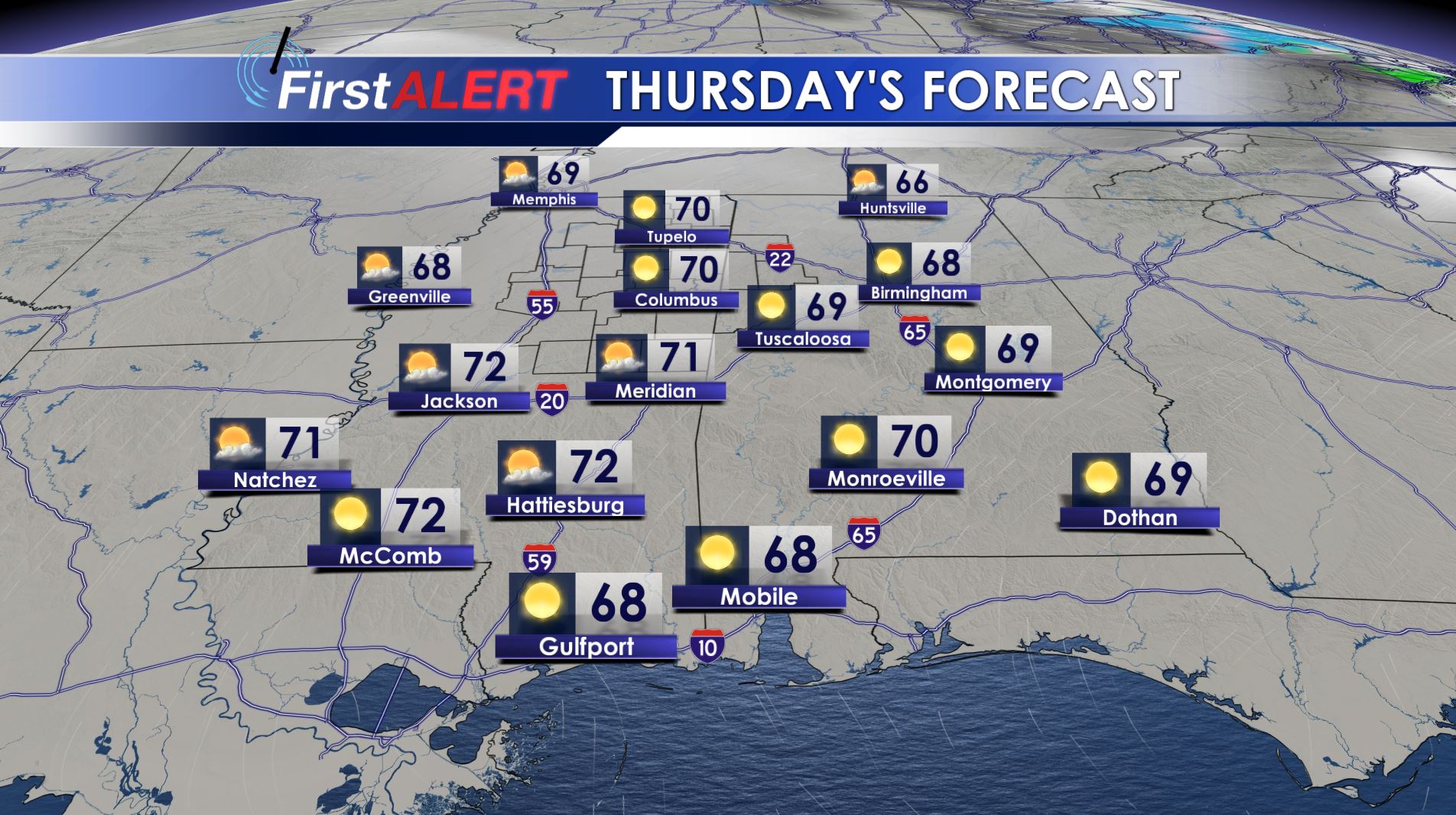
Thursday’s Forecast
TONIGHT: Clear and chilly conditions will continue for the 3rd night in a row. We expect lows in the mid to low 30s and that means another frost or freeze is possible.
THURSDAY: Look for sunny skies and warmer afternoon highs around 70. Winds are going to be from the SW between 10 and 15 mph. It’s going to be a pretty nice March day overall.
THURSDAY NIGHT: Mostly clear to partly cloudy skies hold on. Plan on lows in the mid to upper 40s.
FRIDAY: There is a 50% chance of showers and storms during the day and during Friday night. While there is the potential for some strong storms in the region, confidence remains low on potential timing and the shear number of storms that may actually form. Stay tuned for additional information on Thursday. Highs should be around 70.
WEEKEND: The latest trends suggest a warmer weekend for us with highs well into the 70s and lows in the upper 50s to around 60. Some rain and storms are possible both Saturday and Sunday but it’s not looking like a washout at this time. A few additional strong storms may return to the region late Sunday but it’s still up in the air at the moment.
NEXT WEEK: Yet another batch of rain and storms is possible Monday and some could be on the strong side, especially during the morning hours. We’ll have to keep watching things during the coming days. Look for highs in the mid 70s. Cooler, drier, and sunnier weather is expected to build in for the middle of next week.
Follow @WCBIWEATHER on Facebook, Twitter, Instagram, and Snapchat


Leave a Reply