Warmer Air, Rain, & Storms Return
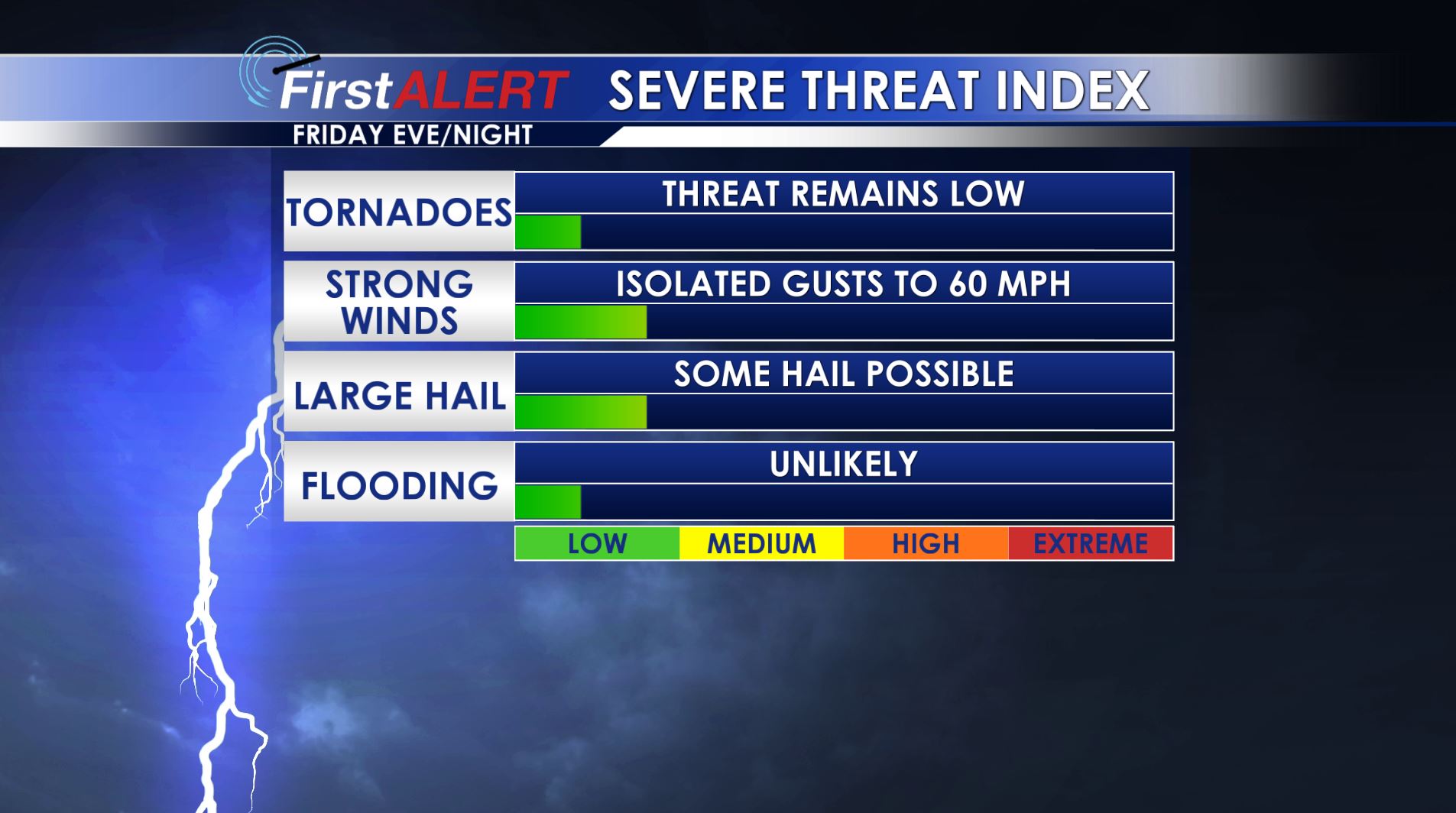
Severe Threat Index
THURSDAY NIGHT: Clear during the evening with increasing clouds late. Lows in the mid to upper 40s.
FRIDAY: Mostly cloudy with highs in the 60s. There is a 50% chance of showers during the daylight hours.
FRIDAY NIGHT: A few strong to severe storms remain possible but anything that develops continues to look very isolated in nature. Look for much warmer lows in the upper 50s.
SATURDAY: Rain chances lower to around 20%. Highs should be well into the 70s.
SUNDAY: Most of the day should be mild and quiet with highs in the 70s. Rain and storm chances ramp up during the evening and overnight hours into early Monday morning. A few of the storms may be strong to severe.
MONDAY: Additional rain and storms are likely and some could be strong to severe. Highs remain in the 70s.
TUESDAY – THURSDAY: Mostly sunny and seasonable. Highs will be around 60 with overnight lows in the mid to upper 30s.
Follow @WCBIWEATHER on Facebook, Twitter, Instagram, and Snapchat


Leave a Reply