Seasonably Warm & Humid Weekend
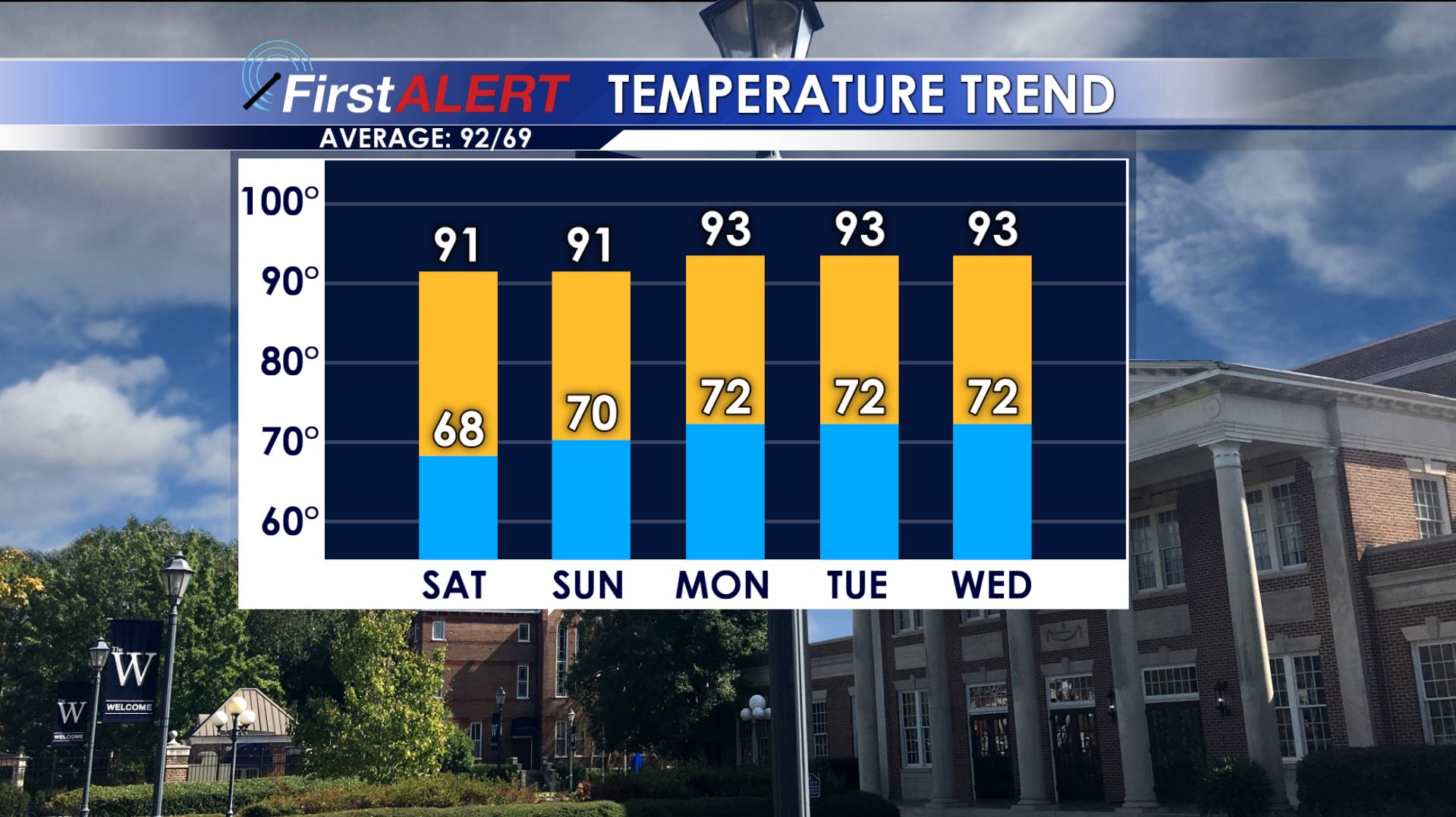
Temperature Trend
SUMMARY: Fairly standard summer weather is on tap for this weekend and all of next week, including the 4th of July holiday. Look for a daily 20-30% chance of showers and storms and seasonably warm highs in the low 90s.
FRIDAY NIGHT: Isolated showers and storms are possible during the evening but they’ll fade away after sunset. Skies will be variably cloudy but some fog may develop. Lows should be in the upper 60s.
SATURDAY: Partly cloudy and warm with afternoon highs either side of 90. The heat index should push into the mid 90s. Some pop-up showers and storms are possible but the rain chance is just 30%.
SATURDAY NIGHT: Any rain or storm activity will fade in the evening. This will set up a quiet night with lows around 70.
SUNDAY: Another seasonably warm and humid summer day is on tap for us. Highs will be in the low 90s with heat index values in the mid to upper 90s. Pop-up showers and storms may develop with the chance of rain holding steady at 30%. Activity will diminish during the evening once again.
NEXT WEEK: No big weather maker is going to affect the region so we’re going to maintain a persistence type forecast… meaning what happens one day will tend to happen the next. Highs stay in the low 90s with heat index values approaching 100. Lows drop into the low 70s. Expect a daily 20-30% chance of rain and storms with most activity occurring during the heating of the day.
Stay connected with @WCBIWEATHER on Facebook, Twitter, and Instagram


Leave a Reply