A decent Friday and weekend ahead as temperatures warm up
SUMMARY: A few stray light rain showers will be possible this weekend as a weak cold front pushes through, but not looking to be much. We’ll have a mix of sun and clouds overall. Temperatures will continue warming up into the mid to upper 70s. Try to get outside if you can. Temperatures will start to warm back up to above average by next week with the return of showers & storms. No strong or severe weather is currently expected during the next week.
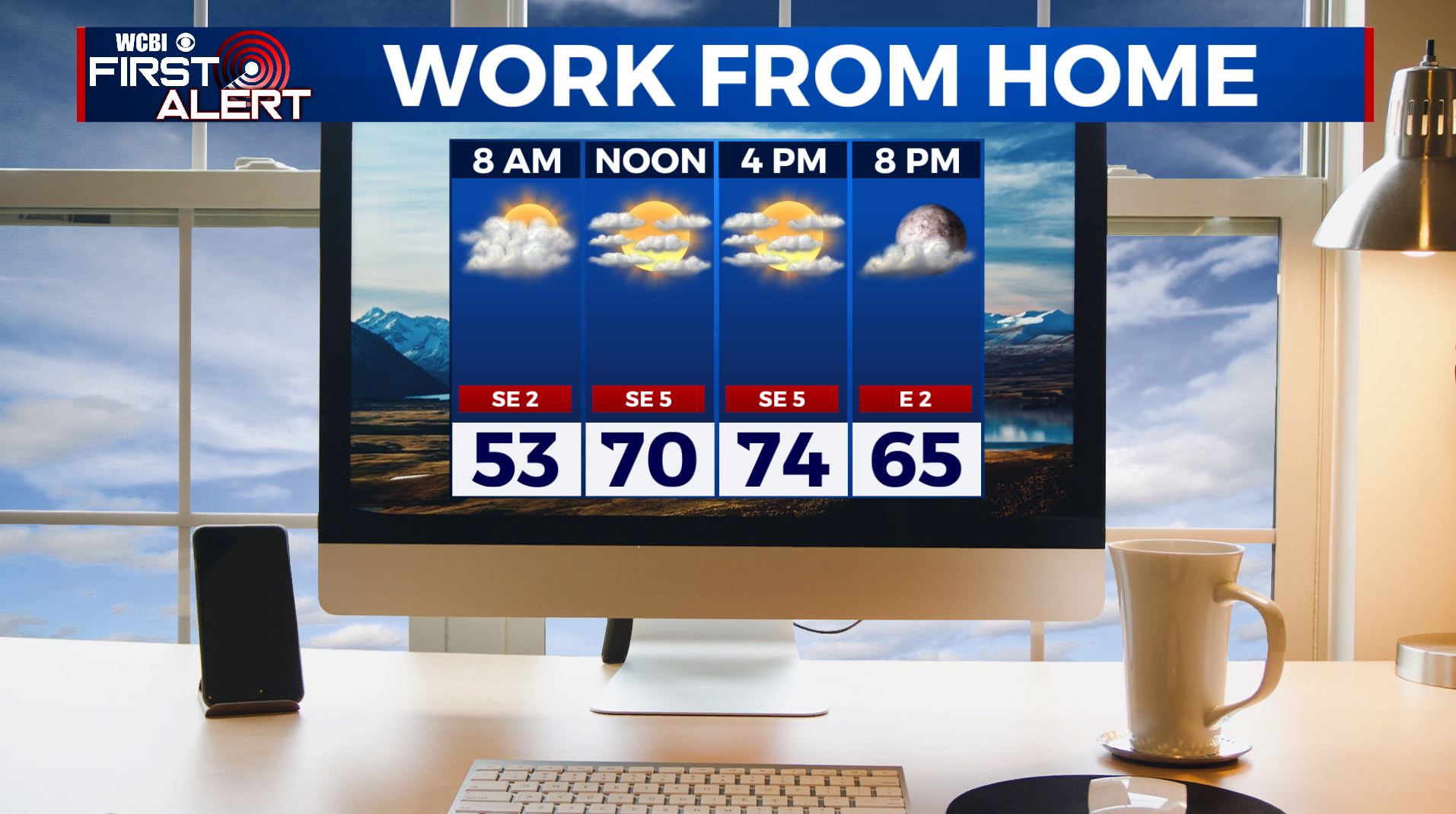
FRIDAY: More clouds are moving in, but we can still see some sunshine. Just a slight chance of a stray shower or sprinkle. Highs in the mid 70s.
FRIDAY NIGHT: Partly cloudy skies. Overnight lows not as chilly in the 50s.
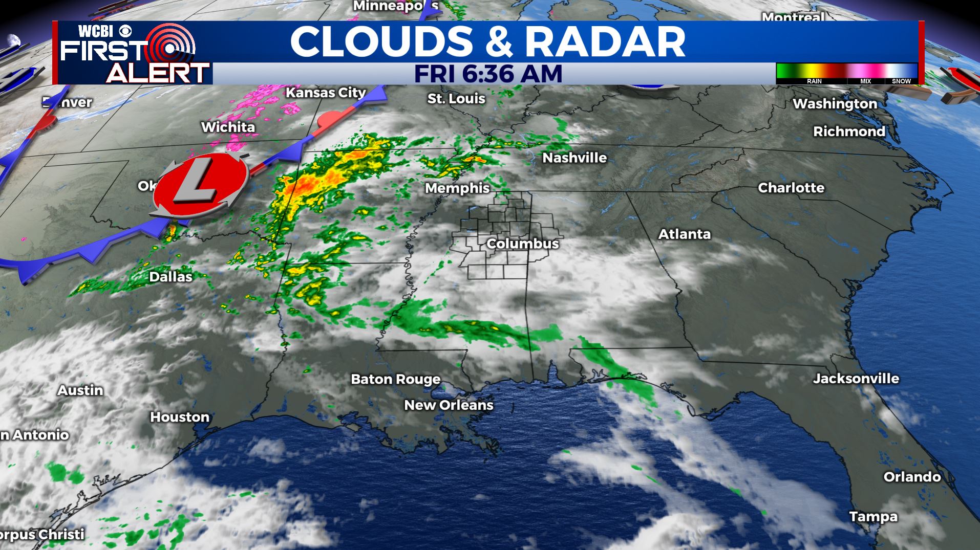
SATURDAY: A slight chance of a shower as a weak cold front pushes through but most locations should stay dry. Partly sunny and mild. Highs in the mid 70s.
SUNDAY: A mix of sun & clouds and warmer. Highs in the mid to upper 70s.
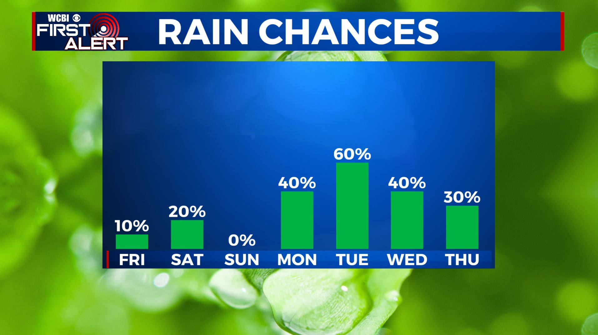

MONDAY: An active weather pattern starts to move back in as we see showers and storms returning to the forecast. Highs in the upper 70s to near 80.
TUESDAY: Mostly cloudy with chances of showers and storms likely. Something we’ll continue to watch. Highs in the lower 80s.
WEDNESDAY: Seasonably warm air still hangs around with highs in the mid 80s expected. Additional chances for showers and storms continues.
THURSDAY: The active weather pattern continues with another chance of scattered showers and storms. Highs a few degrees cooler in the upper 70s.
Stay connected with @WCBIWEATHER on Facebook, Twitter, Instagram, and the WCBI News App


Leave a Reply