Showers Thursday, cold next week
SUMMARY: Several cold fronts will be moving across the region over the next week. Thursday’s front will produce areas of showers. A stronger cold front may give us more rain, colder air, and perhaps even a little frozen precipitation early next week. Sandwiched in between will be a mainly sunny and pleasant weekend.
WEDNESDAY NIGHT: Not as cool with lows in the low 50s. Clouds will fill in during the night but any shower activity is expected to remain to our northwest.
THURSDAY: Highs in the 60s with falling temperatures during the day. Expect areas of showers during the day with rainfall totals generally less than 1/2″. Winds switch from the SE to the NW between 5 and 15 mph.
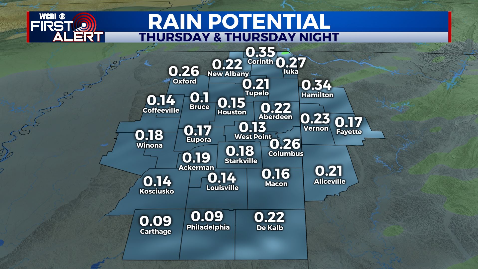
Rain Potential
THURSDAY NIGHT: Rain exits with clouds gradually thinning out from north to south. Temperatures will cool into the mid to possibly low 30s by sunrise Friday. Gusty northerly winds 10-20 mph will produce wind chills into the 20s.
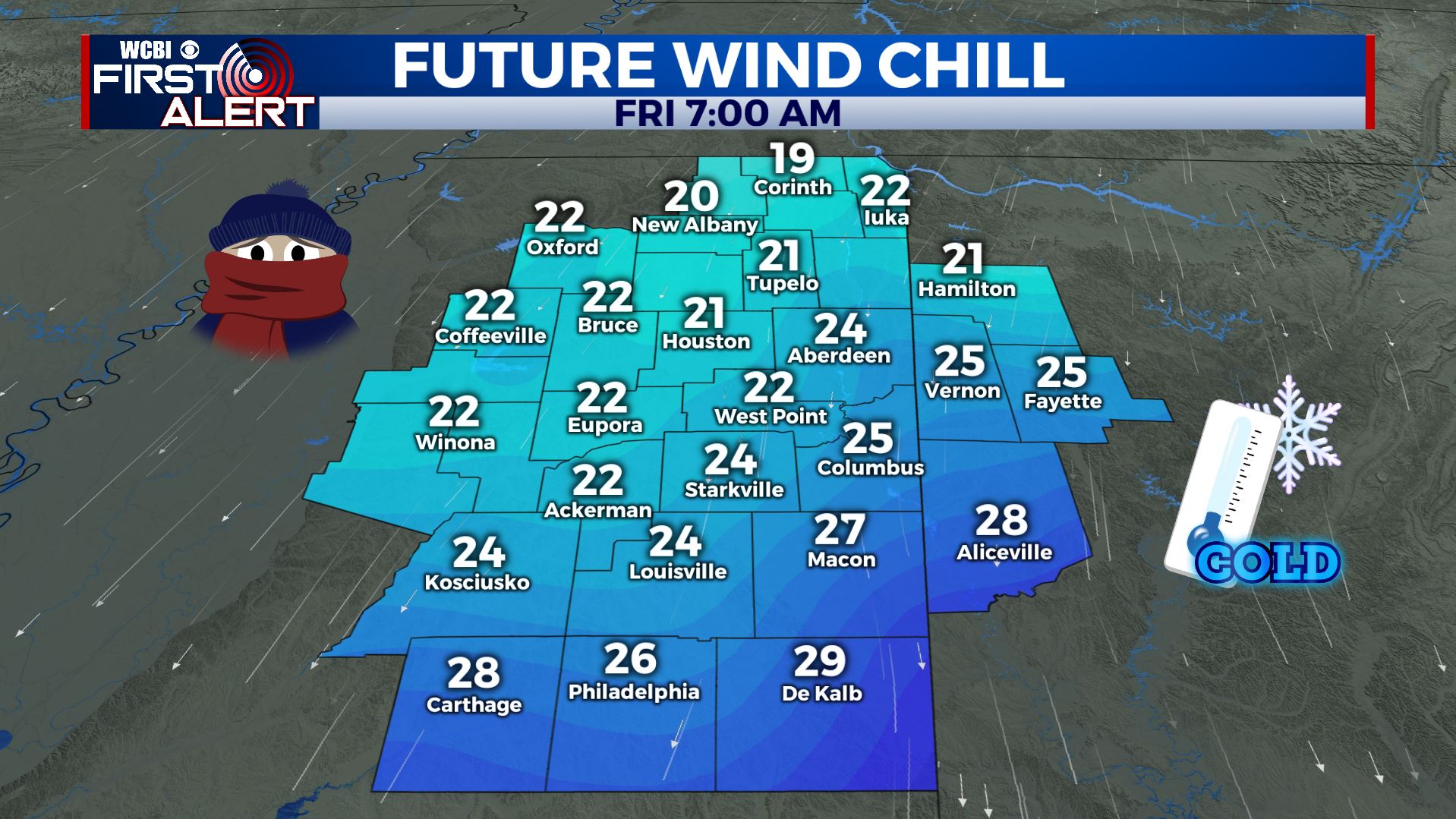
Friday Morning Wind Chill
FRIDAY: Wind chills may be in the 20s when you venture to work and school during the morning commute but conditions will improve during the day under partly cloudy skies. Afternoon highs should be around 50 plus or minus. You’ll need coats for high school football in the evening with temperatures tumbling back into the 30s during the games.
FRIDAY NIGHT: Clear and cold. Lows in the upper 20s.
WEEKEND: Lots of sunshine will be enjoyed! Mid 50s are slated for Saturday with more in the way of 60s on Sunday. Conditions look great for the football games in Tuscaloosa and Oxford Saturday afternoon.
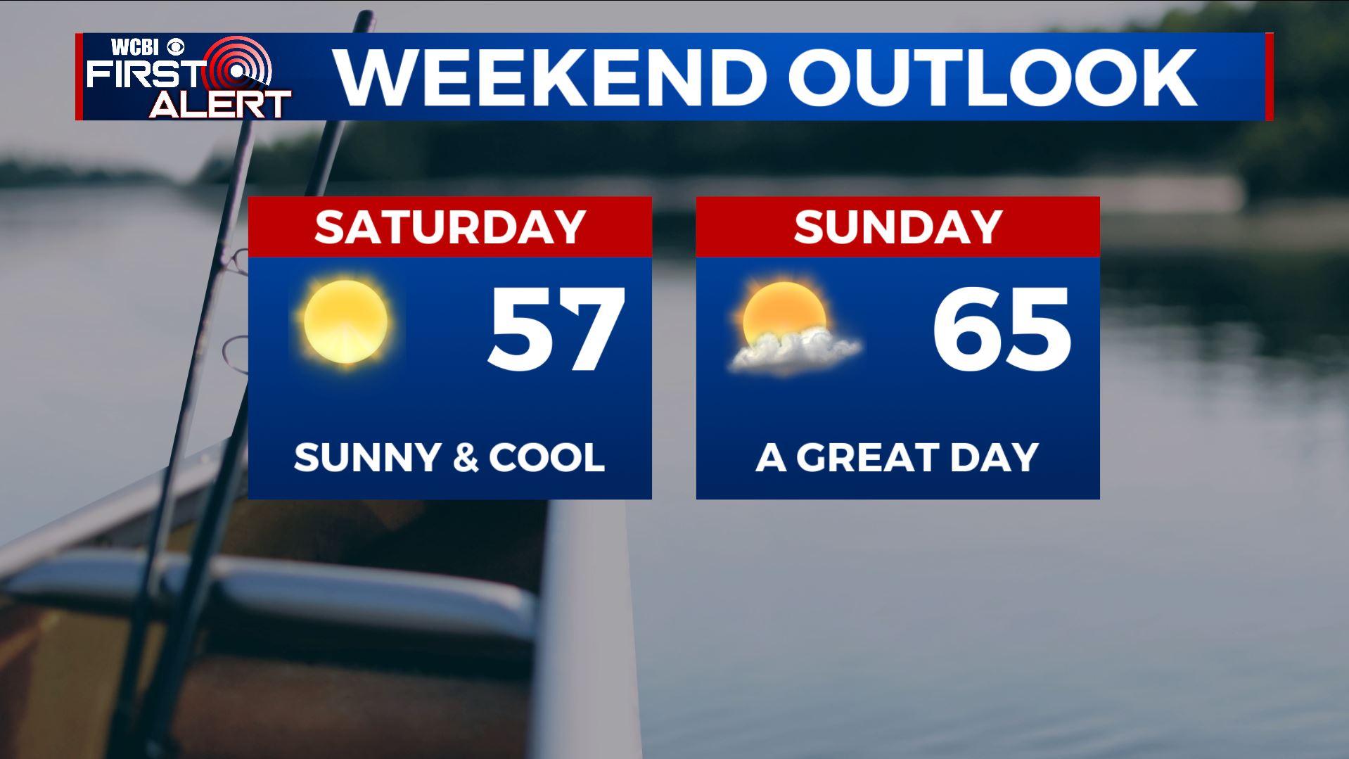
Weekend Outlook
NEXT WEEK: Model data is trending towards a wetter cold frontal passage Monday into Tuesday. We’re bumping up the chance of rain during this time frame. If enough cold air can spill in before the rain exits Tuesday then there may be some wintry weather somewhere in the region. It’s way too early to be any more specific but it’s certainly something we’re going to keep a close eye on. The middle of next week will be cold with highs struggling into the low 40s Tuesday and Wednesday. Overnight lows may dip well into the mid to low 20s.
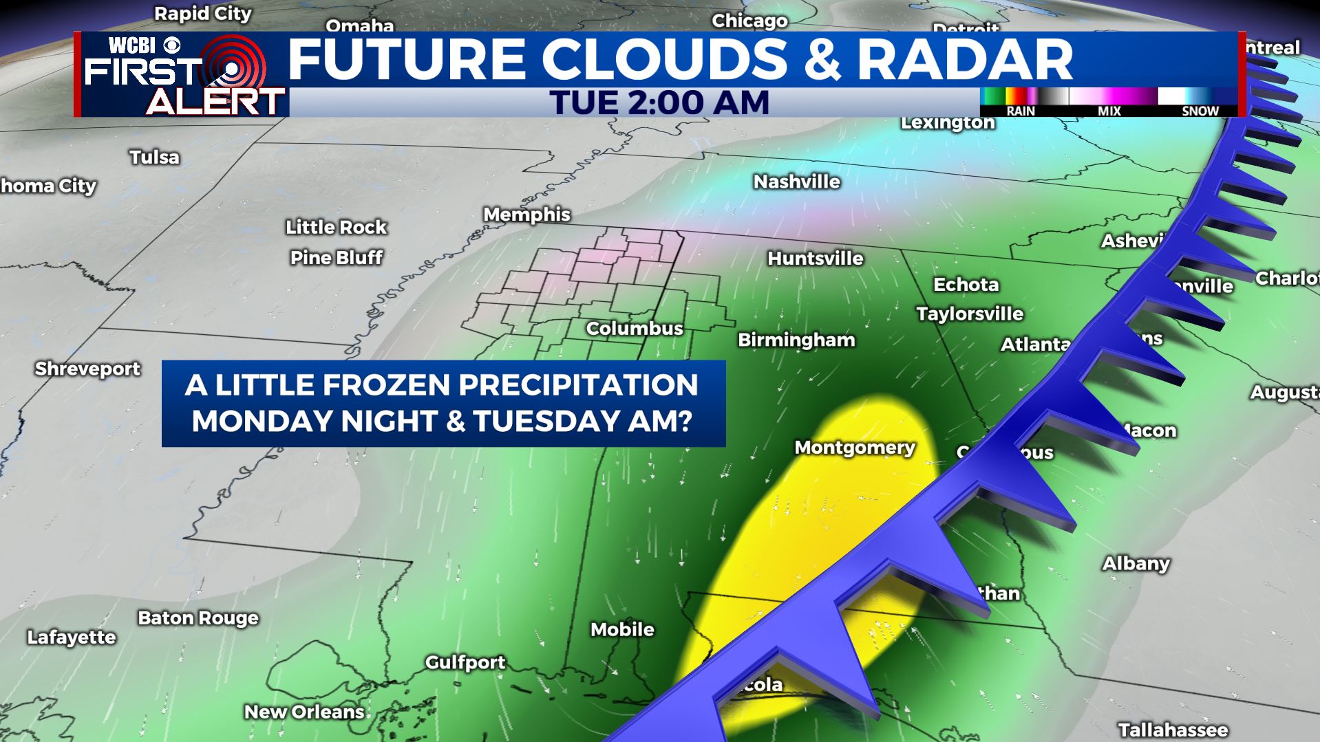
Front Next Week
Follow @WCBIWEATHER on Facebook, Twitter, Instagram and the WCBI News app


Leave a Reply