One more day with sunshine for Monday before rain chances returns
One more decent day for our Monday before an unsettled weather pattern will set up this week, bringing us several chances for showers and even a few thunderstorms. Temperatures will remain above average with highs in the 70s and 80s before we cool down slightly by the end of the week and weekend.
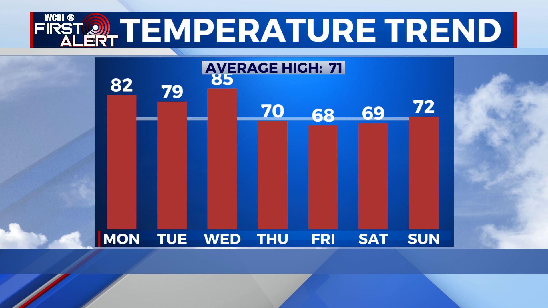
MONDAY: Calm and quiet this morning with a few clouds. Most of the day looks dry but clouds will increase ahead of our next rain chances. Temperatures will be in the lower 80s by the afternoon.
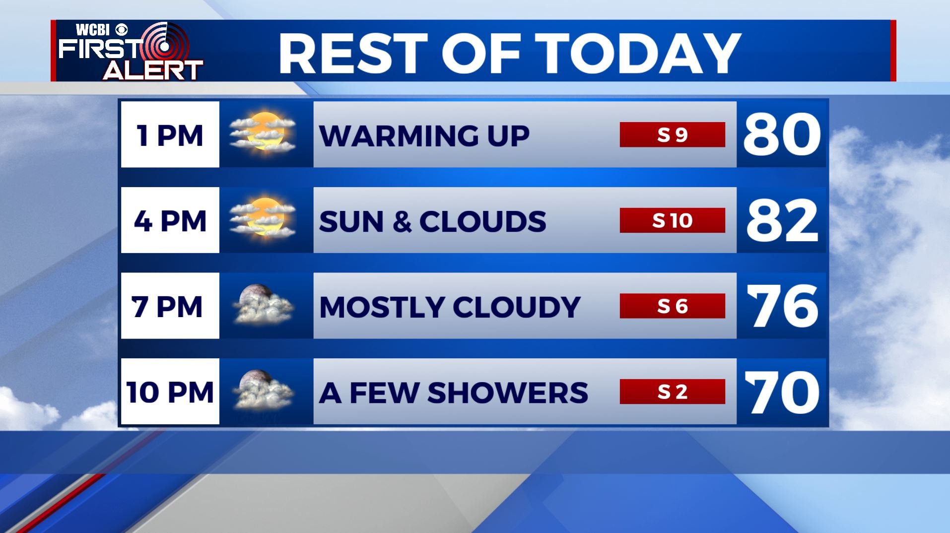
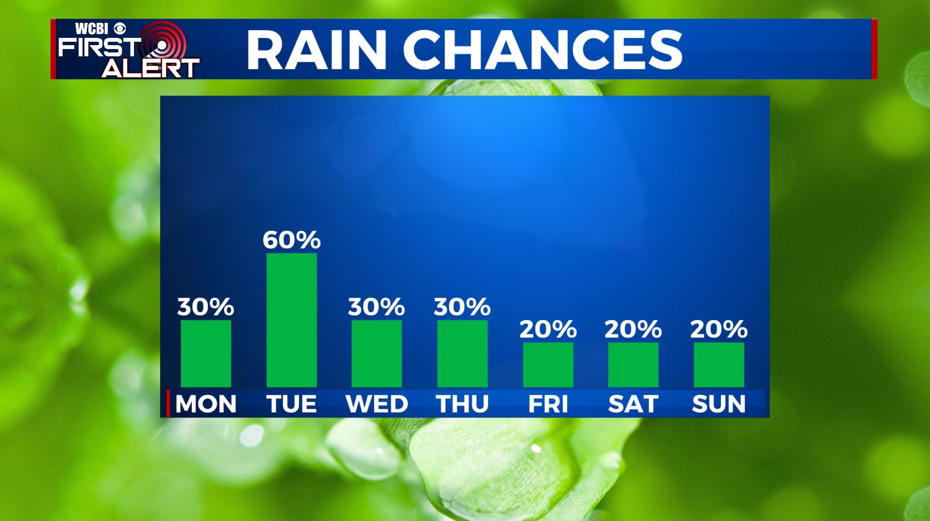
MONDAY NIGHT: A few isolated showers are possible late evening into the overnight hours with mostly cloudy skies. Lows in the 60s.
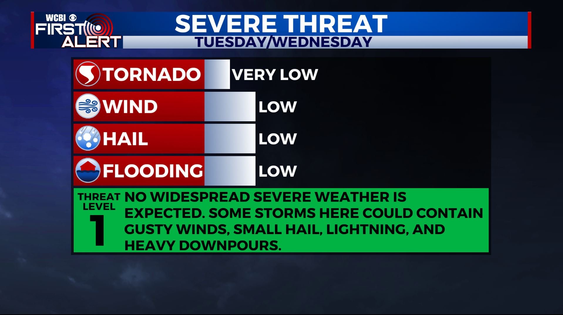
TUESDAY: Our best chance for rain & storms this week will come on Tuesday. It won’t be a total washout all day, but it’s likely that everyone will see some stormy weather. Strong to severe storm threat is low but some thunder and gusty winds are possible. Highs will be in the upper 70s.
WEDNESDAY: Chances for scattered showers and storms continue for the middle portion of the week, but any rain won’t be as widespread as what we will see on Tuesday. Temperatures will peak in the mid 80s on Wednesday.
THURSDAY: Scattered showers and storms are possible with partly sunny skies. Temperatures cooling down as a cold front passes through with highs only near 70.
FRIDAY-SUNDAY: As we get into the end of the week and the weekend, the uncertainty in the forecast grows. While most models have us dry and sunny, one or two models have another round of rainfall. For now, we’re going to keep rain chances at a slight chance for Friday into the weekend, as the drier scenario is most likely. We’re expecting a mix of sun & clouds and cooler temperatures with highs in the upper 60s to near 70.
Stay connected with @WCBIWEATHER on Facebook, Twitter, Instagram, and the WCBI News App


Leave a Reply