Rain and storm chances return for Tuesday
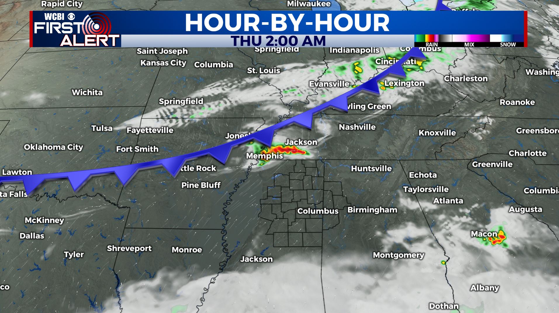
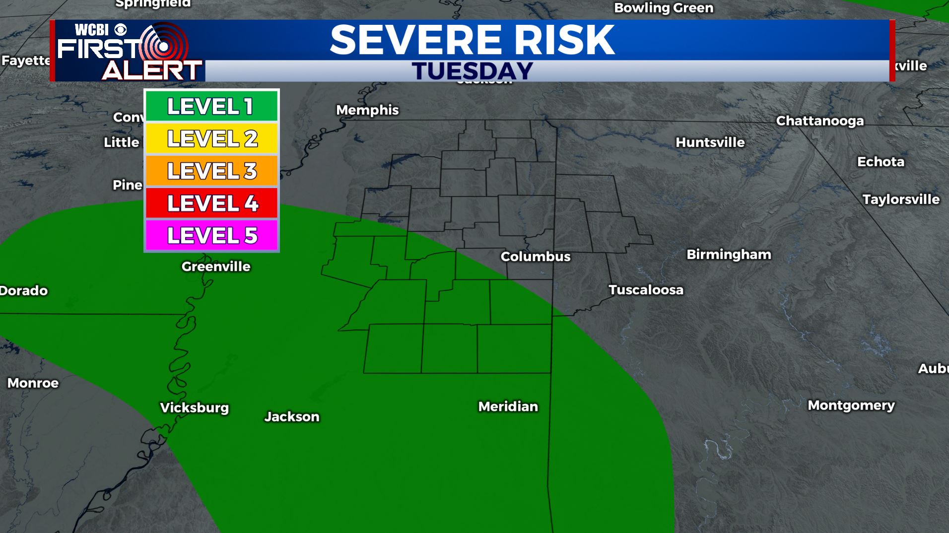
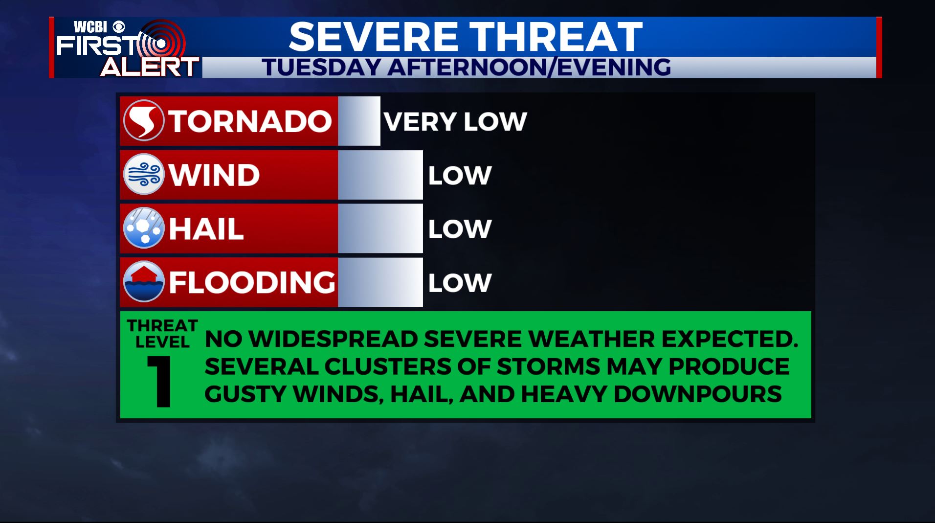
SUMMARY: A batch of showers and storms will cross the region Tuesday. A few locally stronger storms with gusty winds, heavy rain and small hail can’t be totally ruled out. Some additional strong to severe storms are possible late Wednesday night into Thursday morning as a strong cold front pushes through. Quiet and cooler weather looks to return for the end of the week but another storm system could approach by Easter Sunday.
TUESDAY: Mostly cloudy with and a likely chance of showers and storms. A few storms could be locally strong with gusty winds and small hail. Highs top out in the lower to mid 70s.
TUESDAY NIGHT: Mostly cloudy with some lingering showers. Lows in the 60s.
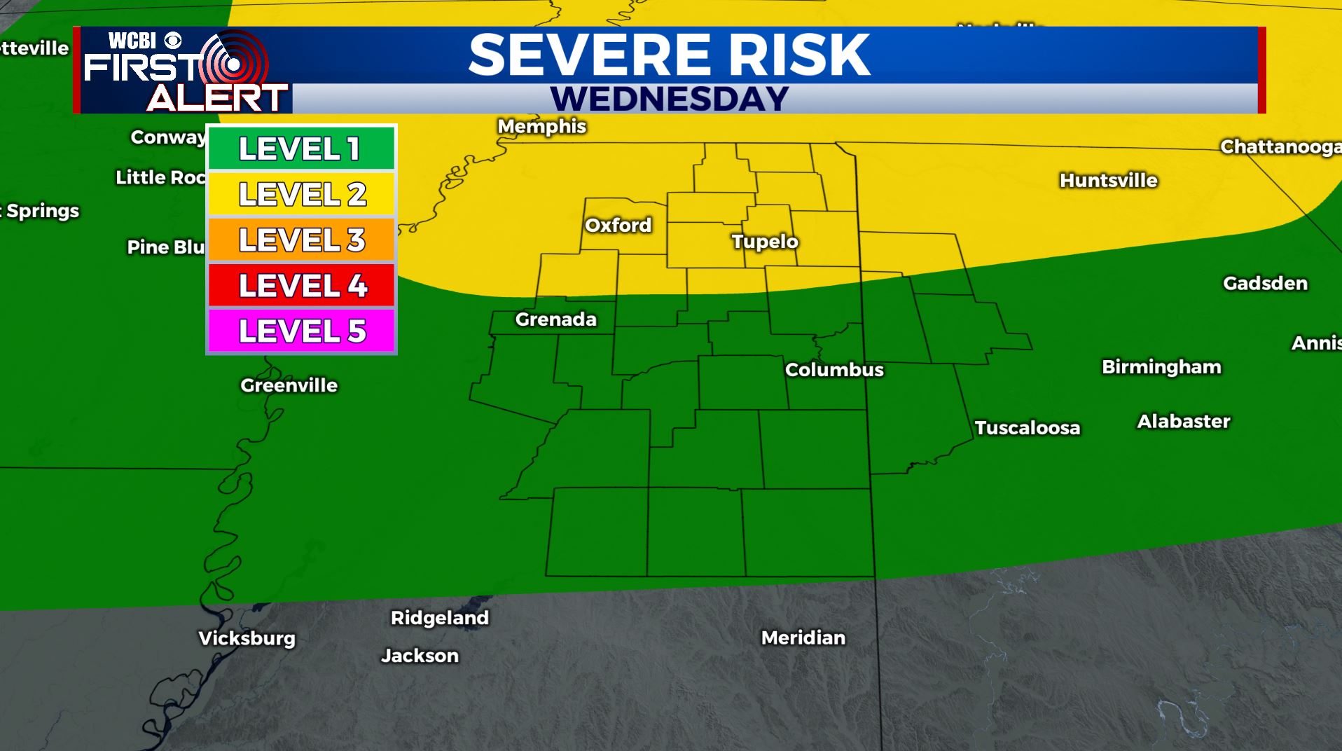
WEDNESDAY: Partly sunny with a chance of a few scattered storms during the afternoon. Very warm for early April with highs in the mid 80s.
WEDNESDAY NIGHT: A chance for some storms late in the overnight hours. Some stronger storms could have some gusty winds and hail. Something we’ll continue to watch. Lows in the 60s.
THURSDAY: A continuing chance of rain & storms, especially during the first half of the day. Highs much cooler in the lower 70s. Chilly overnight lows in the mid to upper 40s Thursday night.
FRIDAY: A mix of sun & clouds. Cooler with highs in the 60s. Lows in the mid 40s Friday night.
SATURDAY: Increasing clouds. A chance of afternoon and evening showers. Highs in the upper 60s to lower 70s.
EASTER SUNDAY: Areas of rain and storms are possible. Something else we will need to continue to monitor heading into the weekend. Highs in the lower 70s.
Stay connected with @WCBIWEATHER on Facebook, Twitter, Instagram, and the WCBI News App


Leave a Reply