Sct’d Storms Friday, Barry’s Remnants This Weekend
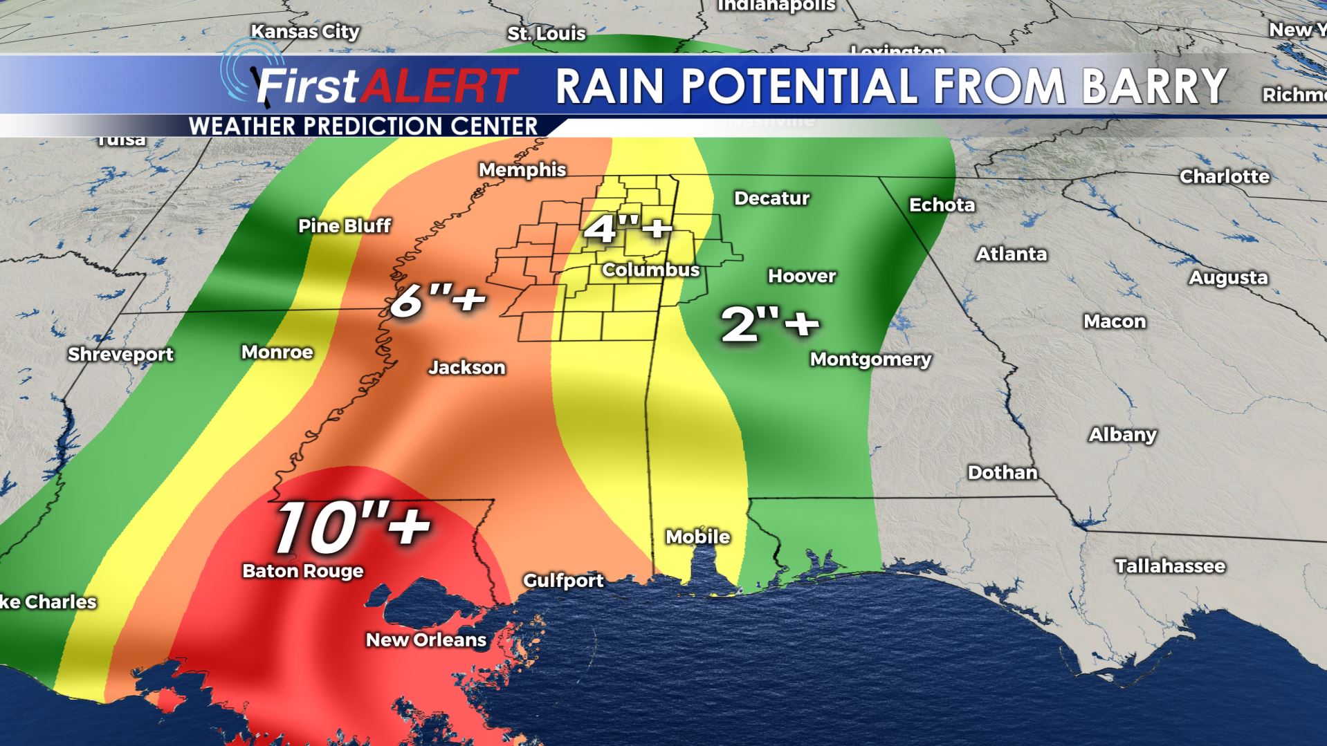
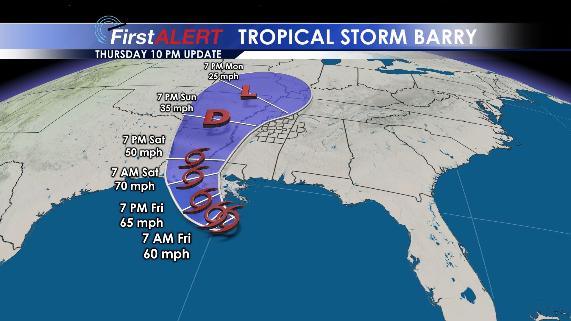 SUMMARY: The remnants of Tropical Storm Barry are expected to move through our area this weekend. Between 2-6″ of rain (or more) could fall in addition to the threat of a few isolated tornadoes. The elevated rain chance and cloud cover will bring temperatures down into the 80s and 70s.
THURSDAY NIGHT: Evening showers and storms are possible but they will tend to fade away by late evening. Lows should be in the mid 70s with light wind continuing.
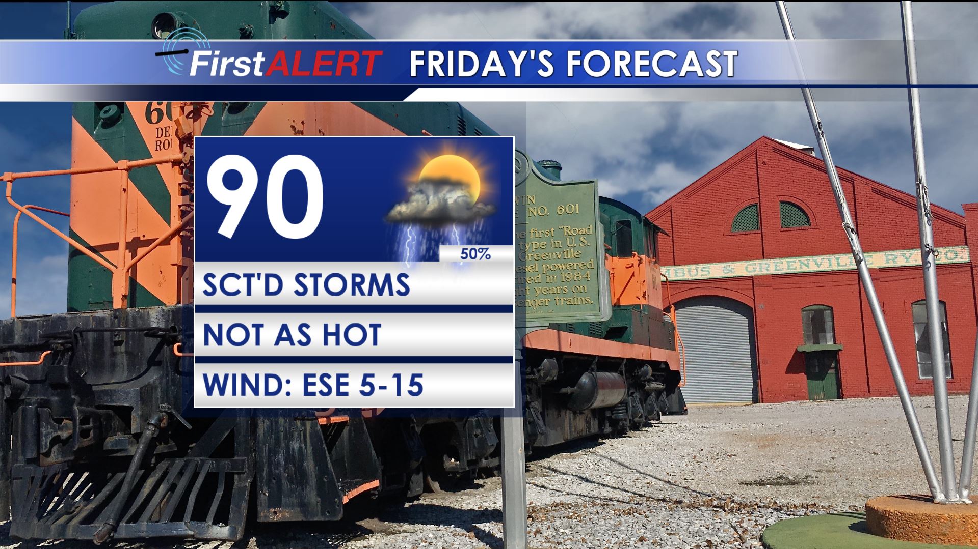
Friday’s Forecast
FRIDAY: Warm and humid with highs around 90. The heat index will still be up to around 100. There is a 50% chance of scattered showers and storms that will hopefully provide some relief to lucky locations.
SATURDAY-SUNDAY: Barry is currently expected to make landfall somewhere in the southwestern Louisiana Saturday and then slowly track to the north along the Mississippi River valley. If this track verifies, our area is going to be on the eastern side of the circulation center which means the potential for heavy rain and isolated tornadoes. Latest model data as of Thursday afternoon suggest the possibility of 2-6″ of rain, if not more. This could lead to flooding and flash flooding. If the ground becomes too saturated trees could come down and cause some power outages as well. Temperature should only be in the 80s Saturday and perhaps only the upper 70s if we really get some heavy rain to establish itself on Sunday. If the track of the system ends up going to our west a little bit more the direct impacts from Barry would be much lower in our area. At this point assume what we have outlined above and go from there. We’ll keep adjusting things as new data arrive.
NEXT WEEK: Some heavy rain could linger on Monday but a gradual return to standard summer weather is likely by Tuesday and Wednesday. That means more in the way of scattered storms, low 90s for highs, and heat index values in the 100s.
Follow @WCBIWEATHER on Facebook, Twitter, and Instagram


Leave a Reply