Less Humidity & Cool Temperatures Continue!
TONIGHT: Temperatures drop to the low 60s overnight under clear skies. A few spots could dip below 60°. We’ll have to watch to see if any record lows fall tonight. Wind will be out of the N around 5-10 MPH.
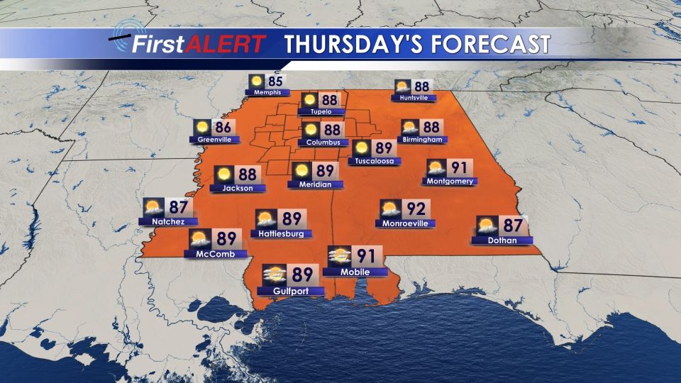
THU/FRI: Temperatures climb into the upper 80s Thursday, and some spots hit 90 by Friday. We stay dry, with lots of sunshine. Despite the warmup, the humidity levels stay relatively low for this time of year, meaning while it will be warm, it won’t be all that uncomfortable.
SATURDAY-TUESDAY: All good things must come to an end which means the break from the humidity ends this weekend. It will feel more like summer by Saturday with dewpoints back in the upper 60s. Dewpoints will also climb back into the 70s by Sunday. High temperatures will be around 90° through the weekend and start of next week. With the increase in moisture, we will also bring back the typical summer pop up rain chances this weekend into the start of next week as well.
FOLLOW US @WCBIWEATHER ON FACEBOOK, TWITTER, AND INSTAGRAM


Leave a Reply