Cristobal brings an active weather day for Monday
SUMMARY: The outer rain bands from Tropical Depression Cristobal are beginning to move into the WCBI Viewing Area this Monday morning. The storm will bring heavy rain, wind and an isolated tornado threat as it slowly moves to the north through the day on Monday and into early Tuesday. The middle and end of the week looks to be much drier as sunshine returns to the area.
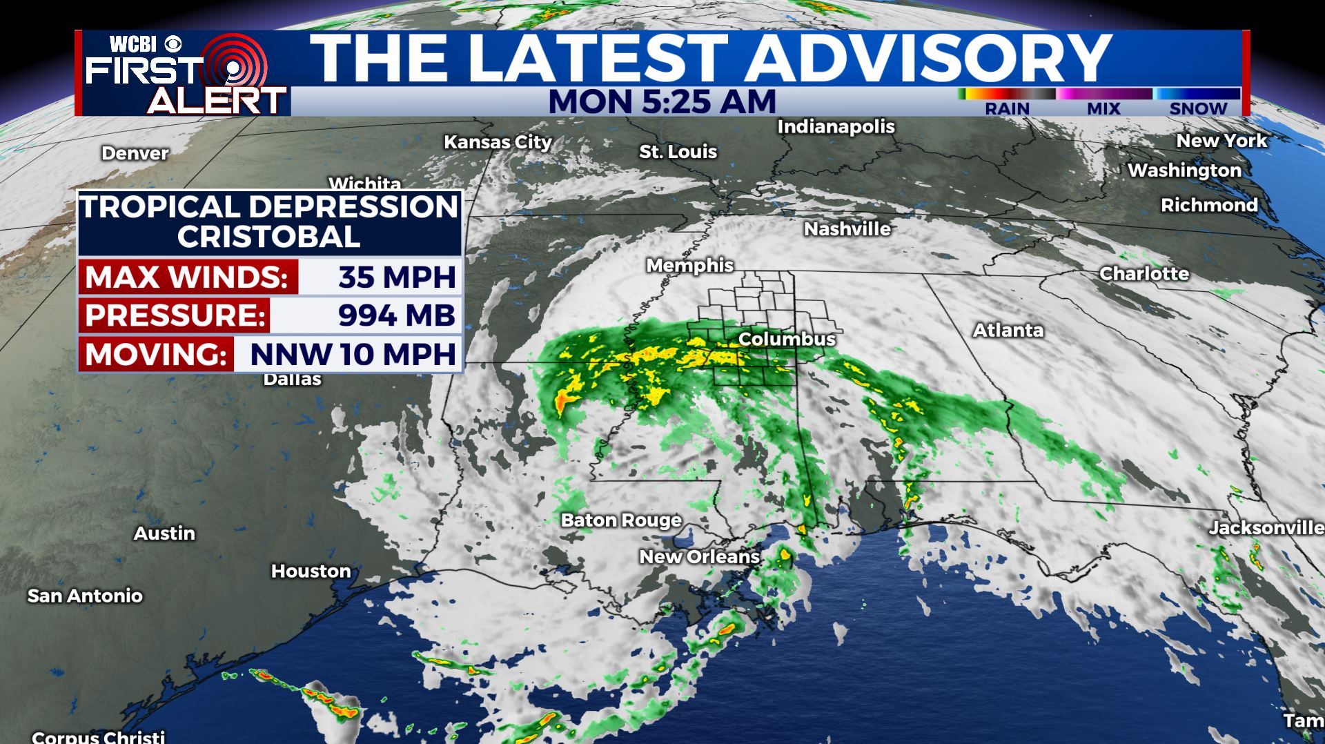
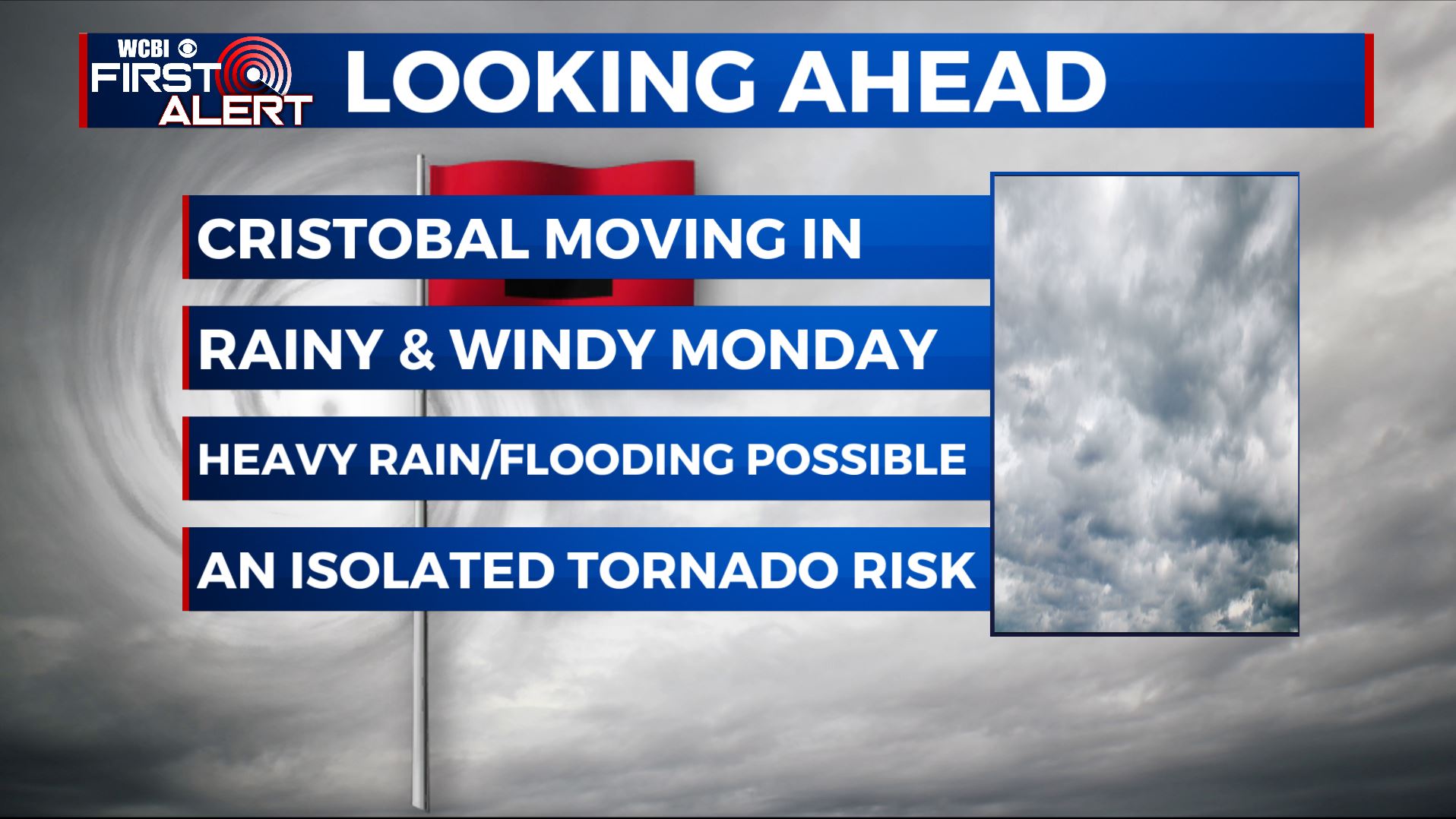
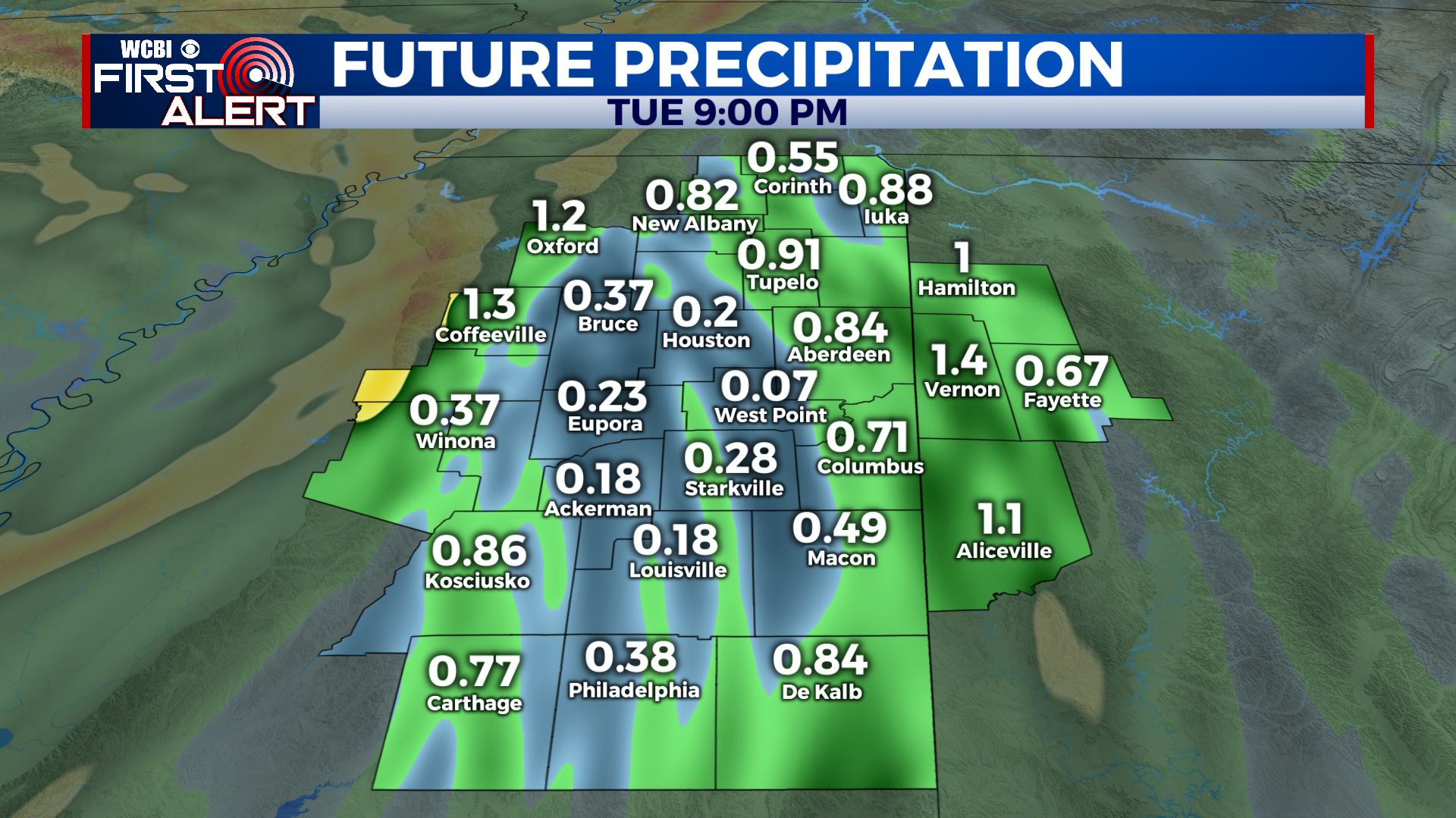
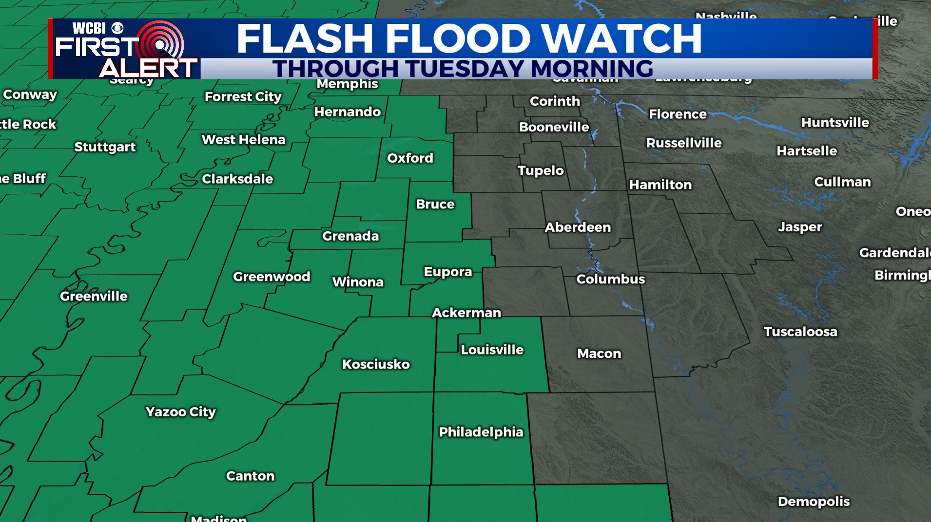
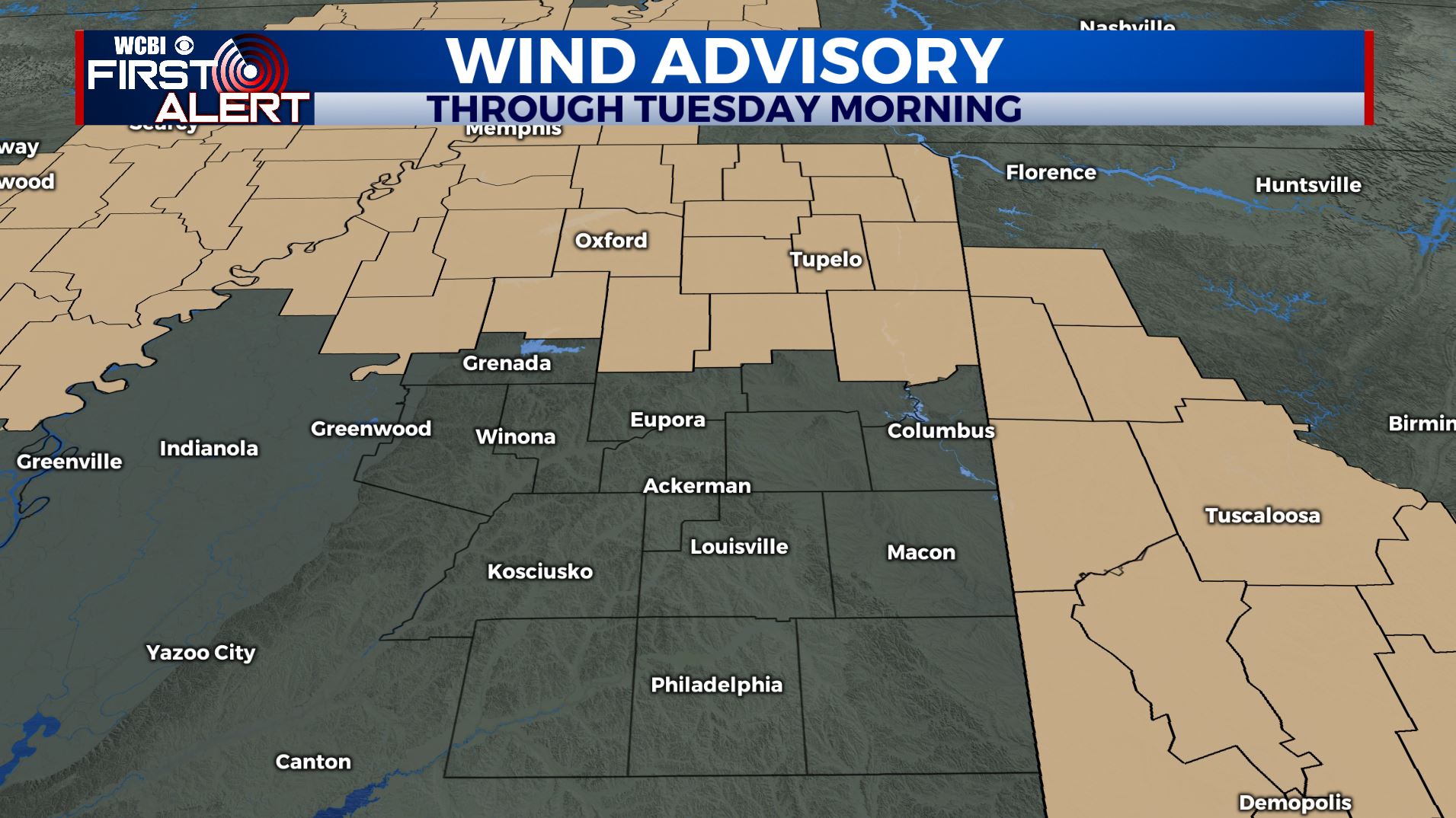
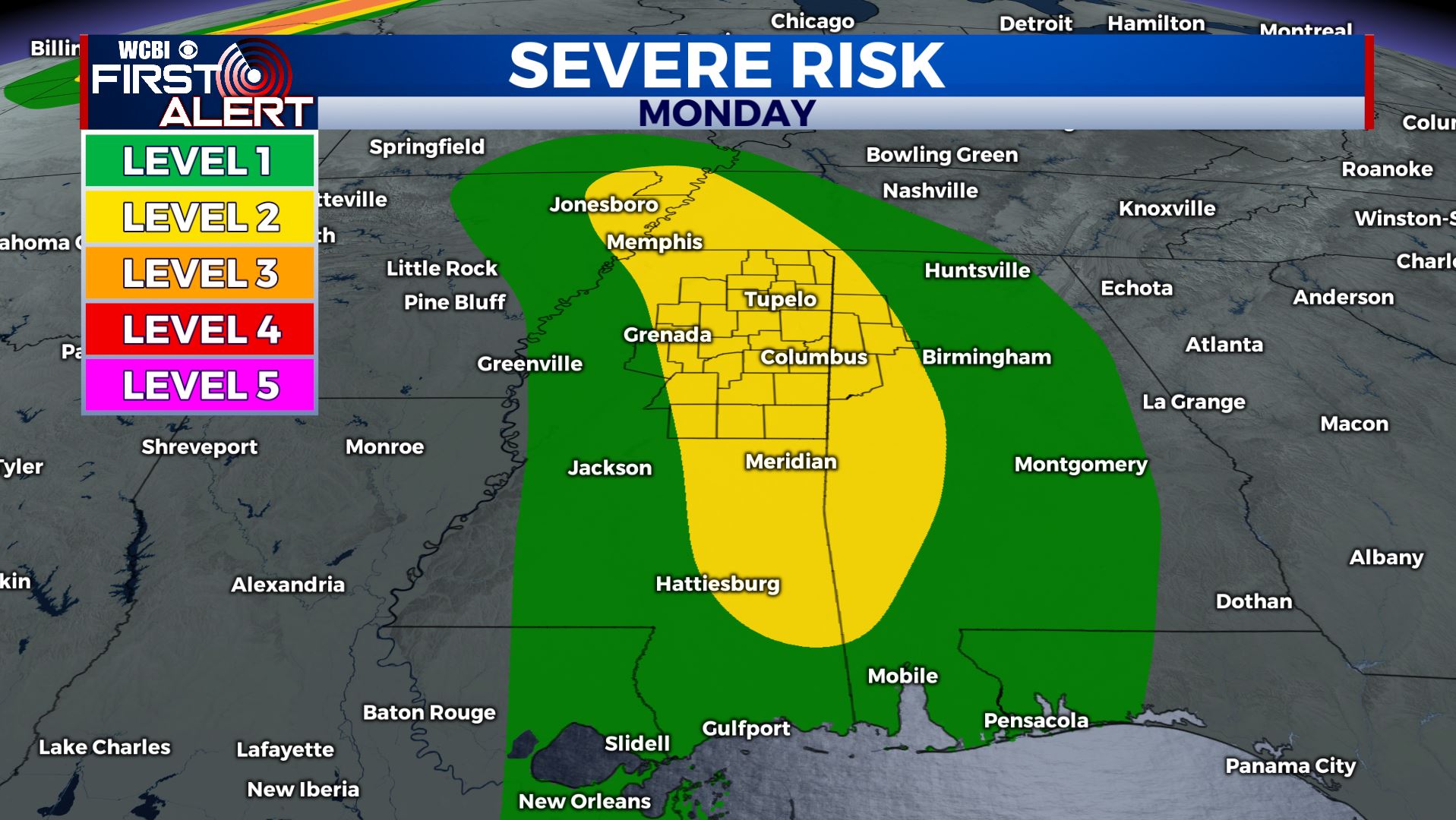
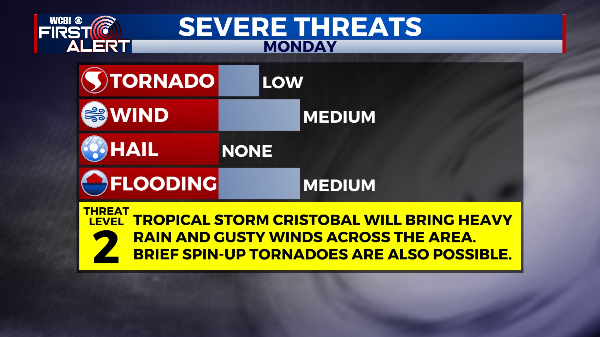
MONDAY: As Cristobal continues to move north and west from us, we’ll remain on the more active, eastern side of the system. Rain showers will become more widespread throughout the day. About a quarter of an inch to a little over an inch for us here in the WCBI Viewing Area. Flash Flood Watches are in effect for our western counties & western Mississippi through Tuesday morning. Depending on where the heaviest rain bands set up, 1-3″ of heavy rain is possible. Winds will also be gusty, occasionally as high as 40 mph out of the southeast. A Wind Advisory is also in effect through Tuesday morning. As with any tropical system, there will also be a threat for brief, isolated tornadoes, especially Monday afternoon and evening. Right now we’re under a Level 1 to Level 2 threat. Highs will be in the lower 80s.
MONDAY NIGHT: Rain showers and gusty winds will continue overnight Monday into early Tuesday. Overnight lows in the mid 70s.
TUESDAY: Depending on how quickly the remnants of Cristobal can move northward, much of the day Tuesday could end up being dry. However, we’re still expecting some rain showers in the morning hours and possibly into the afternoon. Temperatures will climb into the mid to upper 80s.
WEDNESDAY: A cold front moving in from the northwest will bring the chance for a few showers and storms on Wednesday, especially in the morning hours. We’ll see some peeks of sunshine through the day with highs in the mid 80s.
THURSDAY-SUNDAY: A much drier and sunny weather pattern will settle in for Thursday and it’s looking to last into the weekend. Highs will be in the mid and upper 80s with overnight lows staying in the 60s.
Stay connected with @WCBIWEATHER on Facebook, Twitter, Instagram, and the WCBI News App


Leave a Reply