Sunny & dry stretch starts Wednesday
SUMMARY: A cold front will sweep out the tropical humidity and rain showers Wednesday morning. The end of the work week is going to be warm but humidity levels will be much lower than what we’ve been accustomed to of late.
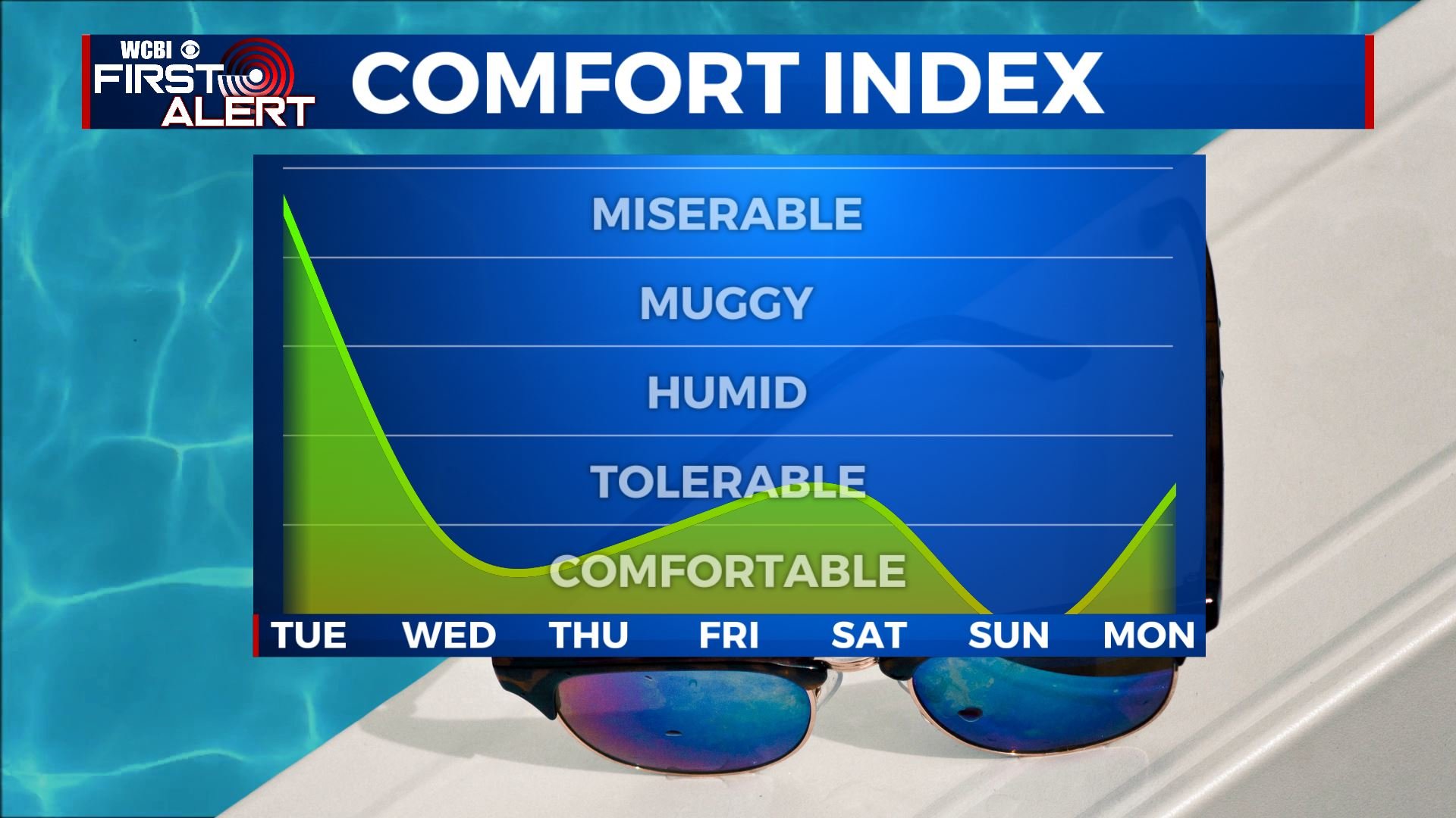
TUESDAY NIGHT: Partly cloudy during the evening with a chance of a few showers and storms after midnight. Muggy all night long with lows in the mid 70s. Winds SSW 10-20 mph.
WEDNESDAY: Clouds and showers are possible early with a clearing trend taking over by midday. The afternoon will be mostly sunny and warm with highs in the mid to upper 80s. Winds SW to NW 10-20 mph.
WEDNESDAY NIGHT: Clear and comfy. Lows around 60.
THURSDAY: Sunny. Highs in the low to mid 80s.
THURSDAY NIGHT: Clear and pleasant. Lows in the upper 50s to lower 60s.
FRIDAY-SUNDAY: Mostly sunny and warm. Highs in the upper 80s to around 90. Lows in the low 60s.
EARLY NEXT WEEK: Partly cloudy and warm. Highs around 90 with lows in the mid to upper 60s.
Follow @WCBIWEATHER on Facebook, Twitter, Instagram, and the WCBI News App


Leave a Reply