Nice June weather coming to an end
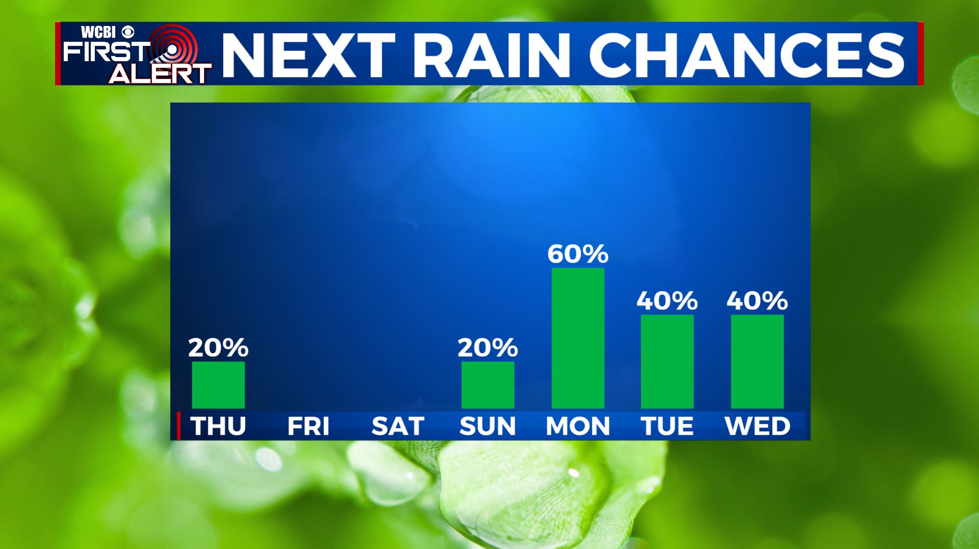
SUMMARY: The rest of the workweek into the weekend looks to remain dry with a mix of sun & clouds. Temperatures on Thursday will be in the upper 80s with pleasant, less humid conditions. 90 degree temperatures and the humidity will return Friday and this weekend. Rain and thunderstorm chances will also make a return early next week.
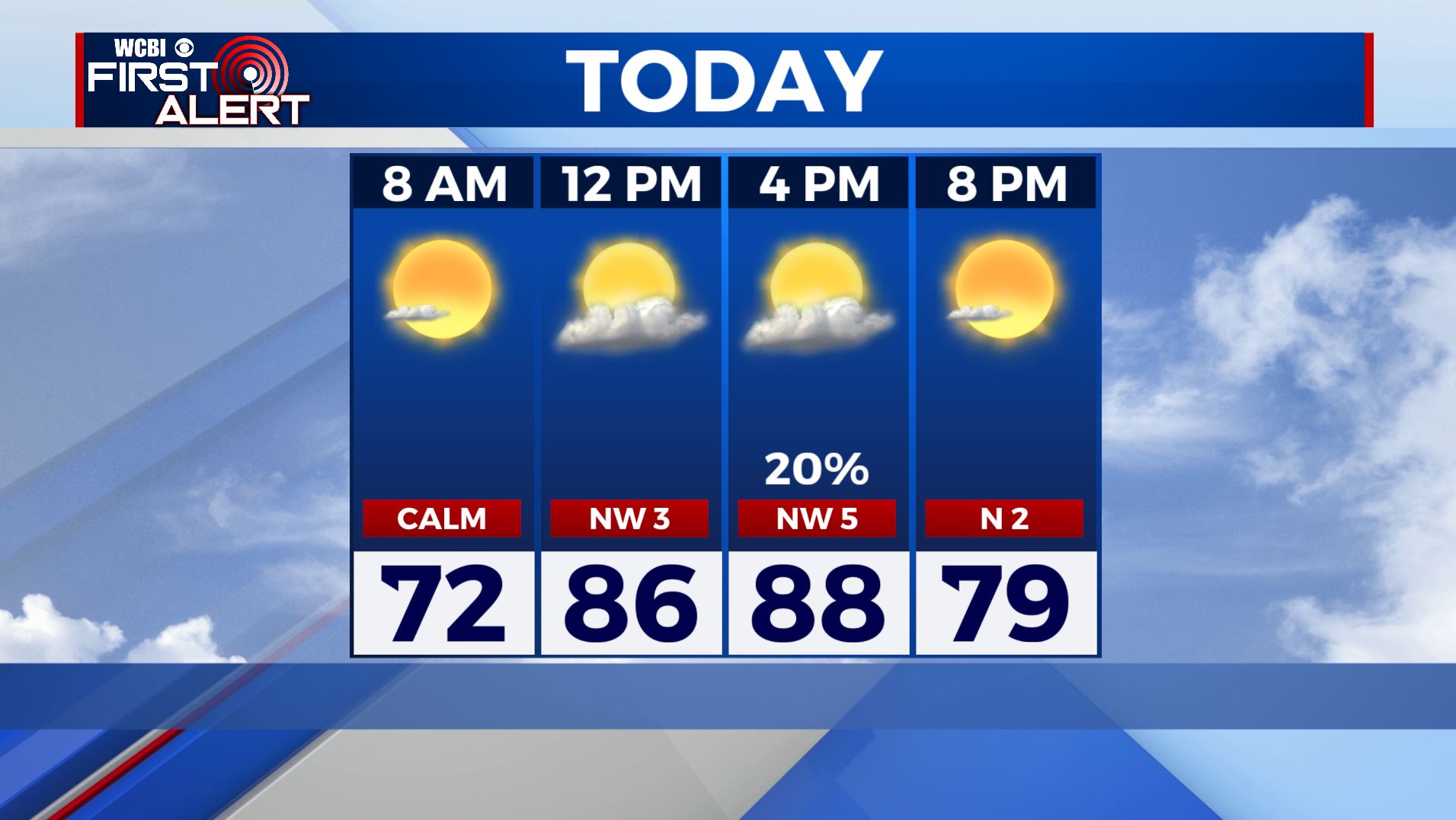
THURSDAY: We’ll have mostly sunny to partly sunny skies for our Thursday. There’s also still a very slight chance of an afternoon stray shower, but we will mostly stay dry. Highs a bit warmer in the mid 80s but still less humid with light NW winds.

THURSDAY NIGHT: Mostly clear skies and calm. Overnight lows a bit mild in the mid 60s.
FRIDAY: Mostly sunny and warmer. Highs back up into the lower 90s.
FRIDAY NIGHT: Mostly clear and mild. Overnight lows in the upper 60s.
SATURDAY: Mostly sunny, humid and warm. Highs in the low to mid 90s. Summer officially begins at 4:44 p.m. CDT.

SATURDAY NIGHT: Partly cloudy. Overnight lows near 70.
SUNDAY: A mix of sun & clouds, warm and more humid for Father’s Day. Highs in the lower to mid 90s. A chance of a stray shower or storms during the heating of the day, but not looking to be a complete washout for any outdoor plans for Dad.
EARLY NEXT WEEK: Scattered summer showers & storms are more likely Monday into Tuesday and Wednesday. Highs will range from the upper 80s to lower 90s with muggy overnight lows in the low 70s.
Stay connected with @WCBIWEATHER on Facebook, Twitter, Instagram, and the WCBI News App


Leave a Reply