More storms Tuesday
SUMMARY: Summer storms will continue over the next few days. Any one of them could become strong with damaging wind gusts, hail, heavy downpours, and frequent lightning. Coverage of activity will lower going into the weekend as temperatures climb back up to around 90.
TONIGHT: Lingering showers and storms are possible. Lows around 70. Winds SW 5-10 mph.
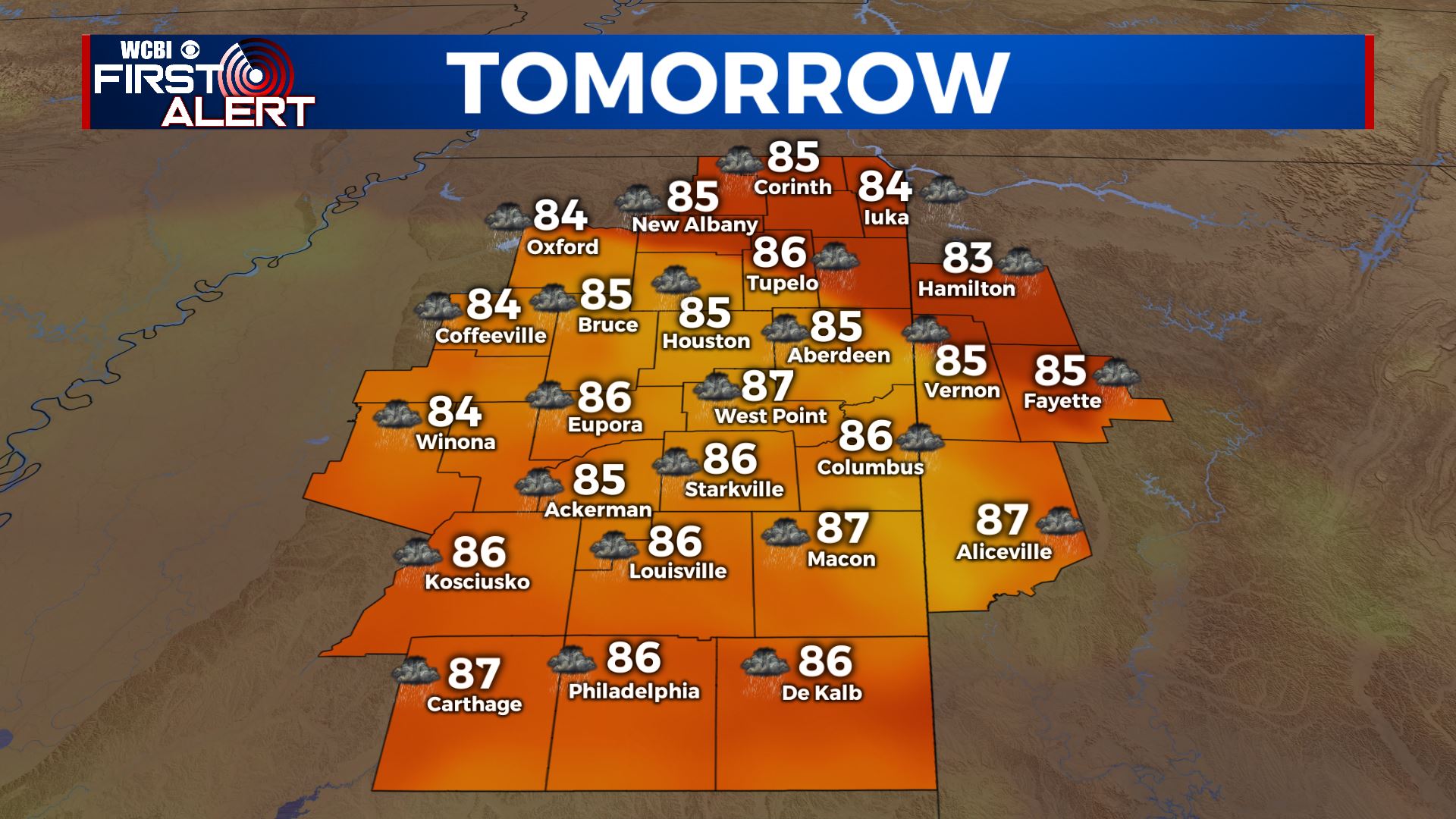
TUESDAY: Scattered showers and storms likely with a 70-80% chance of rain. Some locally strong to severe storms are possible with damaging wind gusts and small hail. Highs will be in the low to mid 80s. Winds SSW 5-15 mph.
WEDNESDAY: Variably cloudy, warm, and humid. A 50% chance of showers and storms. Highs in the mid 80s.
THURSDAY: Partly cloudy, warm, and humid. Highs in the upper 80s. A 40% chance of pop-up storms will continue.
FRIDAY-MONDAY: Rain chances continue in the 20-30% range so not everyone will get a storm every day. Highs will climb back into the lower 90s with higher heat indices.
Follow @WCBIWEATHER on Facebook, Twitter, Instagram, and the WCBI News App


Leave a Reply