An unsettled day of weather for Wednesday
SUMMARY: Our typical summertime pattern of pop-up afternoon showers and storms will return as we head into the second half of the week and head into the weekend. We’ll also satay seasonably warm and humid as we warm back up to near the 90 degree mark this weekend.
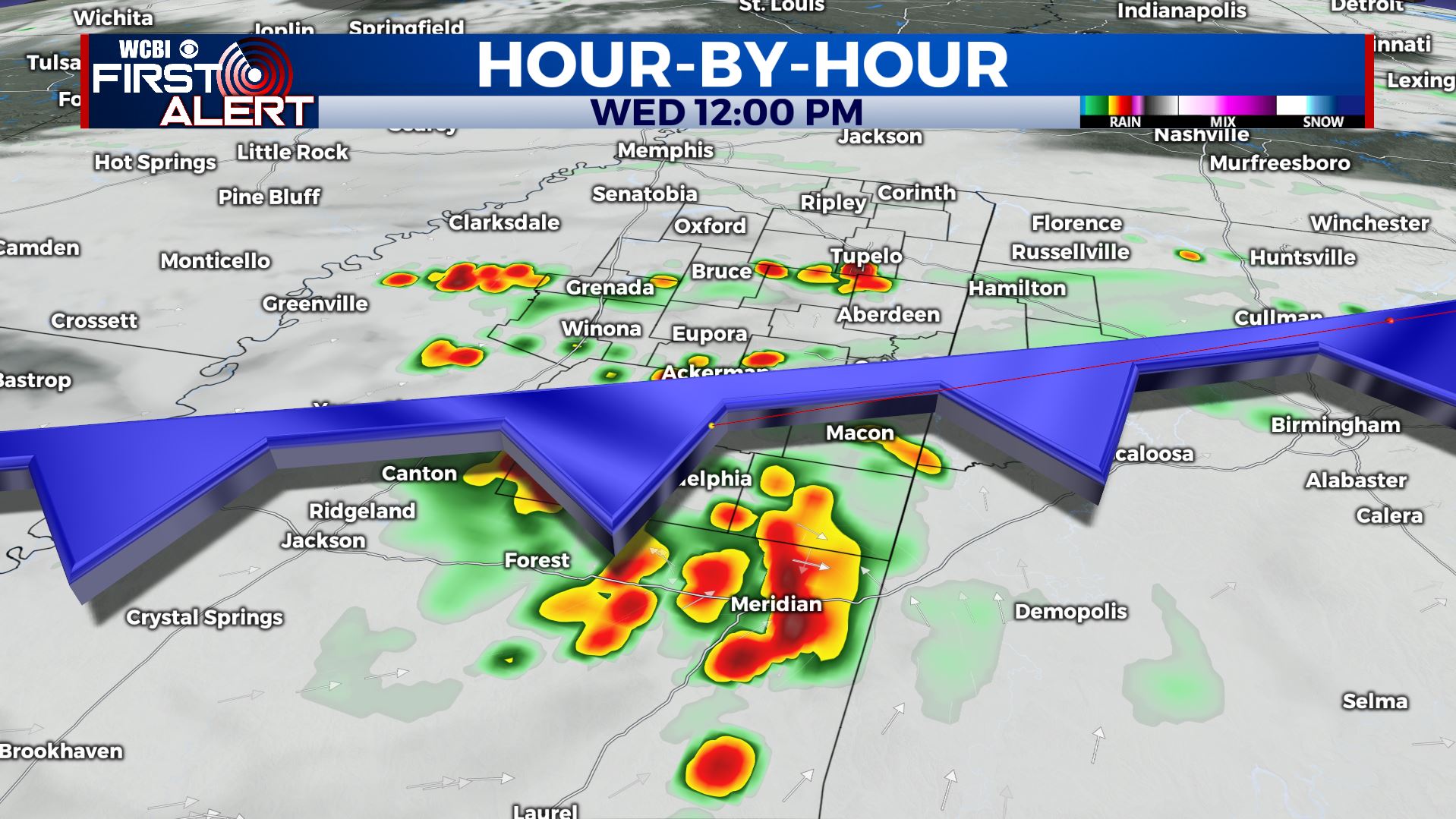
WEDNESDAY: A weak cold front is slowly pushing through the WCBI Viewing Area today. Expect additional showers and thunderstorms throughout the day with cloudy skies. A SW wind at 5-10 mph will allow highs to still climb up into the lower to mid 80s.
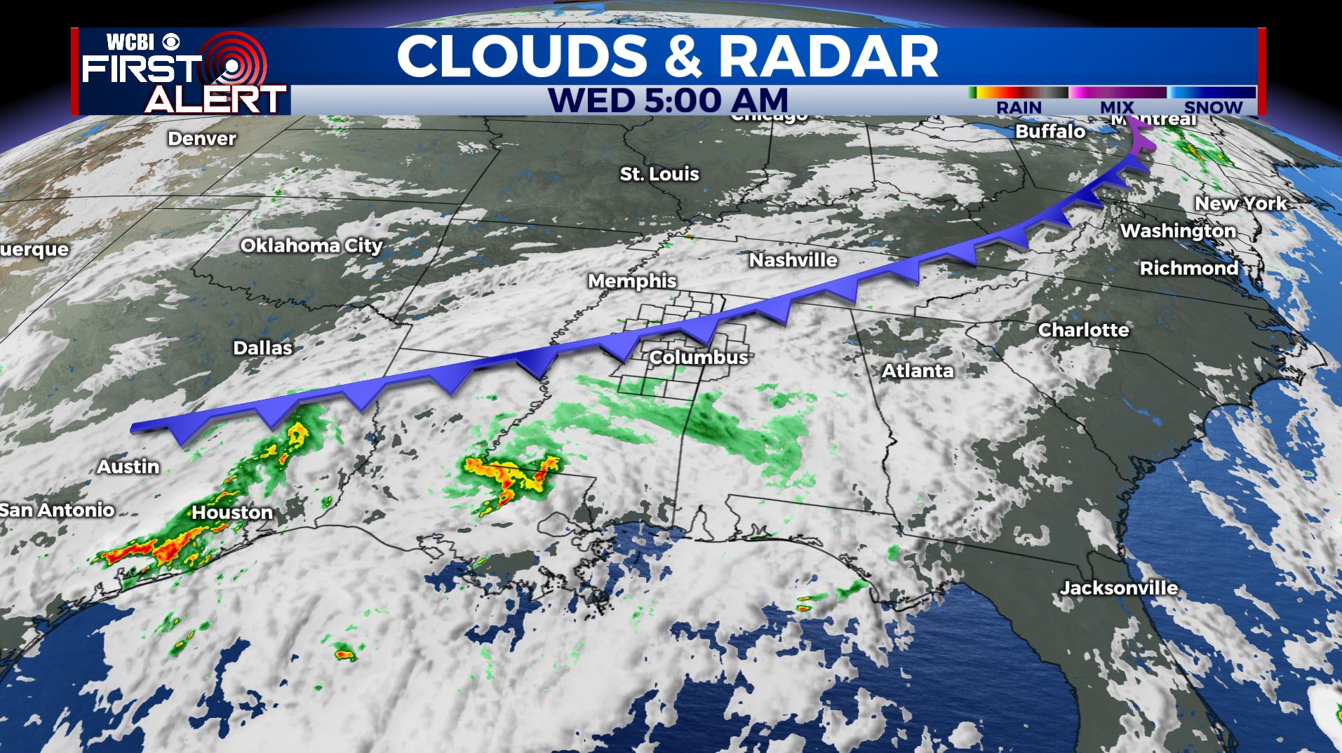
WEDNESDAY NIGHT: Lingering showers and storms are possible early in the evening. Mostly cloudy skies overnight with lows in the upper 60s to near 70.
THURSDAY: A bit drier but a few scattered showers and storms with a mix of sun & clouds as the cold front is finally south of us. Highs will remain in the mid 80s.
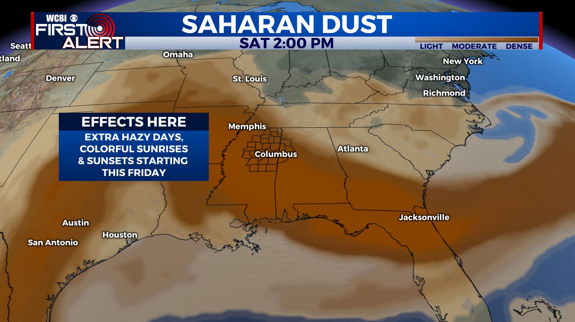
FRIDAY: While showers and storms won’t be as widespread by the end of the workweek, there will still be a chance for some afternoon pop-up storms. Highs in the mid to upper 80s. We’ll also have some Saharan Dust move in from the Caribbean and the Gulf by Friday morning. That’s when we may see more colorful sunrises/sunsets, but also some hazy days.
WEEKEND-EARLY NEXT WEEK: Daily scattered rain & storm chances continue, but not everyone will get a storm every day. Any storm this time of year may become strong with some gusty winds, small hail, heavy downpours and lightning. Highs will climb back into the lower 90s with higher heat indices with that humidity mixed in.
Stay connected with @WCBIWEATHER on Facebook, Twitter, Instagram, and the WCBI News App


Leave a Reply